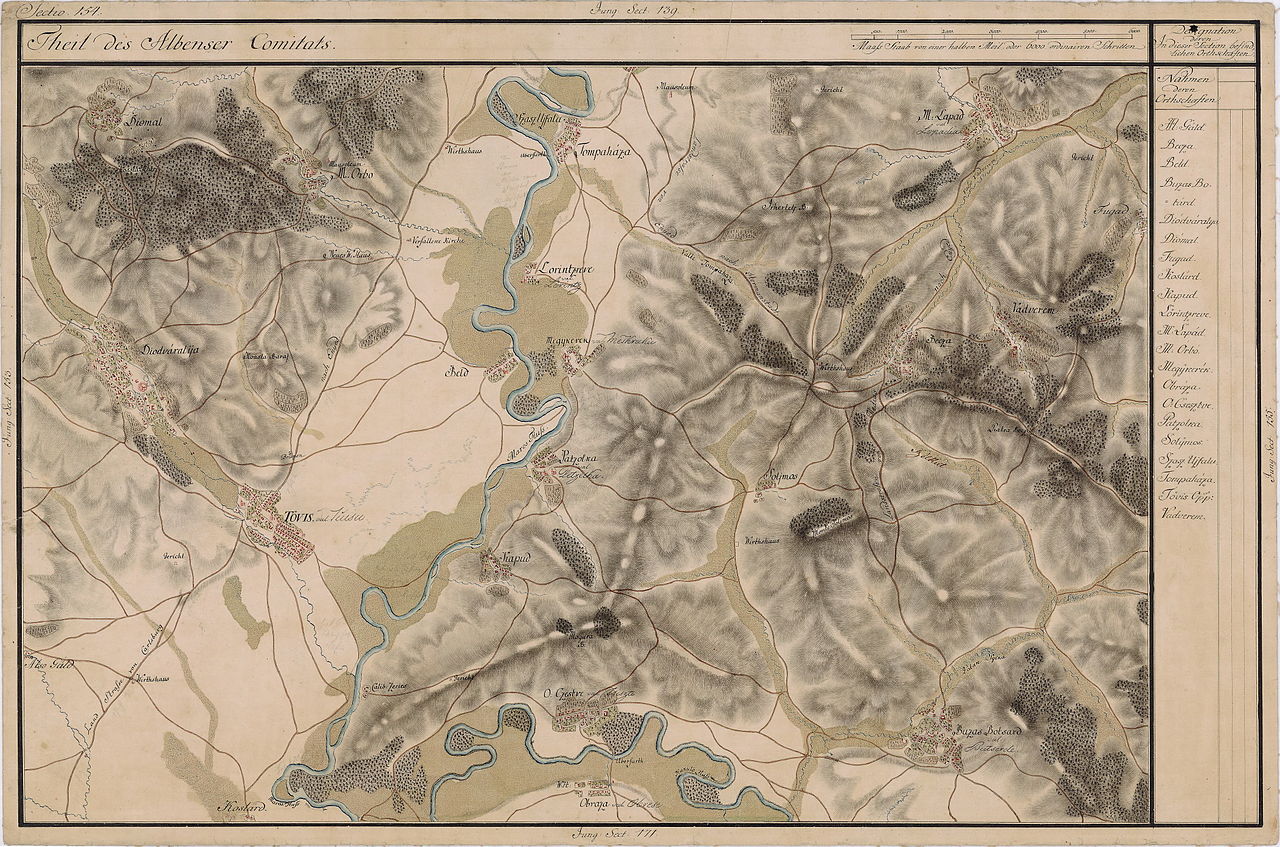
File:Josephinische Landaufnahme pg154.jpg
Jump to navigation
Jump to search

Size of this preview: 800 × 529 pixels. Other resolutions: 320 × 212 pixels | 640 × 424 pixels | 1,024 × 678 pixels | 1,280 × 847 pixels | 2,560 × 1,694 pixels | 8,417 × 5,571 pixels.
Original file (8,417 × 5,571 pixels, file size: 23.25 MB, MIME type: image/jpeg)
Captions
Captions
Add a one-line explanation of what this file represents
| Name shown on the map Nume din hartă |
Administrative unit Unitate administrativă |
Romanian name Numele românesc |
Hungarian name Numele unguresc |
German name Numele german |
Country today Ţara de astăzi |
|---|---|---|---|---|---|
| Diomal | Fehér megye Unterweißenburger Komitat Comitatul Alba de Jos |
Geomal | Diómál | Nussdorf | Romania |
| M. Orbo | Fehér megye | Gârbova de Jos | Alsóorbó | Unterurbau | Romania |
| Diodváralya | Fehér megye | Stremţ | Diód | Nußschloss | Romania |
| Tompaháza | Fehér megye | Rădeşti | Tompaháza | Thomaskirch | Romania |
| Szasz Ujfalu | Fehér megye | Uifalău | Szászújfalu, Tompaháza | Neudorf | Romania |
| Lorintzreve vel Lörintz | Fehér megye | Leorinţ | Lõrincréve | Laurentzi | Romania |
| Nagykerek | Fehér megye | Meşcreac | Meggykerék | Weichseldorf | Romania |
| Beld | Fehér megye | Beldiu | Marosbéld | Beldendorf | Romania |
| M: Lapad vel Lopadia | Fehér megye | Lopadea Nouă | Magyarlapád | Schaufeldorf | Romania |
| Becza | Fehér megye | Beţa | Magyarbece | Benzendorf | Romania |
| Vadverem | Fehér megye | Odverem | Vadverem | Tiergrub | Romania |
| Solymos | Fehér megye | Şoimuş | Magyarsolymos | Falkenstadt | Romania |
| Buzas Botsard vel Butserde | Fehér megye | Bucerdea Grânoasă | Buzásbocsárd | Botschard, Bothard | Romania |
| Patzolka vel Petzelka | Fehér megye | Peţelca | Pacalka | Magendorf | Romania |
| Kapud | Fehér megye | Căpud | Magyarkapud | Thorenburg | Romania |
| O. Csesztve vel Zsiszte | Fehér megye | Cistei | Oláhcsesztve | Thalmühl | Romania |
| Obraza vel Obrese | Fehér megye | Obreja | Obrázsa | Augendorf | Romania |
| Tövis vel Tiusu | Fehér megye | Teiuş | Tövis | Dreikirchen, Dornen, Dornstadt | Romania |
| Koslard | Fehér megye | Coşlariu | Koslárd | Romania | |
| Also Gáld | Fehér megye | Galda de Jos | Alsógáld | Unter-Hahnenberg, Hahnenberg | Romania |
Summary
[edit]
| Description |
English: Grand Duchy of Transylvania, 1769-1773. Josephinische Landaufnahme pg.154 Română: Harta Iosefină a Transilvaniei, 1769-1773. Josephinische Landaufnahme pg.154 |
||||
| Date | between 1769 and 1773 | ||||
| Source | Österreichisches Staatsarchiv, Kriegsarchiv, B IX 715: Original-Aufnahmskarte des Grossfürtenthums Siebenbürgen. Geometrisch aufgenommen und bearbeitet in den Jahren 1769 bis 1773 unter der Direction des Obristen von Fabris, theils durch Officiere des grossen Feld-Generalstabes, theils auch von verschiedenen aus dem in Siebenbürgen bequartierten Regimentern zu diesem Geschäfte | ||||
| Author | Historische Militärkarte der österreichisch-ungarischen Monarchie | ||||
| Permission (Reusing this file) |
|
||||
Clickable Map of the Grand Duchy of Transylvania
[edit]
File history
Click on a date/time to view the file as it appeared at that time.
| Date/Time | Thumbnail | Dimensions | User | Comment | |
|---|---|---|---|---|---|
| current | 07:01, 8 December 2009 | | 8,417 × 5,571 (23.25 MB) | Asybaris01 (talk | contribs) | good rezolution |
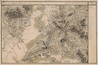
| 07:30, 4 November 2009 |  | 5,471 × 3,621 (16.07 MB) | Asybaris01 (talk | contribs) | {{Information |Description={{ro|1=Josephinische Landaufnahme pg154}} |Source=Josephinische Landaufnahme pg154 |Author=Asybaris01 |Date=2009/11/04 |Permission= |other_versions= }} |
You cannot overwrite this file.
File usage on Commons
The following 2 pages use this file:
File usage on other wikis
The following other wikis use this file:
- Usage on arz.wikipedia.org
- Usage on de.wikipedia.org
- Usage on es.wikipedia.org
- Usage on hu.wikipedia.org
- Usage on ro.wikipedia.org
- Teiuș
- Beldiu, Alba
- Beța, Alba
- Bucerdea Grânoasă, Alba
- Căpud, Alba
- Cistei, Alba
- Coșlariu, Alba
- Coșlariu Nou, Alba
- Galda de Jos, Alba
- Gârbova de Jos, Alba
- Geomal, Alba
- Leorinț, Alba
- Lopadea Nouă, Alba
- Meșcreac, Alba
- Mihalț, Alba
- Obreja, Alba
- Odverem, Alba
- Pețelca, Alba
- Rădești, Alba
- Stremț, Alba
- Șoimuș, Alba
- Comuna Bucerdea Grânoasă, Alba
- Usage on tt.wikipedia.org
- Usage on www.wikidata.org
View more global usage of this file.