File:Josephinische Landaufnahme pg029.jpg
Jump to navigation
Jump to search

Size of this preview: 800 × 531 pixels. Other resolutions: 320 × 212 pixels | 640 × 425 pixels | 1,024 × 680 pixels | 1,280 × 850 pixels | 2,560 × 1,700 pixels | 8,440 × 5,604 pixels.
Original file (8,440 × 5,604 pixels, file size: 26.57 MB, MIME type: image/jpeg)
Captions
Captions
Add a one-line explanation of what this file represents
| Name shown on the map Nume din hartă |
Administrative unit Unitate administrativă |
Romanian name Numele românesc |
Hungarian name Numele unguresc |
German name Numele german |
Country today Ţara de astăzi |
|---|---|---|---|---|---|
| Kis Doba Kis Goroszlo |
hu:Közép-Szolnok vármegye de:Komitat Szolnok-Doboka ro:Comitatul Solnocul de Mijloc |
Traniş | Romania | ||
| K: Debretzen | Közép-Szolnok megye | Vădurele | Szamosdebrecen | Romania | |
| K: Solymos | Kővár kerület Districtul Chioarului (vezi Ţara Chioarului) |
Şoimuşeni | Kővársolymos | Romania | |
| Kozta | Kővár kerület | Cozla | Kecskés | Romania | |
| Csula | Kővár kerület | Ciula | Gyulaszeg | Romania | |
| Kutsulat | Kővár kerület | Cuciulat | Kocsoládfalva | Romania | |
| Litka | Kővár kerület | Letca | Létka | Romania | |
| Letmeny | Kővár kerület | Lemniu | Lemény | Romania | |
| Restoltz | Kővár kerület | Răstoci | Hosszúrév | Romania | |
| Ködmönös | Belső-Szolnok megye de:Komitat Szolnok-Doboka ro:Comitatul Solnocul de Mijloc |
Cormeniş | Ködmönös | Romania | |
| N. Loszna | Belső-Szolnok megye | Lozna | Nagylózna | Romania | |
| K. Loszna | Belső-Szolnok megye | Lozna | Nagylózna | Romania | |
| Bebeny | Kővár kerület | Băbeni | Aranymező | Romania | |
| Pirossa | Kővár kerület | Piroşa | Pirosd | Romania | |
| Poinicza | Közép-Szolnok megye | Poieniţa | Kismező | Romania | |
| Csokmány | Közép-Szolnok megye | Ciocmani | Csokmány | Romania | |
| Klics | Belső-Szolnok megye | Cliţ | Csűrfalva | Romania | |
| Szalonna | Belső-Szolnok megye | Solona | Szalonnapatak | Romania | |
| K. Krisztoltz | Belső-Szolnok megye | Cristolţel | Kiskeresztes | Romania | |
| Szurdok | Belső-Szolnok megye | Surcduc | Szurduk | Romania |
Summary
[edit]
| Description |
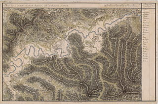
English: Grand Duchy of Transylvania, 1769-1773. Josephinische Landaufnahme pg.029 Română: Harta Iosefină a Transilvaniei, 1769-1773. Josephinische Landaufnahme pg.029 |
||||
| Date | between 1769 and 1773 | ||||
| Source | Österreichisches Staatsarchiv, Kriegsarchiv, B IX 715: Original-Aufnahmskarte des Grossfürtenthums Siebenbürgen. Geometrisch aufgenommen und bearbeitet in den Jahren 1769 bis 1773 unter der Direction des Obristen von Fabris, theils durch Officiere des grossen Feld-Generalstabes, theils auch von verschiedenen aus dem in Siebenbürgen bequartierten Regimentern zu diesem Geschäfte beigezogenen Individuen | ||||
| Author | Historische Militärkarte der österreichisch-ungarischen Monarchie | ||||
| Permission (Reusing this file) |
|
||||
Clickable Map of the Grand Duchy of Transylvania
[edit]
File history
Click on a date/time to view the file as it appeared at that time.
| Date/Time | Thumbnail | Dimensions | User | Comment | |
|---|---|---|---|---|---|
| current | 22:38, 3 December 2009 | | 8,440 × 5,604 (26.57 MB) | Asybaris01 (talk | contribs) | good rezolution |
| 07:16, 21 October 2009 |  | 5,486 × 3,643 (17.84 MB) | Asybaris01 (talk | contribs) | {{Information |Description={{ro|1=Josephinische Landaufnahme pg29}} |Source=Josephinische Landaufnahme pg29 |Author=Asybaris01 |Date=10/21/2009 |Permission= |other_versions= }} |
You cannot overwrite this file.
File usage on Commons
The following 2 pages use this file:
File usage on other wikis
The following other wikis use this file:
- Usage on arz.wikipedia.org
- Usage on hu.wikipedia.org
- Usage on ro.wikipedia.org
- Usage on tt.wikipedia.org
- Usage on www.wikidata.org