File:Jonahs Run Baptist Church.jpg
Jump to navigation
Jump to search

Size of this preview: 800 × 600 pixels. Other resolutions: 320 × 240 pixels | 640 × 480 pixels | 1,024 × 768 pixels | 1,280 × 960 pixels | 2,560 × 1,920 pixels | 2,816 × 2,112 pixels.
Original file (2,816 × 2,112 pixels, file size: 3.11 MB, MIME type: image/jpeg)
Captions
Captions
Add a one-line explanation of what this file represents
|
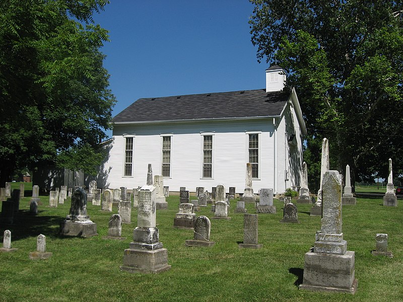
This is an image of a place or building that is listed on the National Register of Historic Places in the United States of America. Its reference number is 5001519. |
| Camera location | | View this and other nearby images on: OpenStreetMap |
|---|
| Description |
English: Side of the Jonahs Run Baptist Church as seen from its cemetery, located at 9614 W. State Route 73 east of Harveysburg in Chester Township, Clinton County, Ohio, United States. Built in 1838, it is part of the Underwood Farms Rural Historic District, a historic district that is listed on the National Register of Historic Places. Church website. |
||
| Date | Taken on 30 June 2010 | ||
| Source | Own work | ||
| Author | Nyttend | ||
| Permission (Reusing this file) |
|
||
| Other versions | None |
File history
Click on a date/time to view the file as it appeared at that time.
| Date/Time | Thumbnail | Dimensions | User | Comment | |
|---|---|---|---|---|---|
| current | 01:27, 1 July 2010 | | 2,816 × 2,112 (3.11 MB) | Nyttend (talk | contribs) | {{Location|39|29|47|N|83|58|50|W}} {{Information |Description={{en|Side of the Jonahs Run Baptist Church as seen from its cemetery, located at 9614 W. {{w|Ohio State Route 73|State Route 73}} east of {{w|Harveysburg, Ohio|Harveysburg}} in {{w|Chester Town |
You cannot overwrite this file.
File usage on Commons
The following page uses this file:
File usage on other wikis
The following other wikis use this file:
- Usage on en.wikipedia.org
- Usage on es.wikipedia.org
- Usage on eu.wikipedia.org
- Usage on fa.wikipedia.org
- Usage on pt.wikipedia.org
- Usage on ur.wikipedia.org
- Usage on vi.wikipedia.org
- Usage on www.wikidata.org
- Usage on zh.wikipedia.org
Metadata
Categories:
- Churches in Ohio built in 1838
- Cemeteries in Ohio
- Chester Township, Clinton County, Ohio
- Historic districts in Clinton County, Ohio
- Protestant cemeteries in the United States
- National Register of Historic Places in Clinton County, Ohio
- Vernacular architecture of Ohio
- Wooden churches in Clinton County, Ohio
- Buildings of religious function on the National Register of Historic Places in Ohio
- Churches in the United States photographed in 2010
- Baptist cemeteries in the United States