File:John Stockdale, A Plan of Ratisbon (FL167448749 2370137).jpg
Jump to navigation
Jump to search

Size of this preview: 800 × 588 pixels. Other resolutions: 320 × 235 pixels | 640 × 471 pixels | 1,024 × 753 pixels | 1,280 × 941 pixels | 2,560 × 1,882 pixels | 6,806 × 5,004 pixels.
Original file (6,806 × 5,004 pixels, file size: 40.52 MB, MIME type: image/jpeg)
Captions
Captions
Add a one-line explanation of what this file represents
Summary
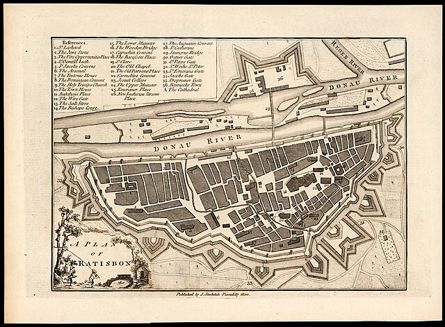
[edit]| John Stockdale: A Plan of Ratisbon
( |
||||||||||||||||||||||||
|---|---|---|---|---|---|---|---|---|---|---|---|---|---|---|---|---|---|---|---|---|---|---|---|---|
| Artist |
|
|||||||||||||||||||||||
| Title |
A Plan of Ratisbon |
|||||||||||||||||||||||
| Publisher |
J. Stockdale |
|||||||||||||||||||||||
| Description |
A Plan of Ratisbon. |
|||||||||||||||||||||||
| Language | English | |||||||||||||||||||||||
| Publication date | 1800 | |||||||||||||||||||||||
| Dimensions | height: 160 mm (6.29 in); width: 225 mm (8.85 in) | |||||||||||||||||||||||
| Collection |
|
|||||||||||||||||||||||
| Current location |
|
|||||||||||||||||||||||
| Place of publication | London | |||||||||||||||||||||||
| search Merhav catalog | London | |||||||||||||||||||||||
| Notes | Includes index | |||||||||||||||||||||||
| IE PID | IE167448747 | |||||||||||||||||||||||
| Rosetta filename | FL167448749 | |||||||||||||||||||||||
| NNL item ID (P3959) | 990023701370205171 | |||||||||||||||||||||||
| search Merhav catalog | English, John Stockdale | |||||||||||||||||||||||
| search Merhav catalog | J. Stockdale | |||||||||||||||||||||||
| Source/Photographer |
|
|||||||||||||||||||||||
| Other versions | ||||||||||||||||||||||||
| Jpg / Tif version |
|
|||||||||||||||||||||||


.jpg)

.jpg&action=edit§ion=1)
Licensing
[edit].jpg&action=edit§ion=2)
The copyright situation of this work is theoretically uncertain, because in the country of origin copyright lasts 70 years after the death of the author, and the date of the author's death is unknown. However, the date of creation of the work was over 120 years ago, and it is thus a reasonable assumption that the copyright has expired (see here for the community discussion). Do not use this template if the date of death of the author is known.
| |
| This file has been identified as being free of known restrictions under copyright law, including all related and neighboring rights. | |
File history
Click on a date/time to view the file as it appeared at that time.
| Date/Time | Thumbnail | Dimensions | User | Comment | |
|---|---|---|---|---|---|
| current | 10:01, 30 July 2023 | | 6,806 × 5,004 (40.52 MB) | Geagea (talk | contribs) | pattypan 22.03 |
You cannot overwrite this file.
File usage on Commons
The following page uses this file:
.jpg&oldid=788220776)