File:John Adams Map of England and Wales 1679 printed 1699.jpg
Jump to navigation
Jump to search

Size of this preview: 800 × 507 pixels. Other resolutions: 320 × 203 pixels | 640 × 406 pixels | 1,200 × 761 pixels.
Original file (1,200 × 761 pixels, file size: 334 KB, MIME type: image/jpeg)
Captions
Captions
Add a one-line explanation of what this file represents
Summary
[edit]
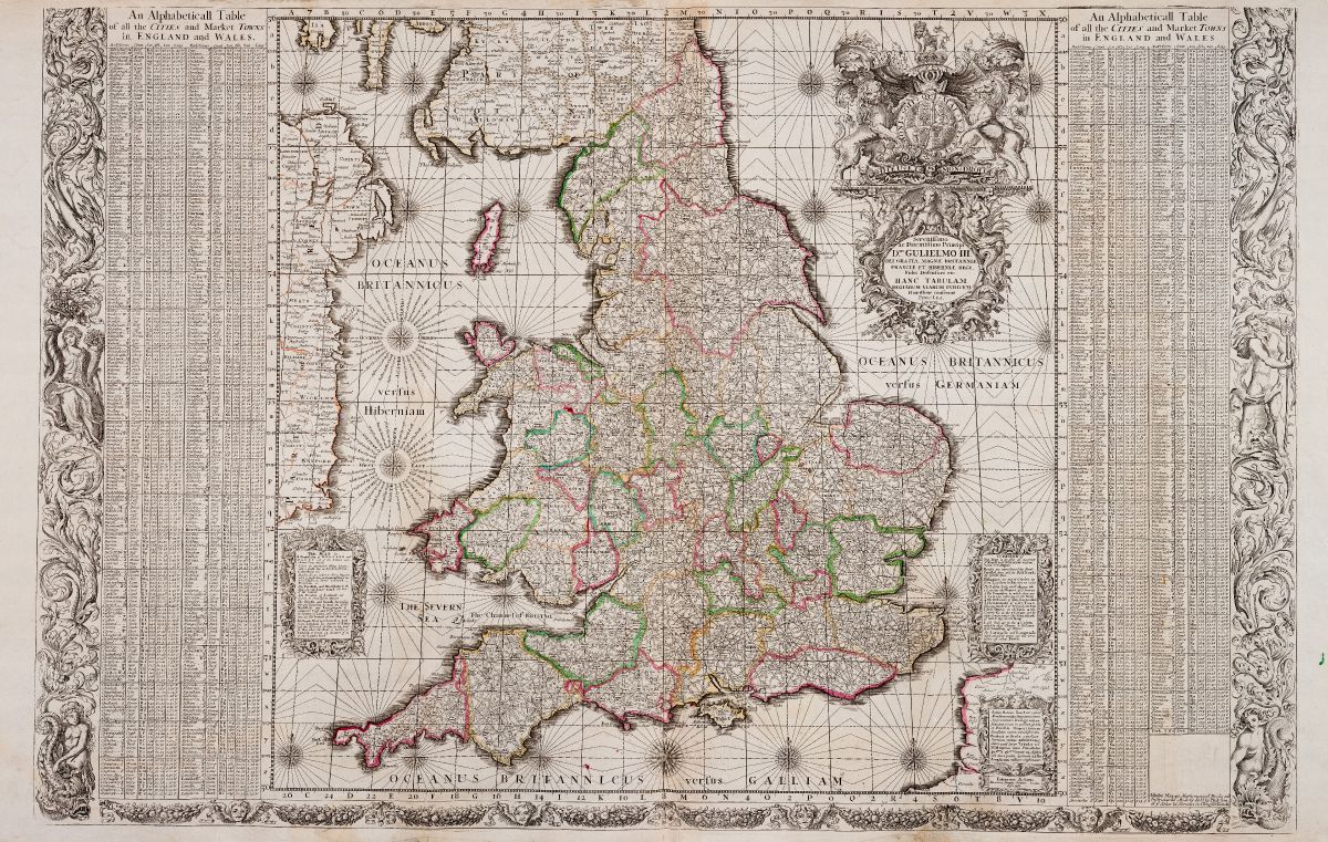
| Title |
Map of the Towns of England and Wales |
||||||||||||||||
| Date | |||||||||||||||||
| Source | Götzfried Antique Maps | ||||||||||||||||
| Creator |
|
||||||||||||||||
| Geotemporal data | |||||||||||||||||
| Date depicted | |||||||||||||||||
| Georeferencing | If inappropriate please set warp_status = skip to hide. | ||||||||||||||||
| Bibliographic data | |||||||||||||||||
| Printed by |
Philip Lea |
||||||||||||||||
| Archival data | |||||||||||||||||
| Medium | engraving | ||||||||||||||||
| artwork-references | [ANGLIAE TOTIUS TABULA... - AN ALPHABETICALL TABLE OF ALL THE CITIES AND MARKET TOWNS...]. | ||||||||||||||||
Licensing
[edit]
|
This is a faithful photographic reproduction of a two-dimensional, public domain work of art. The work of art itself is in the public domain for the following reason:
The official position taken by the Wikimedia Foundation is that "faithful reproductions of two-dimensional public domain works of art are public domain".
This photographic reproduction is therefore also considered to be in the public domain in the United States. In other jurisdictions, re-use of this content may be restricted; see Reuse of PD-Art photographs for details. | ||||
}}
File history
Click on a date/time to view the file as it appeared at that time.
| Date/Time | Thumbnail | Dimensions | User | Comment | |
|---|---|---|---|---|---|
| current | 23:15, 1 May 2021 | | 1,200 × 761 (334 KB) | PKM (talk | contribs) | {{Map |title = Map of the Towns of England and Wales |description = |legend = |author = {{creator:John Adams (cartographer)}} |image = |date = 1679 |source = [https://www.vintage-maps.com/3369-extra_large/adams-british-isles-england-and-wales-1679-1699.jpg Götzfried Antique Maps] |permission = |map date = 1679 |location = |wikidata-location = |type = |projection... |
You cannot overwrite this file.
File usage on Commons
There are no pages that use this file.
File usage on other wikis
The following other wikis use this file:
- Usage on www.wikidata.org