File:Joedavisstadiumusgs.png
Jump to navigation
Jump to search

Size of this preview: 800 × 544 pixels. Other resolutions: 320 × 218 pixels | 640 × 435 pixels | 1,022 × 695 pixels.
Original file (1,022 × 695 pixels, file size: 761 KB, MIME type: image/png)
Captions
Captions
Add a one-line explanation of what this file represents
Summary
[edit]
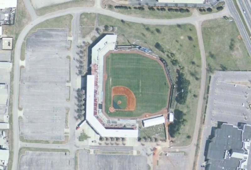
| Description | w:Joe Davis Stadium in Huntsville, Alabama. USGS data via NASA World Wind. |
| Date | upload date |
| Source | NASA |
| Author | NASA |
| This image is in the public domain because it is a screenshot from NASA’s globe software World Wind using a public domain layer, such as Blue Marble, MODIS, Landsat, SRTM, USGS or GLOBE.
|
 |
File history
Click on a date/time to view the file as it appeared at that time.
| Date/Time | Thumbnail | Dimensions | User | Comment | |
|---|---|---|---|---|---|
| current | 01:18, 25 June 2007 | | 1,022 × 695 (761 KB) | Spyder Monkey (talk | contribs) | w:Joe Davis Stadium in Huntsville, Alabama. USGS data via NASA World Wind. {{PD-WorldWind}} Category:Joe Davis Stadium Category:Satellite pictures of Alabama |
You cannot overwrite this file.
File usage on Commons
The following page uses this file:
File usage on other wikis
The following other wikis use this file:
- Usage on en.wikipedia.org
- Usage on www.wikidata.org