File:Jodocus Hondius - Freti Magellanici.jpg
Jump to navigation
Jump to search

Size of this preview: 791 × 600 pixels. Other resolutions: 317 × 240 pixels | 633 × 480 pixels | 1,013 × 768 pixels | 1,280 × 970 pixels | 1,468 × 1,113 pixels.
Original file (1,468 × 1,113 pixels, file size: 924 KB, MIME type: image/jpeg)
Captions
Captions
Add a one-line explanation of what this file represents
Summary
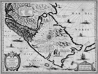
[edit]| Description | Description: A map of Strait of Magellan and Tierra del Fuego. Freti Magellanici ac novi Freti vulgó Le Maire exactissima delineatio. / Afbeelding der Strae Magellanes, So als de selve van M.rBarent Iansz. Potgieter van Munster door en weder door bevaren en met syn Capiteyn Sebald de Waerd met groot pericul syns levens seer naerstig ondersocht is. / Judocus Hondius excudit. / DGriip Sculp. | |||||||||||||||||||||||
| Date | circa 1628 | |||||||||||||||||||||||
| Source | Austrian Academy of Sciences. Gallery: Maps, Atlases, and Globes | |||||||||||||||||||||||
| Author |
|
|||||||||||||||||||||||
| Permission (Reusing this file) |
PD because of age | |||||||||||||||||||||||
| Other versions |
|
|||||||||||||||||||||||


Licensing
[edit]
|
This work is in the public domain in its country of origin and other countries and areas where the copyright term is the author's life plus 100 years or fewer. | |
| This file has been identified as being free of known restrictions under copyright law, including all related and neighboring rights. | |
File history
Click on a date/time to view the file as it appeared at that time.
| Date/Time | Thumbnail | Dimensions | User | Comment | |
|---|---|---|---|---|---|
| current | 21:31, 2 January 2007 | | 1,468 × 1,113 (924 KB) | Lencer (talk | contribs) | |
| 21:23, 2 January 2007 |  | 1,539 × 1,149 (681 KB) | Lencer (talk | contribs) | == Beschreibung == Jodocus Hondius: ''FRETI MAGELLANICI ac novi FRETI vulgo LE MAIRE exactissima delineatio'' * Description: Jodocus Hondius: ''Vera Totius Expeditionis Nauticae'' A map of Magellan Strait and Tierra del Fuego * Year: later 1600 == Licen |
You cannot overwrite this file.
File usage on Commons
The following 4 pages use this file:
File usage on other wikis
The following other wikis use this file:
- Usage on ca.wikipedia.org
- Usage on de.wikipedia.org
- Usage on en.wikiversity.org
- Usage on es.wikipedia.org
- Usage on fr.wikipedia.org
- Usage on fy.wikipedia.org
- Usage on zh.wikipedia.org