File:Jesuit Province Paraguay 1732 map.png
Jump to navigation
Jump to search
Size of this preview: 463 × 600 pixels. Other resolutions: 185 × 240 pixels | 371 × 480 pixels | 593 × 768 pixels | 791 × 1,024 pixels | 1,582 × 2,048 pixels | 3,012 × 3,900 pixels.
Original file (3,012 × 3,900 pixels, file size: 23.65 MB, MIME type: image/png)
Captions
Captions
Add a one-line explanation of what this file represents
Summary
[edit]
| Description |
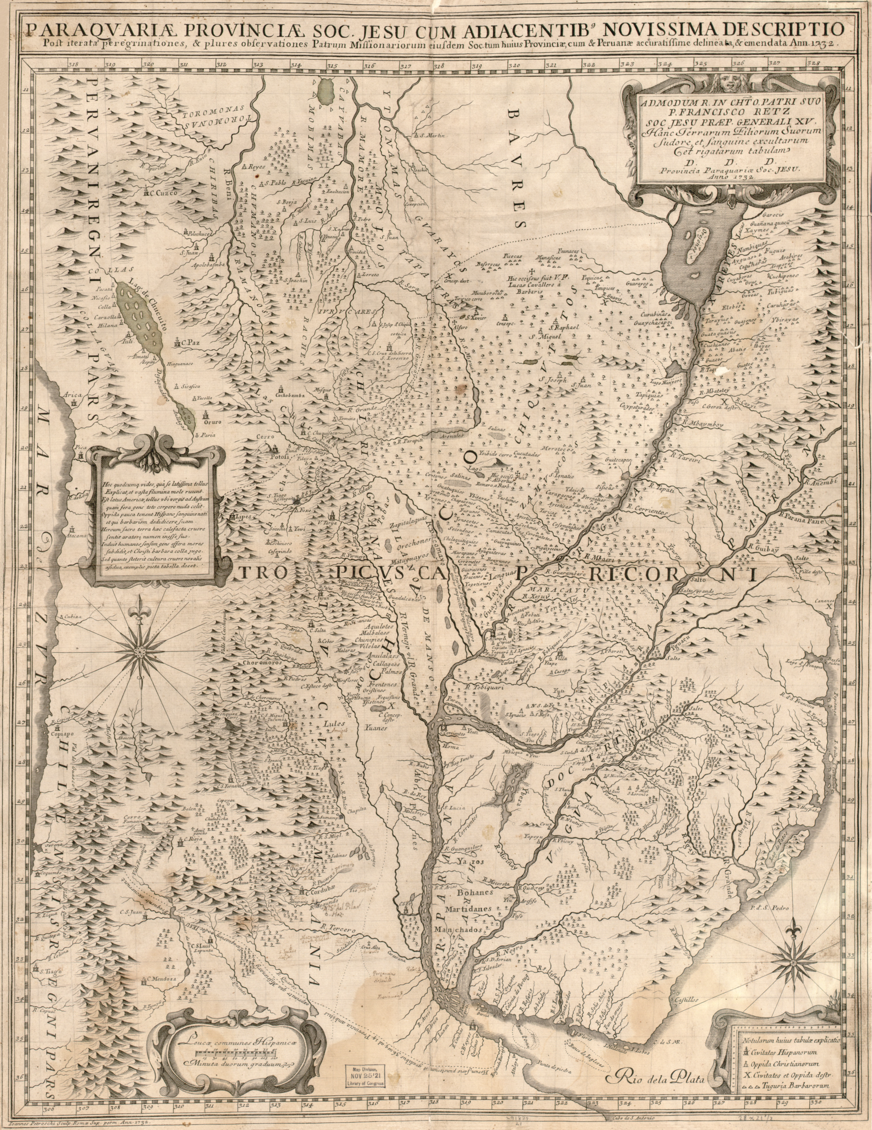
English: Map (66 x 52 cm) in Latin, with some place names in Spanish, showing the Jesuit province of Paraguay and neighbouring areas, with the main missions and missionary journeys. The map was made in Rome by Giovanni Petroschi (1715-66), and is dedicated to Francisco Retz (1673-1750), Superior General of the Society of Jesus.
Latina: Paraguariæ Provinciæ soc. jesu cum adiacentibg. novissima descriptio : post iteratas peregrinationes & plures observationes patrum missionariorum eiusdem soc. tum huius provinciæ, cum & Peruanæ accuratissime delineata & emendata ann. 1732 / admodum r. in cht. o. patri suo P. Francisco Retz, soc. jesu præp. generali XV, hanc terrarum filiorum suorum sudore et sanguine excultarum et rigatarum tabulam ; D.D.D., provincia paraquariæ soc, jesu, anno 1732 ; Ioannes Petroschi, sculp. Romæ sup. perm., ann. 1732. |
| Date | |
| Source | Library of Congress Geography and Map Division Washington, D.C. 20540-4650 USA [1] |
| Author | Giovanni Petroschi |
Licensing
[edit]
|
This is a faithful photographic reproduction of a two-dimensional, public domain work of art. The work of art itself is in the public domain for the following reason:
The official position taken by the Wikimedia Foundation is that "faithful reproductions of two-dimensional public domain works of art are public domain".
This photographic reproduction is therefore also considered to be in the public domain in the United States. In other jurisdictions, re-use of this content may be restricted; see Reuse of PD-Art photographs for details. | ||||
File history
Click on a date/time to view the file as it appeared at that time.
| Date/Time | Thumbnail | Dimensions | User | Comment | |
|---|---|---|---|---|---|
| current | 07:12, 24 April 2009 | | 3,012 × 3,900 (23.65 MB) | Yarnalgo (talk | contribs) | scaled down to below 12 megapixels |
| 06:32, 24 April 2009 |  | 6,585 × 8,535 (72.52 MB) | Bamse (talk | contribs) | {{Information |Description={{en|1=Map (66 x 52 cm) in Latin, with some place names in Spanish, showing the Jesuit province of Paraguay and neighbouring areas, with the main missions and missionary journeys. The map was made in Rome by Giovanni Petroschi ( |
You cannot overwrite this file.
File usage on Commons
The following page uses this file:
File usage on other wikis
The following other wikis use this file:
- Usage on de.wikipedia.org
- Usage on en.wikipedia.org
- Usage on es.wikipedia.org
- Usage on fr.wikipedia.org
- Usage on it.wikipedia.org
- Usage on no.wikipedia.org
- Usage on pt.wikipedia.org
- Usage on ru.wikipedia.org
- Usage on sv.wikipedia.org