File:Jerusalem area.svg
Jump to navigation
Jump to search

Size of this PNG preview of this SVG file: 800 × 518 pixels. Other resolutions: 320 × 207 pixels | 640 × 414 pixels | 1,024 × 663 pixels | 1,280 × 829 pixels | 2,560 × 1,658 pixels | 2,100 × 1,360 pixels.
Original file (SVG file, nominally 2,100 × 1,360 pixels, file size: 117 KB)
Captions
Captions
Add a one-line explanation of what this file represents
Summary
[edit]
| Description |
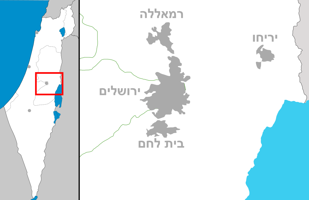
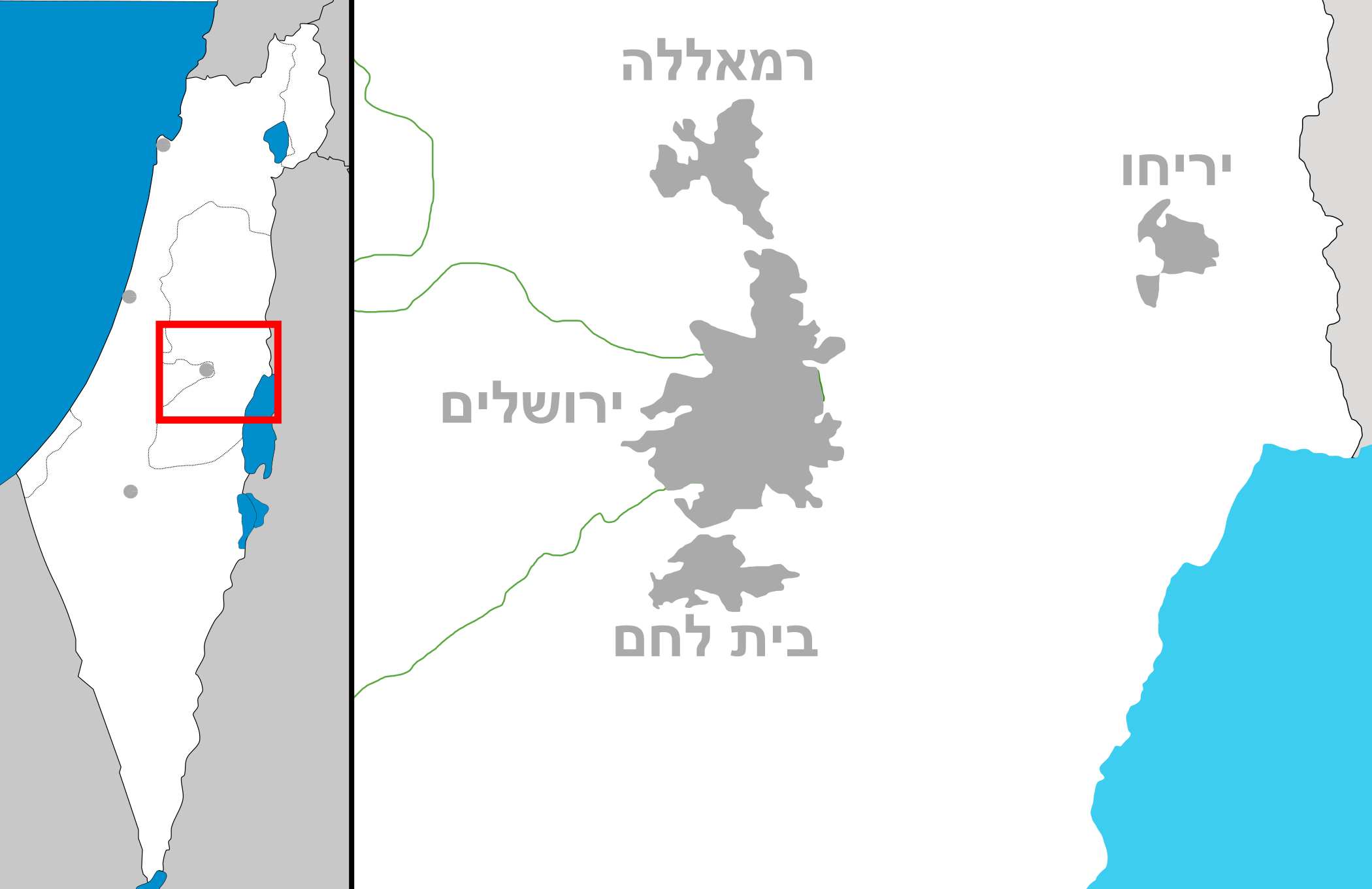
English: Map of Jerusalem and the surrounding area, Hebrew labels
מפה של איזור ירושליים |
| Date | (UTC) |
| Source | Own work |
| Author | Costello |
Licensing
[edit]
I, the copyright holder of this work, hereby publish it under the following licenses:
This file is licensed under the Creative Commons Attribution-Share Alike 3.0 Unported license.
- You are free:
- to share – to copy, distribute and transmit the work
- to remix – to adapt the work
- Under the following conditions:
- attribution – You must give appropriate credit, provide a link to the license, and indicate if changes were made. You may do so in any reasonable manner, but not in any way that suggests the licensor endorses you or your use.
- share alike – If you remix, transform, or build upon the material, you must distribute your contributions under the same or compatible license as the original.

|
Permission is granted to copy, distribute and/or modify this document under the terms of the GNU Free Documentation License, Version 1.2 or any later version published by the Free Software Foundation; with no Invariant Sections, no Front-Cover Texts, and no Back-Cover Texts. A copy of the license is included in the section entitled GNU Free Documentation License. |
You may select the license of your choice.
File history
Click on a date/time to view the file as it appeared at that time.
| Date/Time | Thumbnail | Dimensions | User | Comment | |
|---|---|---|---|---|---|
| current | 16:01, 2 October 2008 | | 2,100 × 1,360 (117 KB) | Costello (talk | contribs) | fixing the south part of the dead sea |
| 10:27, 21 September 2008 |  | 2,100 × 1,360 (114 KB) | Costello (talk | contribs) | fixed version | |
| 10:26, 21 September 2008 |  | 2,100 × 1,360 (167 KB) | Costello (talk | contribs) | {{Information |Description={{en|1=Map of Jerusalem and the surrounding area, Hebrew labels}} מפה של איזור ירושליים |Source=Own work by uploader |Author=Costello |Date=~~~~~ |Permission= |other_versions= }} <!--{{ImageU |
You cannot overwrite this file.
File usage on Commons
The following page uses this file:
File usage on other wikis
The following other wikis use this file:
- Usage on he.wikipedia.org
- האוניברסיטה העברית בירושלים
- האקדמיה ללשון העברית
- יד ושם
- בית לחם
- עמק הצבאים
- חלקת גדולי האומה
- בצלאל אקדמיה לאמנות ועיצוב ירושלים
- מבשרת ציון
- ביתר עילית
- מעלה אדומים
- אבו גוש
- אפרת
- גבעת זאב
- הר אדר
- קריית יערים
- גבע בנימין
- פרשת דיר יאסין
- מדבר יהודה
- נקבת השילוח
- יריחו
- בית המשפט העליון
- נטף
- ורד יריחו
- כרמי צור
- כנסיית מריה מגדלנה
- ביתר
- שער מנדלבאום
- מוזיאון ישראל
- המוסד לביטוח לאומי
- מגרש הרוסים
- נווה דניאל
- הר הצופים
- מעלה עמוס
- הר הרצל
- אצטדיון טדי
- בית הספר מרחבים
- אורה
- הר גילה
- הרבנות הראשית לישראל
- ישיבת הר המור
- בית טיכו
- כנסיית דומינוס פלוויט
- קבר מרים
- בית אברלה
- בית אהמן
- קבר זכריה
- בית בוירלה
- בית זנדל
- גוש עציון
- מועצה אזורית גוש עציון
View more global usage of this file.