File:Jerusalem Old City 1.jpg
Original file (3,072 × 2,048 pixels, file size: 4.23 MB, MIME type: image/jpeg)
Captions
Summary
[edit]DescriptionJerusalem Old City 1.jpg |
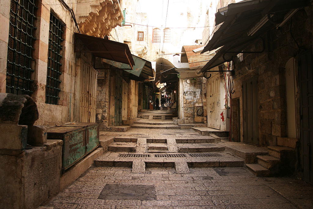
English: Old Jerusalem, Hashalshelet Street (at the corner with Misgav Ladakh road) - A road in the Old City leading away from the Temple Mount or Noble Sanctuary toward Jaffa Gate.
Jerusalem, Israel/Palestine, March 2007
|
||
Date | |||
Source | https://www.flickr.com/photos/94509941@N00/417562117/ | ||
Author | beggs |
Camera location | 31° 46′ 37.21″ N, 35° 13′ 59.55″ E | View this and other nearby images on: OpenStreetMap | 31.777002; 35.233207 |
---|
Licensing
[edit]This image was originally posted to Flickr. Its license was verified as "cc-by-2.0" by the UploadWizard Extension at the time it was transferred to Commons. See the license information for further details. |
- You are free:
- to share – to copy, distribute and transmit the work
- to remix – to adapt the work
- Under the following conditions:
- attribution – You must give appropriate credit, provide a link to the license, and indicate if changes were made. You may do so in any reasonable manner, but not in any way that suggests the licensor endorses you or your use.
This image was uploaded as part of Wiki Loves Monuments 2014.
Afrikaans ∙ Alemannisch ∙ العربية ∙ جازايرية ∙ azərbaycanca ∙ Bikol Central ∙ беларуская ∙ беларуская (тарашкевіца) ∙ български ∙ বাংলা ∙ brezhoneg ∙ bosanski ∙ català ∙ čeština ∙ Cymraeg ∙ dansk ∙ Deutsch ∙ Zazaki ∙ Ελληνικά ∙ English ∙ Esperanto ∙ español ∙ eesti ∙ euskara ∙ فارسی ∙ suomi ∙ français ∙ Frysk ∙ Gaeilge ∙ galego ∙ עברית ∙ हिन्दी ∙ hrvatski ∙ magyar ∙ հայերեն ∙ Bahasa Indonesia ∙ Ido ∙ italiano ∙ 日本語 ∙ ქართული ∙ 한국어 ∙ кыргызча ∙ Lëtzebuergesch ∙ latviešu ∙ Malagasy ∙ македонски ∙ മലയാളം ∙ Bahasa Melayu ∙ Malti ∙ norsk bokmål ∙ नेपाली ∙ Nederlands ∙ norsk nynorsk ∙ norsk ∙ polski ∙ português ∙ português do Brasil ∙ română ∙ русский ∙ sicilianu ∙ davvisámegiella ∙ slovenčina ∙ slovenščina ∙ shqip ∙ српски / srpski ∙ svenska ∙ ไทย ∙ Tagalog ∙ Türkçe ∙ українська ∙ اردو ∙ oʻzbekcha / ўзбекча ∙ Yorùbá ∙ 中文 ∙ 中文(中国大陆) ∙ 中文(简体) ∙ 中文(繁體) ∙ 中文(香港) ∙ 中文(臺灣) ∙ +/− |
Annotations InfoField | This image is annotated: View the annotations at Commons |
notice the security camera
Misgav Ladakh road sign
Tashtimuryya
File history
Click on a date/time to view the file as it appeared at that time.
Date/Time | Thumbnail | Dimensions | User | Comment | |
---|---|---|---|---|---|
current | 02:39, 27 September 2014 | 3,072 × 2,048 (4.23 MB) | Tarawneh (talk | contribs) | User created page with UploadWizard |
You cannot overwrite this file.
File usage on Commons
There are no pages that use this file.
Metadata
This file contains additional information such as Exif metadata which may have been added by the digital camera, scanner, or software program used to create or digitize it. If the file has been modified from its original state, some details such as the timestamp may not fully reflect those of the original file. The timestamp is only as accurate as the clock in the camera, and it may be completely wrong.
Camera manufacturer | Canon |
---|---|
Camera model | Canon EOS 10D |
Exposure time | 1/125 sec (0.008) |
F-number | f/3.5 |
ISO speed rating | 100 |
Date and time of data generation | 15:47, 2 March 2007 |
Lens focal length | 21 mm |
Orientation | Normal |
Horizontal resolution | 180 dpi |
Vertical resolution | 180 dpi |
Software used | Adobe Photoshop CS2 Macintosh |
File change date and time | 20:37, 8 March 2007 |
Y and C positioning | Centered |
Exif version | 2.21 |
Date and time of digitizing | 15:47, 2 March 2007 |
Meaning of each component |
|
Image compression mode | 3 |
APEX shutter speed | 6.9657897949219 |
APEX aperture | 3.6147155761719 |
APEX exposure bias | 0 |
Maximum land aperture | 3.6147155761719 APEX (f/3.5) |
Metering mode | Average |
Flash | Flash did not fire |
Supported Flashpix version | 1 |
Color space | sRGB |
Focal plane X resolution | 3,443.9461883408 |
Focal plane Y resolution | 3,442.0168067227 |
Focal plane resolution unit | inches |
Sensing method | One-chip color area sensor |
File source | Digital still camera |
Custom image processing | Normal process |
Exposure mode | Auto exposure |
White balance | Manual white balance |
Scene capture type | Standard |
Supported Flashpix version | 1 |
Image width | 3,072 px |
Image height | 2,048 px |
Date metadata was last modified | 04:37, 9 March 2007 |
Structured data
Items portrayed in this file
depicts
some value
2 March 2007
31°46'37.207"N, 35°13'59.545"E
image/jpeg
0.008 second
3.5
21 millimetre
100
4,433,715 byte
2,048 pixel
3,072 pixel
46016500691eec2ef545cb55189fa2d385c6da00
- Template Unknown (unspecified)
- Cultural heritage monuments in Palestine with unknown IDs
- Files with coordinates missing SDC location of creation
- Flickr images verified by UploadWizard
- CC-BY-2.0
- Images from Wiki Loves Monuments 2014
- Images from Wiki Loves Monuments 2014 in Palestine
- Images from Wiki Loves Monuments missing SDC depicts
- Images from Wiki Loves Monuments missing SDC location of creation
- Images with annotations
- Uploaded via Campaign:wlm-ps