File:Jay Nixon State Park orthoimage 20170208.jpg
Jump to navigation
Jump to search
Size of this preview: 762 × 600 pixels. Other resolutions: 305 × 240 pixels | 610 × 480 pixels | 975 × 768 pixels | 1,143 × 900 pixels.
Original file (1,143 × 900 pixels, file size: 534 KB, MIME type: image/jpeg)
Captions
Captions
Add a one-line explanation of what this file represents
Summary
[edit]
| Description |
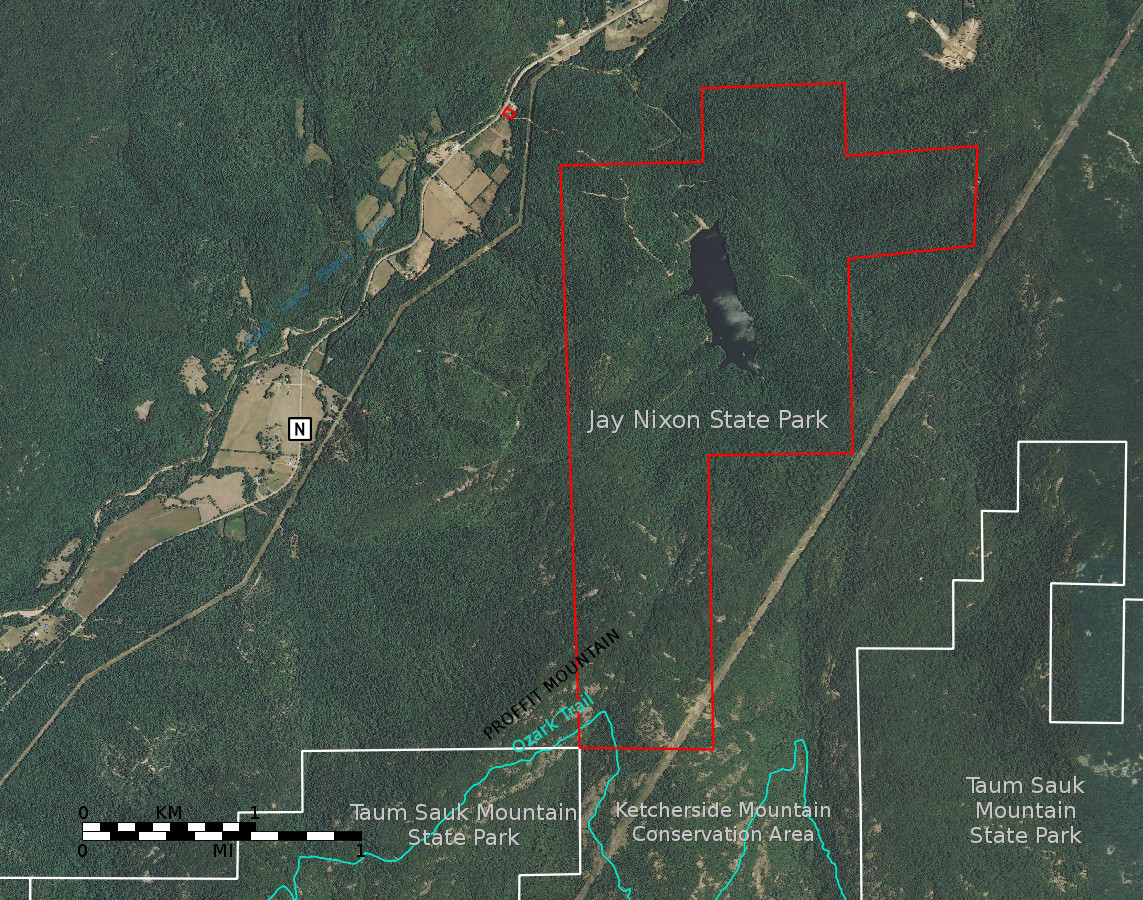
English: A map based on orthoimagery from the USGS showing Jay Nixon State Park in Missouri. Park boundaries are from a shapefile published by the Missouri Department of Natural Resources.[1] At the time the map data was published the tract of land that makes up Jay Nixon State Park was represented as being a part of adjacent Taum Sauk Mountain State Park.[2]
Do not rely on this map for determining legal boundaries or for navigation; it is provided with no guarantee of suitability for any purpose. |
| Date | |
| Source | Own work |
| Author | Kbh3rd |
| Other versions |
 |
| Camera location | | View this and other nearby images on: OpenStreetMap |
|---|
Map projection UTM zone 15N NAD83 datum (EPSG:29615). When rendered at 1143 pixels wide by 900 high this map is described by this world file:
5.80388071946614659
0
0
-5.80388071946614659
692028.76912757614627481
4164500.62966106366366148
Licensing
[edit]
I, the copyright holder of this work, hereby publish it under the following license:
This file is licensed under the Creative Commons Attribution 4.0 International license.
- You are free:
- to share – to copy, distribute and transmit the work
- to remix – to adapt the work
- Under the following conditions:
- attribution – You must give appropriate credit, provide a link to the license, and indicate if changes were made. You may do so in any reasonable manner, but not in any way that suggests the licensor endorses you or your use.
File history
Click on a date/time to view the file as it appeared at that time.
| Date/Time | Thumbnail | Dimensions | User | Comment | |
|---|---|---|---|---|---|
| current | 05:53, 10 February 2017 | | 1,143 × 900 (534 KB) | Kbh3rd (talk | contribs) | User created page with UploadWizard |
You cannot overwrite this file.
File usage on Commons
The following page uses this file: