File:January 2009 Bay of Biscay storm tracker.svg
Jump to navigation
Jump to search
Size of this PNG preview of this SVG file: 680 × 520 pixels. Other resolutions: 314 × 240 pixels | 628 × 480 pixels | 1,004 × 768 pixels | 1,280 × 979 pixels | 2,560 × 1,958 pixels.
Original file (SVG file, nominally 680 × 520 pixels, file size: 530 KB)
Captions
Captions
Add a one-line explanation of what this file represents
Summary
[edit]
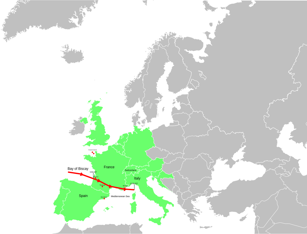
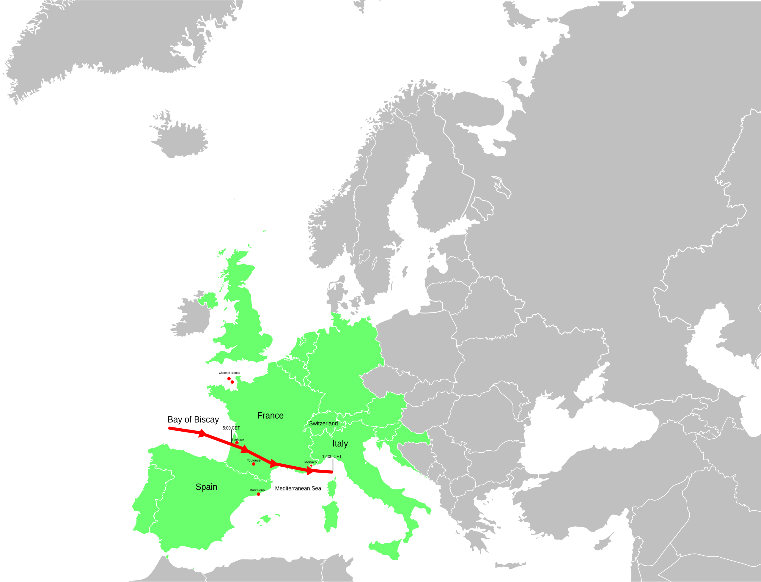
| Description | A map of Europe showing the location of the January 2009 Mediterranean storm. The red line shows the track of the storm. |
| Date | |
| Source | Self-made losely based upon BBC map, but not a derivitive work. |
| Author | Jolly Janner |
| Other versions | Cropped bitmap for article use |
Licensing
[edit]
| I, the copyright holder of this work, release this work into the public domain. This applies worldwide. In some countries this may not be legally possible; if so: I grant anyone the right to use this work for any purpose, without any conditions, unless such conditions are required by law. |
File history
Click on a date/time to view the file as it appeared at that time.
| Date/Time | Thumbnail | Dimensions | User | Comment | |
|---|---|---|---|---|---|
| current | 14:05, 25 January 2009 | 680 × 520 (530 KB) | Jolly Janner (talk | contribs) | Added Channel Islands, labeled Switzerland and shaded in more counries | |
| 01:07, 25 January 2009 | 680 × 520 (530 KB) | Jolly Janner (talk | contribs) | {{Information |Description=A map of Europe showing the location of the January 2009 Mediterranean storm. The red line shows the track of the storm. |Source=Self-made losely based upon [http://newsimg.bbc.co.u |
You cannot overwrite this file.
File usage on Commons
There are no pages that use this file.