File:Jalur Tracking di Hutan Lindung Sungai Wain.jpg
Jump to navigation
Jump to search
Size of this preview: 337 × 598 pixels. Other resolutions: 135 × 240 pixels | 270 × 480 pixels | 432 × 768 pixels | 576 × 1,024 pixels | 1,153 × 2,048 pixels | 2,919 × 5,183 pixels.
Original file (2,919 × 5,183 pixels, file size: 3.01 MB, MIME type: image/jpeg)
Captions
Captions
Add a one-line explanation of what this file represents
Summary
[edit]
| Description |
Afrikaans: Hutan Lindung Sungai Wain is 'n beskermde gebied in Balikpapanstad, Oos-Kalimantan. Hierdie gebied het 'n tuiste geword vir sommige vrygelate Orang-oetangs nadat hulle gerehabiliteer is.
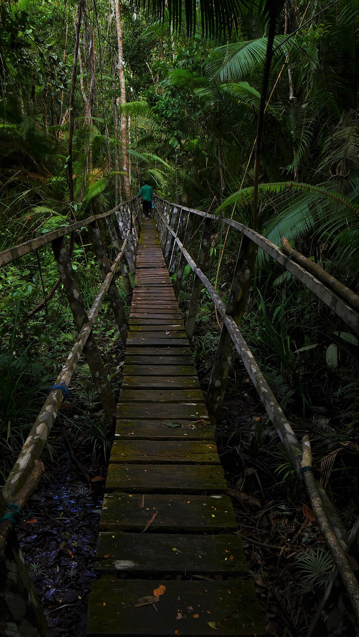
English: Hutan Lindung Sungai Wain is a protected area that situated in Balikpapan City, East Kalimantan. This area become a home for some released Orangutans after being rehabilitated. |
| Date | |
| Source | Own work |
| Author | Gunawan gtp |
Hutan Lindung Sungai Wain terletak di Kota Balikpapan, Provinsi Kalimantan Timur
Licensing
[edit]
I, the copyright holder of this work, hereby publish it under the following license:
This file is licensed under the Creative Commons Attribution-Share Alike 4.0 International license.
- You are free:
- to share – to copy, distribute and transmit the work
- to remix – to adapt the work
- Under the following conditions:
- attribution – You must give appropriate credit, provide a link to the license, and indicate if changes were made. You may do so in any reasonable manner, but not in any way that suggests the licensor endorses you or your use.
- share alike – If you remix, transform, or build upon the material, you must distribute your contributions under the same or compatible license as the original.
This image was uploaded as part of Wiki Loves Earth 2020.
|
 |
File history
Click on a date/time to view the file as it appeared at that time.
| Date/Time | Thumbnail | Dimensions | User | Comment | |
|---|---|---|---|---|---|
| current | 06:31, 31 May 2020 | 2,919 × 5,183 (3.01 MB) | Gunawan gtp (talk | contribs) | Uploaded own work with UploadWizard |
You cannot overwrite this file.
File usage on Commons
There are no pages that use this file.