File:Jaligny lieux-dits 2023.png
Jump to navigation
Jump to search

Size of this preview: 800 × 583 pixels. Other resolutions: 320 × 233 pixels | 640 × 466 pixels | 1,024 × 746 pixels | 1,280 × 932 pixels | 2,560 × 1,864 pixels | 3,407 × 2,481 pixels.
Original file (3,407 × 2,481 pixels, file size: 2.25 MB, MIME type: image/png)
Captions
Captions
Add a one-line explanation of what this file represents
Summary
[edit]
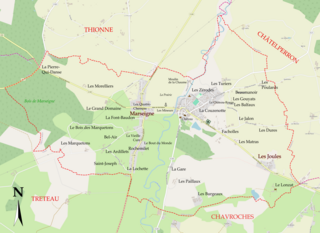
| Description | Carte des faubourgs et lieux-dits de Jaligny-sur-Besbre (France, Allier) |
| Date | |
| Source | Own work - Fond de carte par OpenStreetMap® sous licence Creative Commons Attribution – Partage à l’identique v2.0 (CC BY-SA 2.0). |
| Author | Jaligniacus |
| Other versions | Jaligny lieux-dits.svg |
Licensing
[edit]
I, the copyright holder of this work, hereby publish it under the following licenses:

|
Permission is granted to copy, distribute and/or modify this document under the terms of the GNU Free Documentation License, Version 1.2 or any later version published by the Free Software Foundation; with no Invariant Sections, no Front-Cover Texts, and no Back-Cover Texts. A copy of the license is included in the section entitled GNU Free Documentation License. |
This file is licensed under the Creative Commons Attribution-Share Alike 4.0 International license.
- You are free:
- to share – to copy, distribute and transmit the work
- to remix – to adapt the work
- Under the following conditions:
- attribution – You must give appropriate credit, provide a link to the license, and indicate if changes were made. You may do so in any reasonable manner, but not in any way that suggests the licensor endorses you or your use.
- share alike – If you remix, transform, or build upon the material, you must distribute your contributions under the same or compatible license as the original.
You may select the license of your choice.
File history
Click on a date/time to view the file as it appeared at that time.
| Date/Time | Thumbnail | Dimensions | User | Comment | |
|---|---|---|---|---|---|
| current | 15:41, 7 February 2024 | | 3,407 × 2,481 (2.25 MB) | Jaligniacus (talk | contribs) | == {{int:filedesc}} == {{Information |Description=Carte des faubourgs et lieux-dits de Jaligny-sur-Besbre (France, Allier) |Source={{own}} - Fond de carte par OpenStreetMap® sous licence Creative Commons Attribution – Partage à l’identique v2.0 (CC BY-SA 2.0). |Date=2024-02-07 |Author= Jaligniacus |Permission= |other_versions=Jaligny lieux-dits.svg }} Category:Maps of Jaligny-sur-Besbre == {{int:license-header}} == {{self|GFDL|cc-... |
You cannot overwrite this file.
File usage on Commons
There are no pages that use this file.
File usage on other wikis
The following other wikis use this file:
- Usage on fr.wikipedia.org