File:JOG Index 250k.jpg
Jump to navigation
Jump to search
Size of this preview: 800 × 428 pixels. Other resolutions: 320 × 171 pixels | 640 × 343 pixels | 1,024 × 548 pixels | 1,280 × 685 pixels | 2,246 × 1,202 pixels.
Original file (2,246 × 1,202 pixels, file size: 610 KB, MIME type: image/jpeg)
Captions
Captions
Add a one-line explanation of what this file represents
Summary
[edit]
| Description |
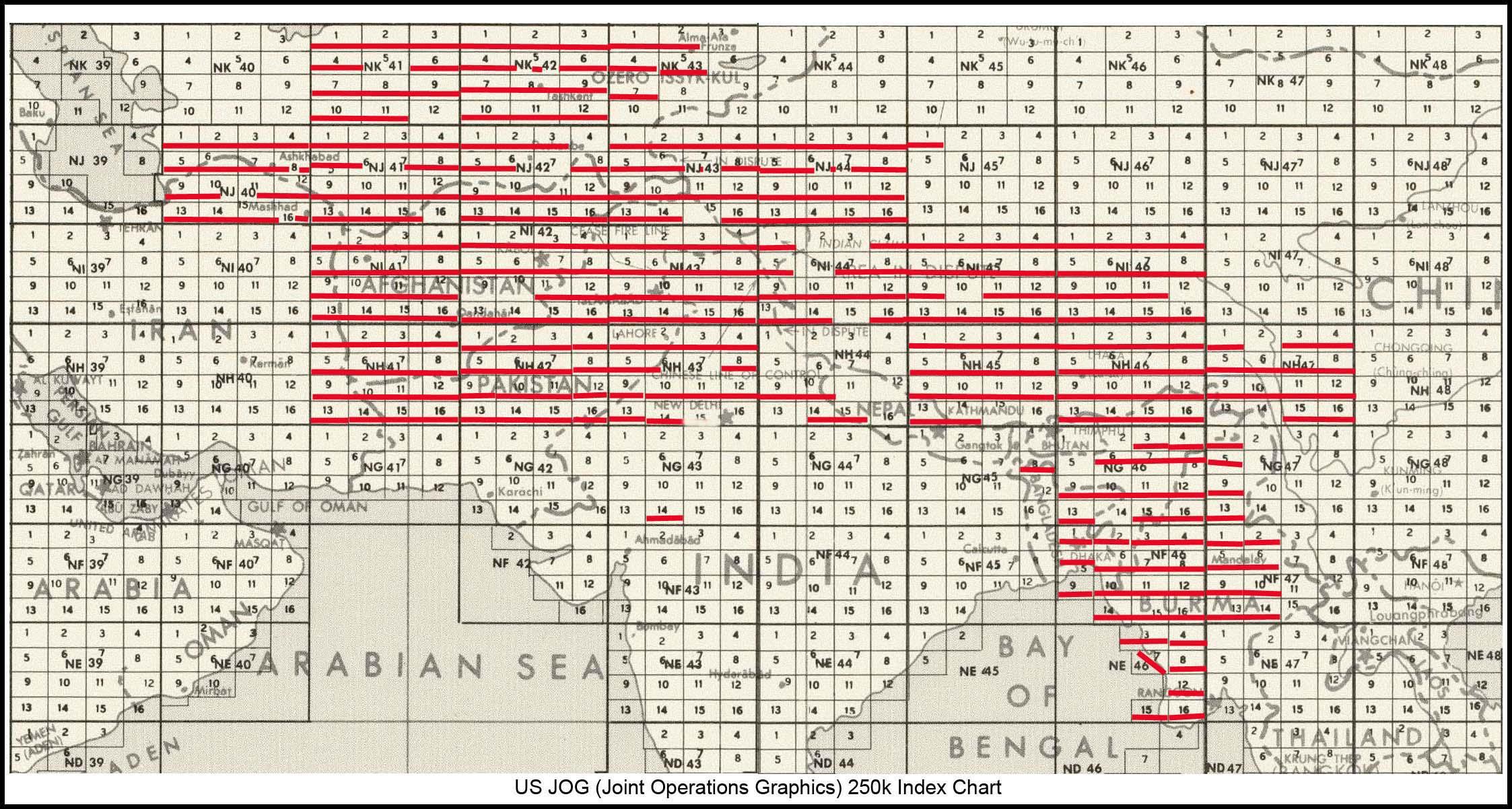
English: JOG Index 250k (edited to include map NH-45-1 which had been mislabeled as NJ-45-1) |
| Date | |
| Source | People's Association for Himalaya Area Research |
| Author | US Government |
Licensing
[edit]
This work is in the public domain in the United States because it is a work prepared by an officer or employee of the United States Government as part of that person’s official duties under the terms of Title 17, Chapter 1, Section 105 of the US Code.
Note: This only applies to original works of the Federal Government and not to the work of any individual U.S. state, territory, commonwealth, county, municipality, or any other subdivision. This template also does not apply to postage stamp designs published by the United States Postal Service since 1978. (See § 313.6(C)(1) of Compendium of U.S. Copyright Office Practices). It also does not apply to certain US coins; see The US Mint Terms of Use.
|
 | |
| This file has been identified as being free of known restrictions under copyright law, including all related and neighboring rights. | ||
File history
Click on a date/time to view the file as it appeared at that time.
| Date/Time | Thumbnail | Dimensions | User | Comment | |
|---|---|---|---|---|---|
| current | 06:48, 9 May 2020 | | 2,246 × 1,202 (610 KB) | Geographyinitiative (talk | contribs) | Both NJ-45-1 and NH-45-1 (mislabeled as NJ-45-1) are part of the collection |
| 06:20, 9 May 2020 |  | 2,246 × 1,202 (610 KB) | Geographyinitiative (talk | contribs) | Correction- the [https://pahar.in/1501-series-maps/ People's Association for Himalaya Area Research] site has NH-45-1 mislabeled as NJ-45-1 | |
| 03:38, 4 May 2020 |  | 2,246 × 1,202 (531 KB) | Geographyinitiative (talk | contribs) | Uploaded a work by US Government from [https://pahar.in/1501-series-maps/ People's Association for Himalaya Area Research] with UploadWizard |
You cannot overwrite this file.
File usage on Commons
The following 6 pages use this file: