File:Its the bloody Sage again - Flickr - smlp.co.uk.jpg
Original file (4,058 × 2,758 pixels, file size: 4.91 MB, MIME type: image/jpeg)
Captions
Captions
Summary
[edit]
| Description |
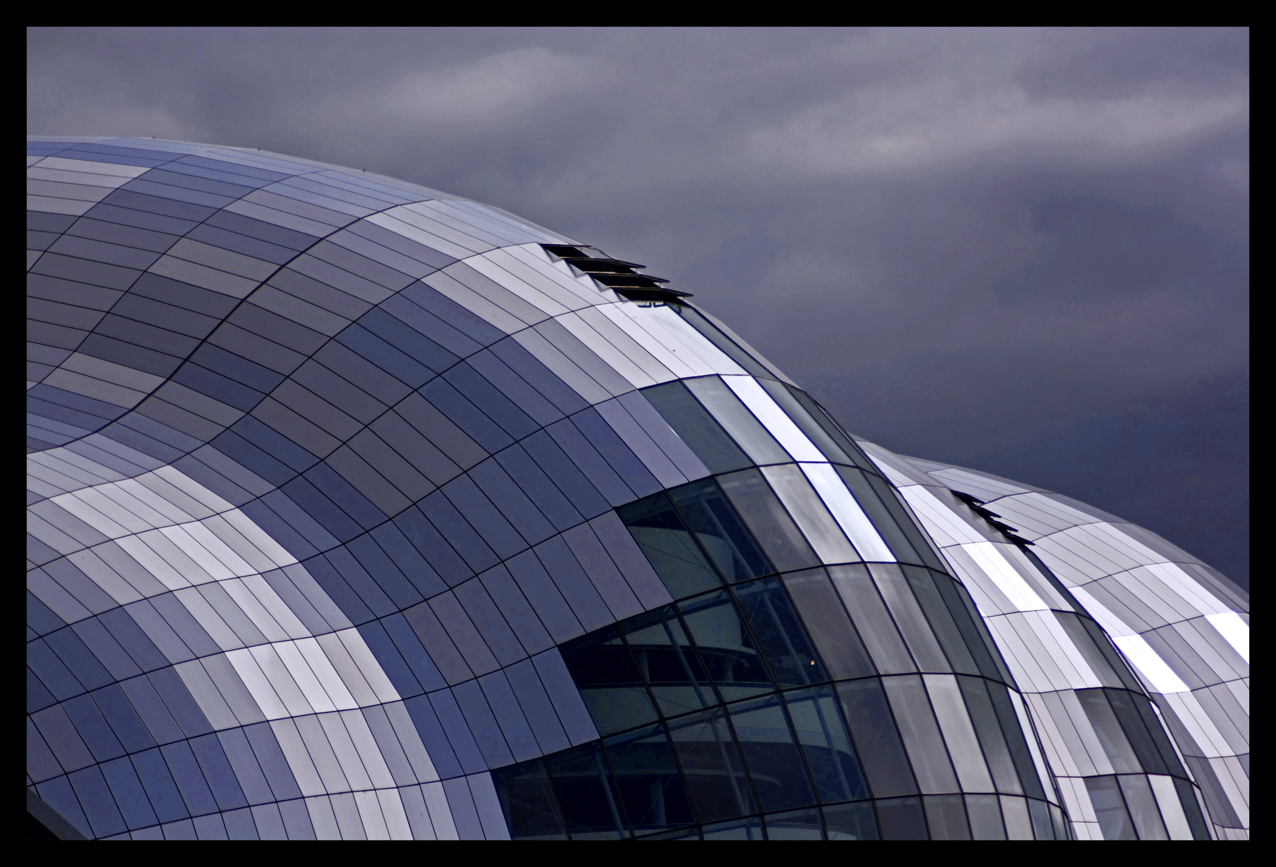
So its been a little while since I had a photo trip out on a Sunday but I managed to get out and about today. Myself and littlecharva headed down to Gateshead Quayside. We both had our normal issue of not being able to get any decent shots to start off with but did manage to warm up a bit just in time for heading into The Sage Gateshead. I will post the shots from inside later; but for now I thought I would start with this shot. I often find I always get the same shots of the Sage however I thought the colours in this one were interesting. I do still thing I need to get myself a Polarizing Filter for these type of shots but due to not having one yet I guess I’ll just have to make do. One of the things we were talking about while out today was something me have been thinking about for a little while. Setting up a Newcastle Photo Walk. This is something that me and littlecharva have been doing it for some time. So if you live in the Newcastle area and want to meet up and group together to take pictures in and around Newcastle then you can Twitter us up: twitter.com/littlecharva twitter.com/smlp Or head on over to the discussion board on the new group and let us know you are interested: Let me know what of think of this photo and let us know if your interested in meeting up for a wonder round Newcastle to share what you know or just have a banter. |
| Date | Taken on 13 July 2008, 17:34 |
| Source | Its the bloody Sage again! |
| Author | smlp.co.uk from Wirral, England |
| Flickr tags | the, sage, gateshead, curves, building, newcastle, tyne, wear, blue, sky, quayside, photo, walk, newcastlecentric |
| Camera location | | View this and other nearby images on: OpenStreetMap |
|---|
Licensing
[edit]
- You are free:
- to share – to copy, distribute and transmit the work
- to remix – to adapt the work
- Under the following conditions:
- attribution – You must give appropriate credit, provide a link to the license, and indicate if changes were made. You may do so in any reasonable manner, but not in any way that suggests the licensor endorses you or your use.
| This image was originally posted to Flickr by smlp.co.uk at https://flickr.com/photos/28552335@N00/2664933697. It was reviewed on 13 July 2020 by FlickreviewR 2 and was confirmed to be licensed under the terms of the cc-by-2.0. |
File history
Click on a date/time to view the file as it appeared at that time.
| Date/Time | Thumbnail | Dimensions | User | Comment | |
|---|---|---|---|---|---|
| current | 09:30, 13 July 2020 | | 4,058 × 2,758 (4.91 MB) | Red panda bot (talk | contribs) | In Flickr Explore: 2008-07-13 |
You cannot overwrite this file.
File usage on Commons
There are no pages that use this file.