File:Itami Town Map 1885 - Hozumi village.jpg
Jump to navigation
Jump to search

Size of this preview: 683 × 600 pixels. Other resolutions: 273 × 240 pixels | 547 × 480 pixels | 875 × 768 pixels | 1,166 × 1,024 pixels | 2,259 × 1,984 pixels.
Original file (2,259 × 1,984 pixels, file size: 841 KB, MIME type: image/jpeg)
Captions
Captions
Add a one-line explanation of what this file represents
Summary
[edit]
| Description |
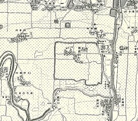
日本語:明治18年(1885)測量同20年製版「伊丹町」二万分の一仮製地形図から穂積村周辺をトリミングしたもの |
| Date | |
| Source | 出版物「明治十八年測量同二十年製版二万分一之尺 兵庫四号(仮製地形図)伊丹町」 |
| Author | 大日本帝国陸地測量部 (Geographical Section of Imperial Japanese Army) in 1885 |
Licensing
[edit]
This file is in the public domain because 測量法(昭和24年法律第188号)では測量成果の保護期間の定めはなく、法附則第5項により陸地測量標条例(明治23年3月26日施行)に基づく測量成果は測量法に基づくものとみなされています。このファイルは陸地測量標条例制定以前の明治18年の測量成果である地形図を使用していることから測量法の範囲外と考えられます。
|
File history
Click on a date/time to view the file as it appeared at that time.
| Date/Time | Thumbnail | Dimensions | User | Comment | |
|---|---|---|---|---|---|
| current | 01:17, 10 November 2018 | | 2,259 × 1,984 (841 KB) | Amiotama (talk | contribs) | User created page with UploadWizard |
You cannot overwrite this file.
File usage on Commons
The following 3 pages use this file:
File usage on other wikis
The following other wikis use this file:
- Usage on ja.wikipedia.org