File:Italian Peninsula in Europe with lines.svg
Jump to navigation
Jump to search

Size of this PNG preview of this SVG file: 680 × 520 pixels. Other resolutions: 314 × 240 pixels | 628 × 480 pixels | 1,004 × 768 pixels | 1,280 × 979 pixels | 2,560 × 1,958 pixels.
Original file (SVG file, nominally 680 × 520 pixels, file size: 540 KB)
Captions
Captions
Add a one-line explanation of what this file represents
Summary
[edit]
| Description |
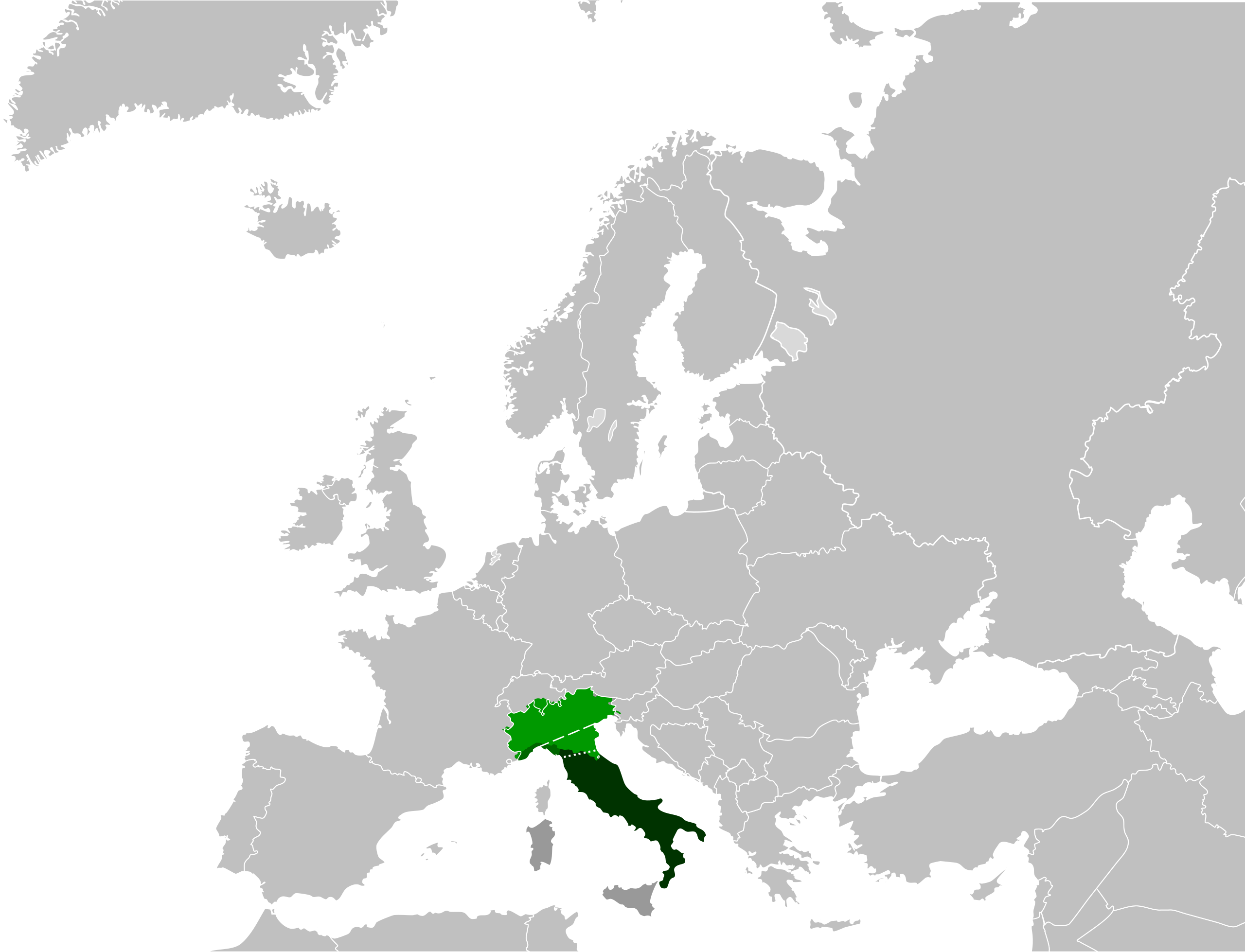
English: Map of the Italian peninsula. Non-peninsular parts of the Italian Republic. Italian peninsula (Tyrrhenian, Lower Adriatic and Ionian watersheds). Ligurian watershed (it may belong to the Peninsula according to some methods). Greatest extent of the Italian peninsula (Italian geographic region). Geometric line. Geometric bottleneck. Italiano: Mappa della penisola italiana. Territori della Repubblica Italiana non facenti parte della penisola italiana. Penisola italiana (versanti tirrenico, adriatico inferiore e ionico). Versante ligure (può far parte della penisola secondo alcuni criteri). Estensione massima della Penisola italiana come Regione geografica italiana. Linea geometrica. Collo geometrico. |
| Date | |
| Source |
|
| Author |
|
| SVG development | This W3C-invalid vector image was created with Inkscape, or with something else. |
Licensing
[edit]
I, the copyright holder of this work, hereby publish it under the following license:
This file is licensed under the Creative Commons Attribution-Share Alike 3.0 Unported license.
- You are free:
- to share – to copy, distribute and transmit the work
- to remix – to adapt the work
- Under the following conditions:
- attribution – You must give appropriate credit, provide a link to the license, and indicate if changes were made. You may do so in any reasonable manner, but not in any way that suggests the licensor endorses you or your use.
- share alike – If you remix, transform, or build upon the material, you must distribute your contributions under the same or compatible license as the original.
Original upload log
[edit]
This image is a derivative work of the following images:
- File:Italian_Peninsula_in_Europe.svg licensed with Cc-by-sa-3.0
Uploaded with derivativeFX
File history
Click on a date/time to view the file as it appeared at that time.
| Date/Time | Thumbnail | Dimensions | User | Comment | |
|---|---|---|---|---|---|
| current | 20:43, 21 March 2012 | | 680 × 520 (540 KB) | Carnby (talk | contribs) | Bigger line |
| 20:29, 21 March 2012 |  | 680 × 520 (540 KB) | Carnby (talk | contribs) | == {{int:filedesc}} == {{Information |Description={{en|1=Map of the Italian peninsula.}} <table border="0" cellspacing="0" cellpadding="0" style="background:transparent"> <tr valign="top"> {{Legend|#999999|Non-peninsular parts of the Italian Republic.}... |
You cannot overwrite this file.
File usage on Commons
The following page uses this file: