File:Istribution of the German forces on the Western Front according to a captured map dated 30th October 1918.jpg
Jump to navigation
Jump to search

Size of this preview: 748 × 600 pixels. Other resolutions: 299 × 240 pixels | 599 × 480 pixels | 958 × 768 pixels | 1,277 × 1,024 pixels | 2,555 × 2,048 pixels | 3,000 × 2,405 pixels.
Original file (3,000 × 2,405 pixels, file size: 763 KB, MIME type: image/jpeg)
Captions
Captions
Add a one-line explanation of what this file represents
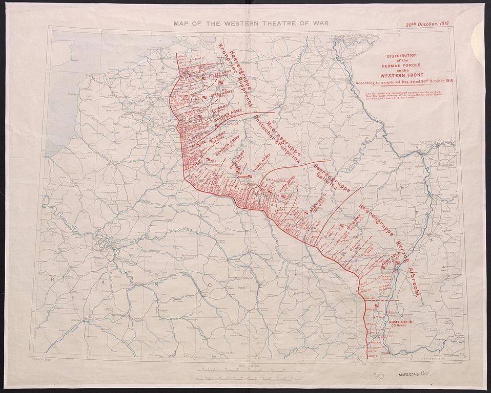
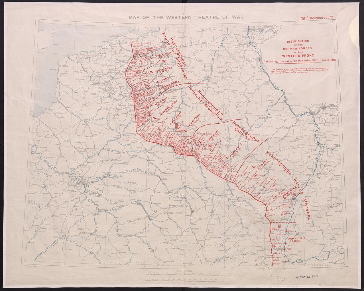
| Description | Scale 1:750000; Area of Germany shown is mostly west of the Rhine. Information overprinted on Map of the Western Theatre of War. GSGS 2862. Ordnance Survey. 1916. Note on map: 'The Divisions are reproduced as given on the original Map. The exact meaning of the conventional signs against Divisions in reserve is not known.' | ||
| Date | |||
| Source |
|
||
| Author | Great Britain. War Office. General Staff. Geographical Section, |

This work is an Ordnance Survey map over 50 years old, which is covered by Crown Copyright which in this case expires 50 years after publication. Ordnance Survey does however ask that they be credited and that the date of publication be given.
Any ancillary rights gained through the creation of the electronic version are granted as freely usable under any circumstances.
|
This work created by the United Kingdom Government is in the public domain.
This is because it is one of the following:
HMSO has declared that the expiry of Crown Copyrights applies worldwide (ref: HMSO Email Reply)
|
 |
File history
Click on a date/time to view the file as it appeared at that time.
| Date/Time | Thumbnail | Dimensions | User | Comment | |
|---|---|---|---|---|---|
| current | 18:18, 2 November 2014 | | 3,000 × 2,405 (763 KB) | Labattblueboy (talk | contribs) | {{Information |Description= Scale 1:750000; Area of Germany shown is mostly west of the Rhine. Information overprinted on Map of the Western Theatre of War. GSGS 2862. Ordnance Survey. 1916. Note on map: 'The Divisions are reproduced as given on the or... |
You cannot overwrite this file.
File usage on Commons
The following page uses this file:
File usage on other wikis
The following other wikis use this file:
- Usage on ru.wikipedia.org