File:Island-Surtsey.png
Jump to navigation
Jump to search
No higher resolution available.
Island-Surtsey.png (330 × 355 pixels, file size: 25 KB, MIME type: image/png)
Captions
Captions
Add a one-line explanation of what this file represents
| Description |
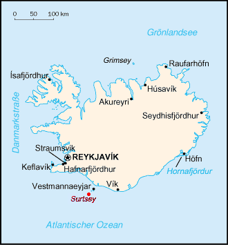
English: CIA Factbook map of Surtsey and Iceland |
|||
| Date | ||||
| Source | File:CIA Factbook map of Iceland.png | |||
| Author | CIA Factbook map of Iceland | |||
| Permission (Reusing this file) |
|

Original upload log
[edit]
The original description page was here. All following user names refer to de.wikipedia.
File history
Click on a date/time to view the file as it appeared at that time.
| Date/Time | Thumbnail | Dimensions | User | Comment | |
|---|---|---|---|---|---|
| current | 04:21, 2 September 2009 | | 330 × 355 (25 KB) | Pauk (talk | contribs) | {{Information |Description={{en|1=CIA Factbook map of Surtsey and Iceland}} |Source=File:CIA Factbook map of Iceland.png |Author=CIA Factbook map of Iceland |Date=December 3, 2006 |Permission={{PD-USGov-CIA-WF}} |other_versions= }} [[Category:Maps of Ice |
You cannot overwrite this file.
File usage on Commons
There are no pages that use this file.
File usage on other wikis
The following other wikis use this file:
- Usage on az.wikipedia.org