File:Irma 2017-09-09 1825Z.jpg
Jump to navigation
Jump to search

Size of this preview: 551 × 600 pixels. Other resolutions: 220 × 240 pixels | 441 × 480 pixels | 705 × 768 pixels | 941 × 1,024 pixels | 1,881 × 2,048 pixels | 5,233 × 5,697 pixels.
Original file (5,233 × 5,697 pixels, file size: 3.8 MB, MIME type: image/jpeg)
Captions
Captions
Add a one-line explanation of what this file represents
Summary
[edit]
| Description |
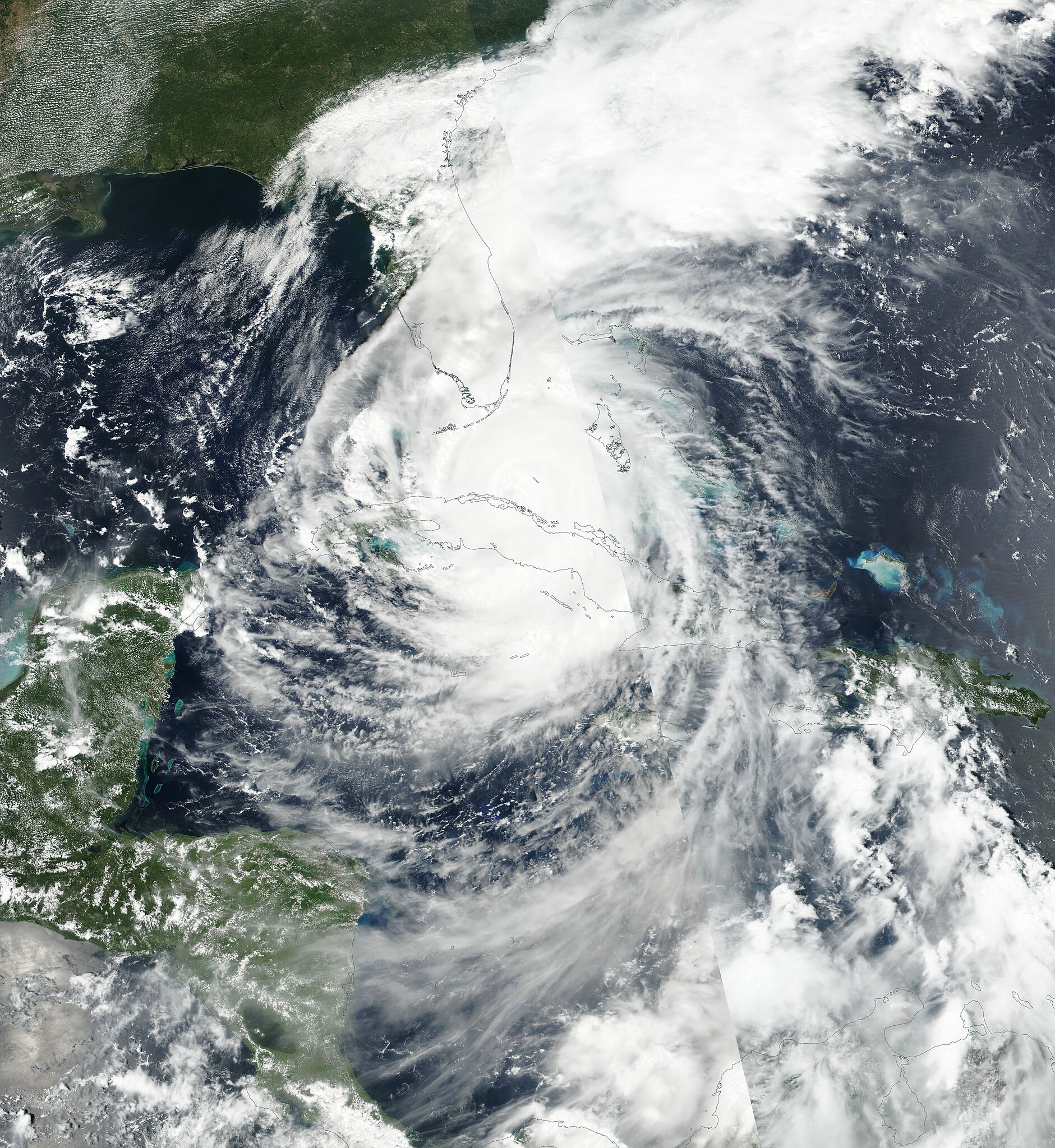
English: Hurricane Irma (11L) over Cuba and the Bahamas on September 9, 2017. Taken from the Suomi-NPP satellite, with the Visible Infrared Imaging Radiometer Suite (VIIRS). Pixel size: 500 m.
Français : Le cyclone tropical Irma (11L) au-dessus de Cuba et des Bahamas, dans l'Océan Atlantique, le 9 septembre 2017. Pris du satellite Suomi-NPP, avec le Visible Infrared Imaging Radiometer Suite (VIIRS). Taille d'un pixel : 500 m. |
| Date | |
| Source | NASA Worldview September 9 2017 |
| Author | NASA Worldview |
| Camera location | | View this and other nearby images on: OpenStreetMap |
|---|
Licensing
[edit]
| This file is in the public domain in the United States because it was solely created by NASA. NASA copyright policy states that "NASA material is not protected by copyright unless noted". (See Template:PD-USGov, NASA copyright policy page or JPL Image Use Policy.) | ||
 |
Warnings:
|
File history
Click on a date/time to view the file as it appeared at that time.
| Date/Time | Thumbnail | Dimensions | User | Comment | |
|---|---|---|---|---|---|
| current | 02:01, 10 September 2017 | | 5,233 × 5,697 (3.8 MB) | Asmoth (talk | contribs) | User created page with UploadWizard |
You cannot overwrite this file.
File usage on Commons
The following page uses this file:
- File:Irma 2017-09-09 Worldview 500m.jpg (file redirect)