File:Irish-peace-tower-counties-belgium.redvers.jpg
Jump to navigation
Jump to search
Size of this preview: 411 × 599 pixels. Other resolutions: 165 × 240 pixels | 329 × 480 pixels | 527 × 768 pixels | 1,150 × 1,675 pixels.
Original file (1,150 × 1,675 pixels, file size: 1.21 MB, MIME type: image/jpeg)
Captions
Captions
Add a one-line explanation of what this file represents
Summary
[edit]
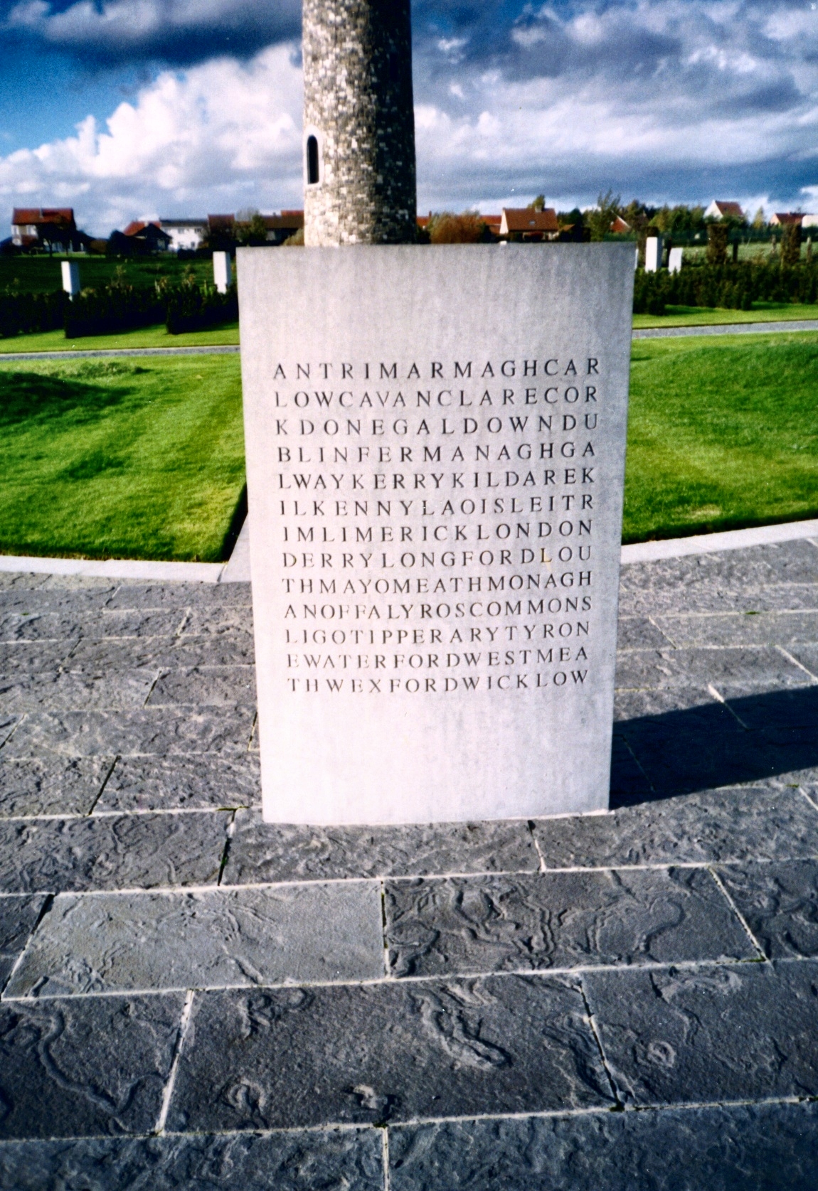
| Description | Stone tablet beside the Irish Peace Tower in Flanders, Belgium, listing the counties of the island of Ireland symbolically run together. Photograph by User:Redvers originally from en:wikipedia, now transferred to Commons. Note that the photograph has been altered by the author since the original upload and that the licence status has changed from Own Work GDFL to the more explicitly free Own Work Public Domain All Rights Released. |
| Date | 16 January 2006 (original upload date) |
| Source | No machine-readable source provided. Own work assumed (based on copyright claims). |
| Author | No machine-readable author provided. Redvers assumed (based on copyright claims). |
Licensing
[edit]
| I, the copyright holder of this work, release this work into the public domain. This applies worldwide. In some countries this may not be legally possible; if so: I grant anyone the right to use this work for any purpose, without any conditions, unless such conditions are required by law. |
File history
Click on a date/time to view the file as it appeared at that time.
| Date/Time | Thumbnail | Dimensions | User | Comment | |
|---|---|---|---|---|---|
| current | 19:55, 16 January 2006 | | 1,150 × 1,675 (1.21 MB) | Redvers (talk | contribs) | Stone tablet beside the Irish Peace Tower in Flanders, Belgium, listing the counties of the island of Ireland symbolically run together. Photograph by User:Redvers originally from en:wikipedia, now transferred to Commons. Note that the photograph has |
You cannot overwrite this file.
File usage on Commons
The following page uses this file:
.jpg&redirect=no)
File usage on other wikis
The following other wikis use this file:
- Usage on en.wikipedia.org
- Irish Volunteers
- 10th (Irish) Division
- 36th (Ulster) Division
- List of Ireland-related topics
- 16th (Irish) Division
- National Volunteers
- Connaught Rangers
- 5th Royal Irish Lancers
- William Cosgrove
- Martin Doyle (VC)
- Royal Dublin Fusiliers
- Royal Munster Fusiliers
- Island of Ireland Peace Park
- Tom Kettle
- Ulster Volunteers
- Royal Irish Regiment (1684–1922)
- 4th Royal Irish Dragoon Guards
- Irish National War Memorial Gardens
- Royal Irish Fusiliers
- Prince of Wales's Leinster Regiment (Royal Canadians)
- Template:Great War in Ireland
- South Irish Horse
- Ireland and World War I
- Irish in the British Armed Forces
- Usage on ms.wikipedia.org
- Usage on nl.wikipedia.org
- Usage on www.wikidata.org