File:Irene 2011-08-23 1245Z.jpg
Jump to navigation
Jump to search
Size of this preview: 743 × 599 pixels. Other resolutions: 298 × 240 pixels | 595 × 480 pixels | 952 × 768 pixels | 1,270 × 1,024 pixels | 2,540 × 2,048 pixels | 2,682 × 2,163 pixels.
Original file (2,682 × 2,163 pixels, file size: 5 MB, MIME type: image/jpeg)
Captions
Captions
Add a one-line explanation of what this file represents
Summary
[edit]
| Description |
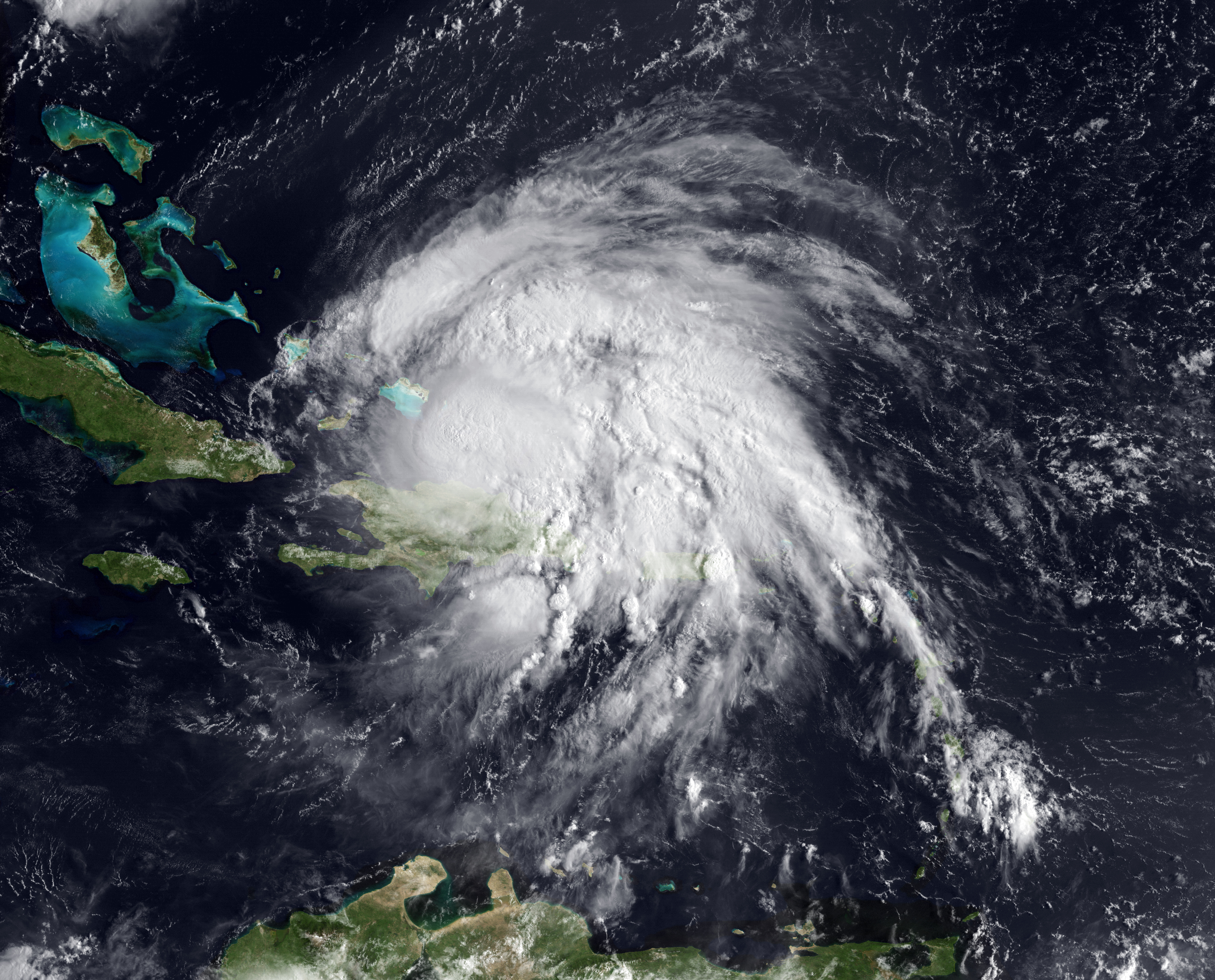
English: With sustained winds of 100 mph, Hurricane Irene is now a Category 2 hurricane, and predicted to strengthen even more, possible into Category 3 in the next 36 hours. This GOES-East satellite image shows its current position (as of August 23, 2011 at 1245sz) at latitude 20 N, longitude 70 W. A second image shows the full resolution 1km per pixel visible imagery from GOES from the same time. |
| Date | |
| Source | https://www.nnvl.noaa.gov/MediaDetail.php?MediaID=808&MediaTypeID=1&ResourceID=216 |
| Author | NOAA |
Licensing
[edit]
This image is in the public domain because it contains materials that originally came from the U.S. National Oceanic and Atmospheric Administration, taken or made as part of an employee's official duties.
|
File history
Click on a date/time to view the file as it appeared at that time.
| Date/Time | Thumbnail | Dimensions | User | Comment | |
|---|---|---|---|---|---|
| current | 00:15, 18 April 2018 | | 2,682 × 2,163 (5 MB) | A1Cafel (talk | contribs) | User created page with UploadWizard |
You cannot overwrite this file.
File usage on Commons
The following page uses this file: