File:Indonesia, administrative divisions - id.svg
Jump to navigation
Jump to search

Size of this PNG preview of this SVG file: 800 × 367 pixels. Other resolutions: 320 × 147 pixels | 640 × 293 pixels | 1,024 × 469 pixels | 1,280 × 587 pixels | 2,560 × 1,173 pixels | 982 × 450 pixels.
Original file (SVG file, nominally 982 × 450 pixels, file size: 1.21 MB)
Captions
Captions
Add a one-line explanation of what this file represents
Summary
[edit]| Description |
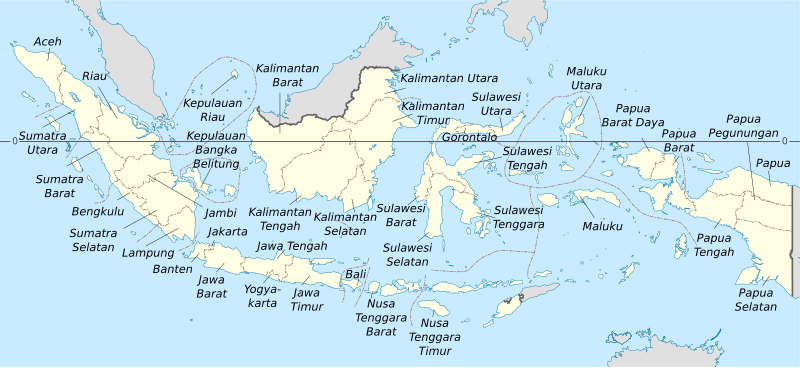
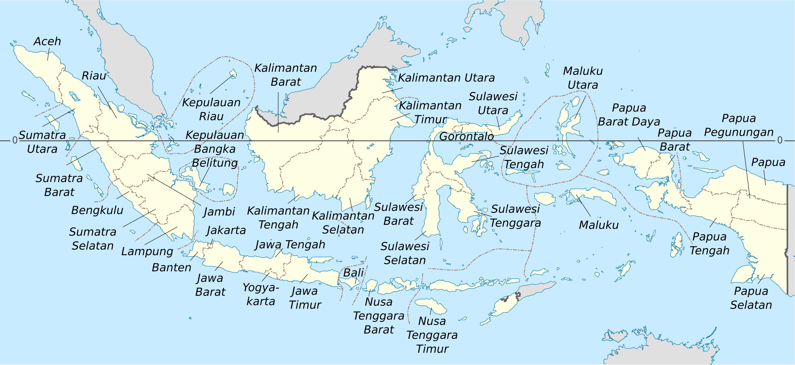
English: Indonesia provinces map (in Indonesian)
Français : Carte des provinces indonésiennes) Deutsch: Karte der indonesischen Provinzen |
||||
| Date | 15:42, 8 August 2023 (UTC) | ||||
| Source | |||||
| Author | Bennylin (yes?) | ||||
| Other versions | File:Indonesia, administrative divisions - en - monochrome.svg, File:Peta provinsi Indonesia.svg | ||||
| SVG development |
|

This file is licensed under the Creative Commons Attribution-Share Alike 4.0 International license.
- You are free:
- to share – to copy, distribute and transmit the work
- to remix – to adapt the work
- Under the following conditions:
- attribution – You must give appropriate credit, provide a link to the license, and indicate if changes were made. You may do so in any reasonable manner, but not in any way that suggests the licensor endorses you or your use.
- share alike – If you remix, transform, or build upon the material, you must distribute your contributions under the same or compatible license as the original.
File history
Click on a date/time to view the file as it appeared at that time.
| Date/Time | Thumbnail | Dimensions | User | Comment | |
|---|---|---|---|---|---|
| current | 12:10, 23 August 2023 | | 982 × 450 (1.21 MB) | Bennylin (talk | contribs) | |
| 15:42, 8 August 2023 |  | 982 × 450 (950 KB) | Bennylin (talk | contribs) | {{Information |Description={{en|1=Indonesia provinces map (in Indonesian)}} {{fr|1= Carte des provinces indonésiennes)}} {{de|1= Karte der indonesischen Provinzen}} |Source=*Indonesia, administrative divisions - en - monochrome.svg *Peta provinsi Indonesia.svg |Date=~~~~~ |Author=~~~ |Other versions=File:Indonesia, administrative divisions - en - monochrome.svg, [[:File:Peta provins... |
You cannot overwrite this file.
File usage on Commons
The following 3 pages use this file: