File:Indian Ocean earthquak blank.png
Jump to navigation
Jump to search
Size of this preview: 732 × 599 pixels. Other resolutions: 293 × 240 pixels | 586 × 480 pixels.
Original file (800 × 655 pixels, file size: 59 KB, MIME type: image/png)
Captions
Captions
Add a one-line explanation of what this file represents
| Description |
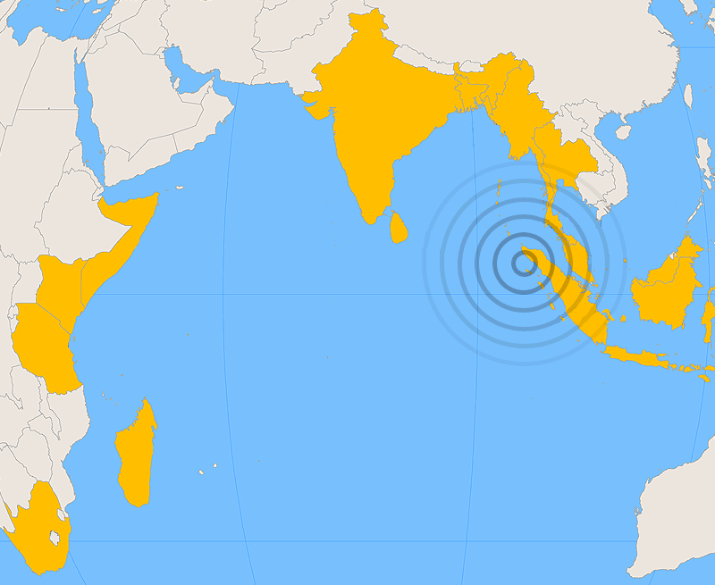
Subject: Map showing countries affected by the 2004 Indian Ocean earthquake. Source: Created by Cantus using ArchView and Photoshop. Orthographic projection, centered at lat. 0°, long. 80°. |
| Date | (UTC) |
| Source | |
| Author |
|
| This is a retouched picture, which means that it has been digitally altered from its original version. Modifications: blank map. The original can be viewed here: 2004 Indian Ocean earthquake - affected countries.png:
|
I, the copyright holder of this work, hereby publish it under the following licenses:
| This file is licensed under the Creative Commons Attribution-Share Alike 3.0 Unported license. | ||
| ||
| This licensing tag was added to this file as part of the GFDL licensing update. |

|
Permission is granted to copy, distribute and/or modify this document under the terms of the GNU Free Documentation License, Version 1.2 or any later version published by the Free Software Foundation; with no Invariant Sections, no Front-Cover Texts, and no Back-Cover Texts. A copy of the license is included in the section entitled GNU Free Documentation License. |
You may select the license of your choice.
Original upload log
[edit]
This image is a derivative work of the following images:
- File:2004_Indian_Ocean_earthquake_-_affected_countries.png licensed with Cc-by-sa-3.0-migrated, GFDL
- 2004-12-30T04:17:55Z Cantus 800x655 (60104 Bytes) Moving Indonesia label slightly to the right
- 2004-12-29T10:29:43Z Ævar Arnfjörð Bjarmason 800x655 (60148 Bytes)
Uploaded with derivativeFX
File history
Click on a date/time to view the file as it appeared at that time.
| Date/Time | Thumbnail | Dimensions | User | Comment | |
|---|---|---|---|---|---|
| current | 00:49, 6 October 2009 | | 800 × 655 (59 KB) | Yumetriz (talk | contribs) | {{Information |Description='''Subject''': Map showing countries affected by the 2004 Indian Ocean earthquake.<br> '''Source''': Created by Cantus using ArchView and Photoshop. [[:en:Orthographi |
You cannot overwrite this file.
File usage on Commons
There are no pages that use this file.
File usage on other wikis
The following other wikis use this file:
- Usage on he.wikipedia.org
- Usage on kn.wikipedia.org