File:Indian Kingdom of Mewar map.svg
Jump to navigation
Jump to search

Size of this PNG preview of this SVG file: 530 × 599 pixels. Other resolutions: 212 × 240 pixels | 425 × 480 pixels | 680 × 768 pixels | 906 × 1,024 pixels | 1,812 × 2,048 pixels | 1,639 × 1,852 pixels.
Original file (SVG file, nominally 1,639 × 1,852 pixels, file size: 551 KB)
Captions
Captions
Add a one-line explanation of what this file represents
Summary
[edit]
| Description |
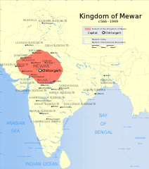
English: Indian Kingdom of Mewar map |
| Date | |
| Source | Own work |
| Author | Nikel3012 |
Licensing
[edit]
I, the copyright holder of this work, hereby publish it under the following license:
This file is licensed under the Creative Commons Attribution 4.0 International license.
- You are free:
- to share – to copy, distribute and transmit the work
- to remix – to adapt the work
- Under the following conditions:
- attribution – You must give appropriate credit, provide a link to the license, and indicate if changes were made. You may do so in any reasonable manner, but not in any way that suggests the licensor endorses you or your use.
File history
Click on a date/time to view the file as it appeared at that time.
| Date/Time | Thumbnail | Dimensions | User | Comment | |
|---|---|---|---|---|---|
| current | 07:36, 1 June 2024 | | 1,639 × 1,852 (551 KB) | Nikel3012 (talk | contribs) | Reverted to version as of 18:01, 20 May 2024 (UTC) |
| 07:33, 1 June 2024 |  | 1,639 × 1,852 (544 KB) | Nikel3012 (talk | contribs) | Removed less important powers of that time | |
| 18:01, 20 May 2024 |  | 1,639 × 1,852 (551 KB) | Nikel3012 (talk | contribs) | Colour Change | |
| 15:51, 6 May 2024 |  | 1,639 × 1,852 (540 KB) | Nikel3012 (talk | contribs) | Reverted to version as of 02:36, 27 April 2024 (UTC) | |
| 15:50, 6 May 2024 |  | 1,639 × 1,852 (529 KB) | Nikel3012 (talk | contribs) | Minor Change | |
| 15:42, 6 May 2024 |  | 1,639 × 1,852 (533 KB) | Nikel3012 (talk | contribs) | More Clear Version of the Map | |
| 02:36, 27 April 2024 |  | 1,639 × 1,852 (540 KB) | Nikel3012 (talk | contribs) | Fixed Vijaynagar Empire's position | |
| 09:12, 26 April 2024 |  | 1,639 × 1,852 (540 KB) | Rawn3012 (talk | contribs) | Reverted to version as of 00:21, 26 April 2024 (UTC) | |
| 01:54, 26 April 2024 |  | 1,639 × 1,852 (539 KB) | Nikel3012 (talk | contribs) | Improved Image | |
| 00:21, 26 April 2024 |  | 1,639 × 1,852 (540 KB) | Nikel3012 (talk | contribs) | Minor Changes |
You cannot overwrite this file.
File usage on Commons
There are no pages that use this file.
File usage on other wikis
The following other wikis use this file:
- Usage on en.wikipedia.org
- Usage on fr.wikipedia.org
- Usage on ko.wikipedia.org
- Usage on ru.wikipedia.org