File:IndiaMapCarey.jpg

Original file (5,000 × 4,931 pixels, file size: 14.03 MB, MIME type: image/jpeg)
Captions
Captions
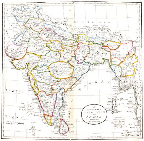
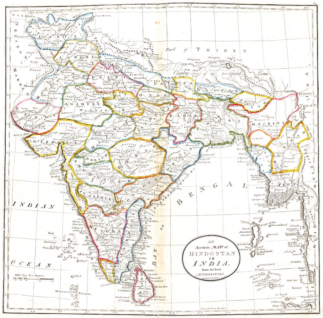
| Description | An Accurate Map of Hindostan or India, from the best authorities | ||||||||||||||||||||
| Date | |||||||||||||||||||||
| Source | Carey's General atlas, improved and enlarged; being a collection of maps of the world and quarters; their principal empires, kingdoms, &c. | ||||||||||||||||||||
| Author |
|
||||||||||||||||||||
| Permission (Reusing this file) |
|
||||||||||||||||||||

File history
Click on a date/time to view the file as it appeared at that time.
| Date/Time | Thumbnail | Dimensions | User | Comment | |
|---|---|---|---|---|---|
| current | 12:08, 2 September 2012 | | 5,000 × 4,931 (14.03 MB) | Shyamal (talk | contribs) | {{Information |Description=An Accurate Map of Hindostan or India, from the best authorities |Source=[http://beinecke.library.yale.edu/dl_crosscollex/brbldl_getrec.asp?fld=img&id=1024535 Carey's General atlas, improved and enlarged; being a collection o... |
You cannot overwrite this file.
File usage on Commons
There are no pages that use this file.