File:Inco Railway open street map.png
Jump to navigation
Jump to search
Size of this preview: 630 × 599 pixels. Other resolutions: 252 × 240 pixels | 505 × 480 pixels | 698 × 664 pixels.
Original file (698 × 664 pixels, file size: 266 KB, MIME type: image/png)
Captions
Captions
Add a one-line explanation of what this file represents
| Description |
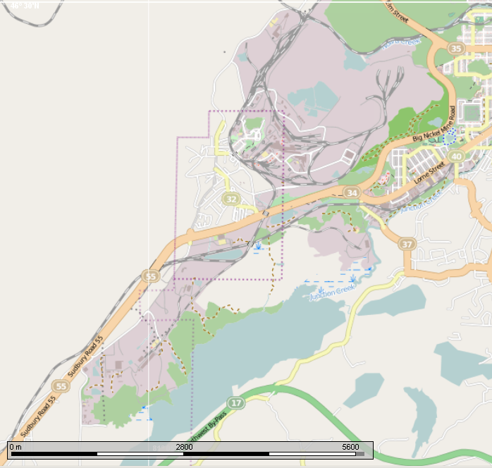
English: Map showing the extent of the Inco (now Vale) Railway around Sudbury, Ontario. (The Vale properties are in purple on the map). |
||
| Date | |||
| Source | Open Street Map overlay in the Marble program | ||
| Author | Own work | ||
| Permission (Reusing this file) |
This file is licensed under the Creative Commons Attribution-Share Alike 2.5 Canada license.

|

File history
Click on a date/time to view the file as it appeared at that time.
| Date/Time | Thumbnail | Dimensions | User | Comment | |
|---|---|---|---|---|---|
| current | 23:42, 4 August 2013 | | 698 × 664 (266 KB) | Oaktree b (talk | contribs) | {{Information |Description ={{en|1=Map showing the extent of the Inco (now Vale) Railway around Sudbury, Ontario. (The Vale properties are in purple on the map).}} |Source =Open Street Map overlay in the Marble program |Author ={{own... |
You cannot overwrite this file.
File usage on Commons
There are no pages that use this file.
File usage on other wikis
The following other wikis use this file:
- Usage on en.wikipedia.org
- Usage on www.wikidata.org