File:Imperial Palace Tokyo Map.svg
Jump to navigation
Jump to search

Size of this PNG preview of this SVG file: 383 × 500 pixels. Other resolutions: 184 × 240 pixels | 368 × 480 pixels | 588 × 768 pixels | 784 × 1,024 pixels | 1,569 × 2,048 pixels.
Original file (SVG file, nominally 383 × 500 pixels, file size: 384 KB)
Captions
Captions
Add a one-line explanation of what this file represents
| Description |
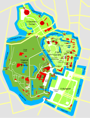
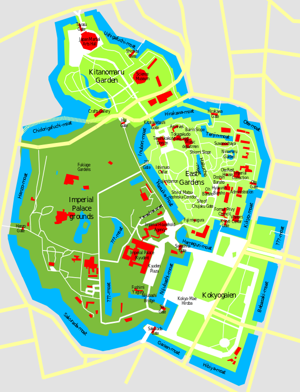
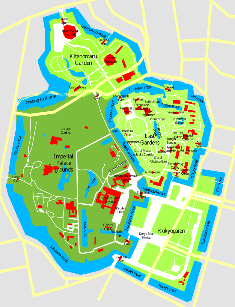
This is the SVG version of Image:Imperial Palace Tokyo Map.sxd, checked with a GoogleMaps Satellite Image and corrected for proportions. Notes by the original authoru: This is a map of the Imperial Palace in Tokyo (Kokyo), drawn by me based on various sources and satelite pics. Disclaimer: Many locations are only approximate, not all streets, buildings, and waterways are shown, I give no guarantee for accuracy, use at your own risk. |
| Date | (UTC) |
| Source | |
| Author |
|
I, the copyright holder of this work, hereby publish it under the following licenses:
This file is licensed under the Creative Commons Attribution-Share Alike 3.0 Unported license.
- You are free:
- to share – to copy, distribute and transmit the work
- to remix – to adapt the work
- Under the following conditions:
- attribution – You must give appropriate credit, provide a link to the license, and indicate if changes were made. You may do so in any reasonable manner, but not in any way that suggests the licensor endorses you or your use.
- share alike – If you remix, transform, or build upon the material, you must distribute your contributions under the same or compatible license as the original.

|
Permission is granted to copy, distribute and/or modify this document under the terms of the GNU Free Documentation License, Version 1.3 or any later version published by the Free Software Foundation; with no Invariant Sections, no Front-Cover Texts, and no Back-Cover Texts. A copy of the license is included in the section entitled GNU Free Documentation License.
|
You may select the license of your choice.
Original upload log
[edit]
This image is a derivative work of the following images:
- File:Imperial_Palace_Tokyo_Map.png licensed with Cc-by-sa-3.0, GFDL-1.3
- 2006-01-02T09:52:23Z Chris 73 834x989 (67236 Bytes)
- 2006-01-01T12:16:22Z Chris 73 828x1026 (65523 Bytes) This is a map of the Imperial Palace in Tokyo (Kokyo), drawn by me based on various sources and satelite pics. See [[.Imperial_Palace_Tokyo_Map.sxd]] for the OpenOffice.Org source file where the entire map can be edited.
Uploaded with derivativeFX
File history
Click on a date/time to view the file as it appeared at that time.
| Date/Time | Thumbnail | Dimensions | User | Comment | |
|---|---|---|---|---|---|
| current | 00:43, 21 November 2009 | | 383 × 500 (384 KB) | Justass (talk | contribs) | cropped |
| 00:40, 21 November 2009 |  | 500 × 500 (384 KB) | Justass (talk | contribs) | ? | |
| 00:20, 21 November 2009 |  | 512 × 668 (361 KB) | ExplicitImplicity (talk | contribs) | {{Information |Description=This is the SVG version of Image:Imperial Palace Tokyo Map.sxd, checked with a GoogleMaps Satellite Image and corrected for proportions. Notes by the original authoru: This is a map of the Imperial Palace in Tokyo (Kokyo |
You cannot overwrite this file.
File usage on Commons
The following 5 pages use this file:
File usage on other wikis
The following other wikis use this file:
- Usage on ca.wikipedia.org
- Usage on de.wikipedia.org
- Usage on en.wikipedia.org
- Usage on fr.wikipedia.org
- Usage on it.wikipedia.org
- Usage on it.wikivoyage.org
- Usage on ms.wikipedia.org
- Usage on ru.wikipedia.org
- Usage on simple.wikipedia.org
- Usage on sv.wikipedia.org
- Usage on www.wikidata.org