File:ImKlosterhof1und5.jpg
Jump to navigation
Jump to search
Size of this preview: 685 × 599 pixels. Other resolutions: 274 × 240 pixels | 549 × 480 pixels | 878 × 768 pixels | 1,170 × 1,024 pixels | 2,341 × 2,048 pixels | 2,759 × 2,414 pixels.
Original file (2,759 × 2,414 pixels, file size: 1.94 MB, MIME type: image/jpeg)
Captions
Captions
Add a one-line explanation of what this file represents
| Description |
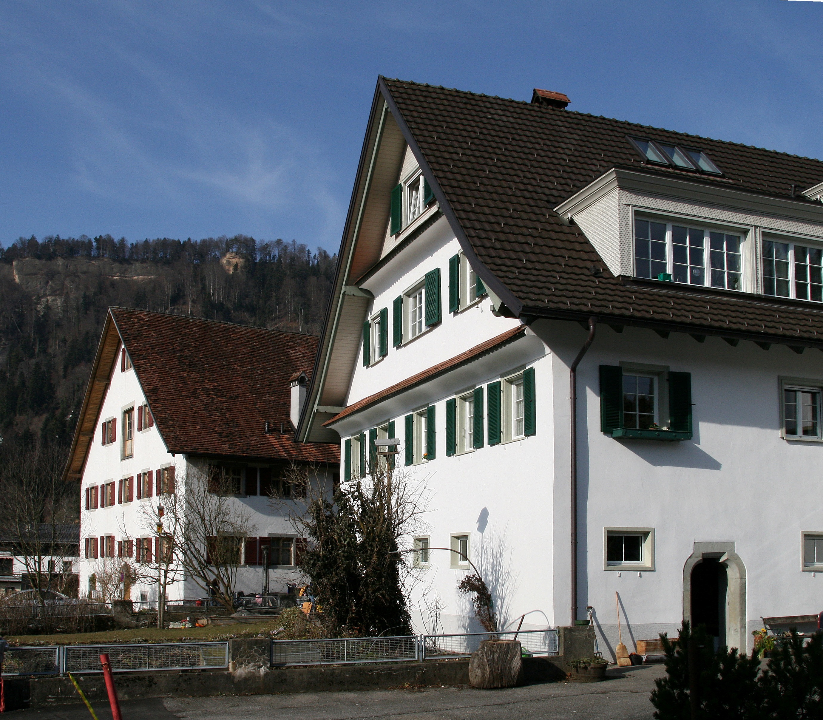
Deutsch: Im Klosterhof Nr. 1 und 5: Alle Gebäude oberhalb Pfarrkirche und Friedhof mit den Adressen Im Klosterhof gehörten zu dem ehemaligen Dominikanerinnenkloster, das nach dem Brand 1796 aufgelassen und nach Thalbach verlegt wurde. Im Klosterhof Nr. 1: Wirtschaftshof (Gesindehaus), 17 Jh., Steinmauerbau mit Wohnteil, Tenne, Stall; 2geschossig mit Kellersockel und steilem Giebel; Giebelseite 5achsig mit Rundbogenportal zum Kellergeschoss, traufseitiges Portal mit rechteckigem Oberlicht. Im Klosterhof Nr.5: Wohnhaus mit Wirtschaftsteil (Herrschaftshof), im Kern 16. Jh., mit hohem gemauertem Kellersockel, Wohngeschoss und Giebel verputzter Riegelbau; an der Giebelseite Klebdächer; traufseititg spätgotisches Schulterbogenportal mit abgefastem Gewände *** in Kennelbach, Vorarlberg. Quelle: DEHIO Vorarlberg 1983 |
| Date | |
| Source | Own work |
| Author | böhringer friedrich |
| Permission (Reusing this file) |
I, the copyright holder of this work, hereby publish it under the following license: This file is licensed under the Creative Commons Attribution-Share Alike 2.5 Generic license.
|
| Other versions |
|


| Camera location | | View this and other nearby images on: OpenStreetMap |
|---|
| Object location | | View this and other nearby images on: OpenStreetMap |
|---|
File history
Click on a date/time to view the file as it appeared at that time.
| Date/Time | Thumbnail | Dimensions | User | Comment | |
|---|---|---|---|---|---|
| current | 21:49, 1 March 2008 | | 2,759 × 2,414 (1.94 MB) | Böhringer (talk | contribs) | {{Information |Description= {{de| '''aus dem DEHIO Vorarlberg 1983:''' Im Klosterhof Nr. 1 und 5, gegenüber der Pfarrkirche: Ehemalig zu dem nach dem Brand 1796 aufgelassenen und nach Thalbach verlegten [[:de:Dominikanerinnen|Dominikanerinn |
You cannot overwrite this file.
File usage on Commons
The following 2 pages use this file: