File:Illa de Xàtiva.jpg

Original file (2,275 × 2,203 pixels, file size: 1.5 MB, MIME type: image/jpeg)
Captions
Captions
Summary
[edit]
| Description |
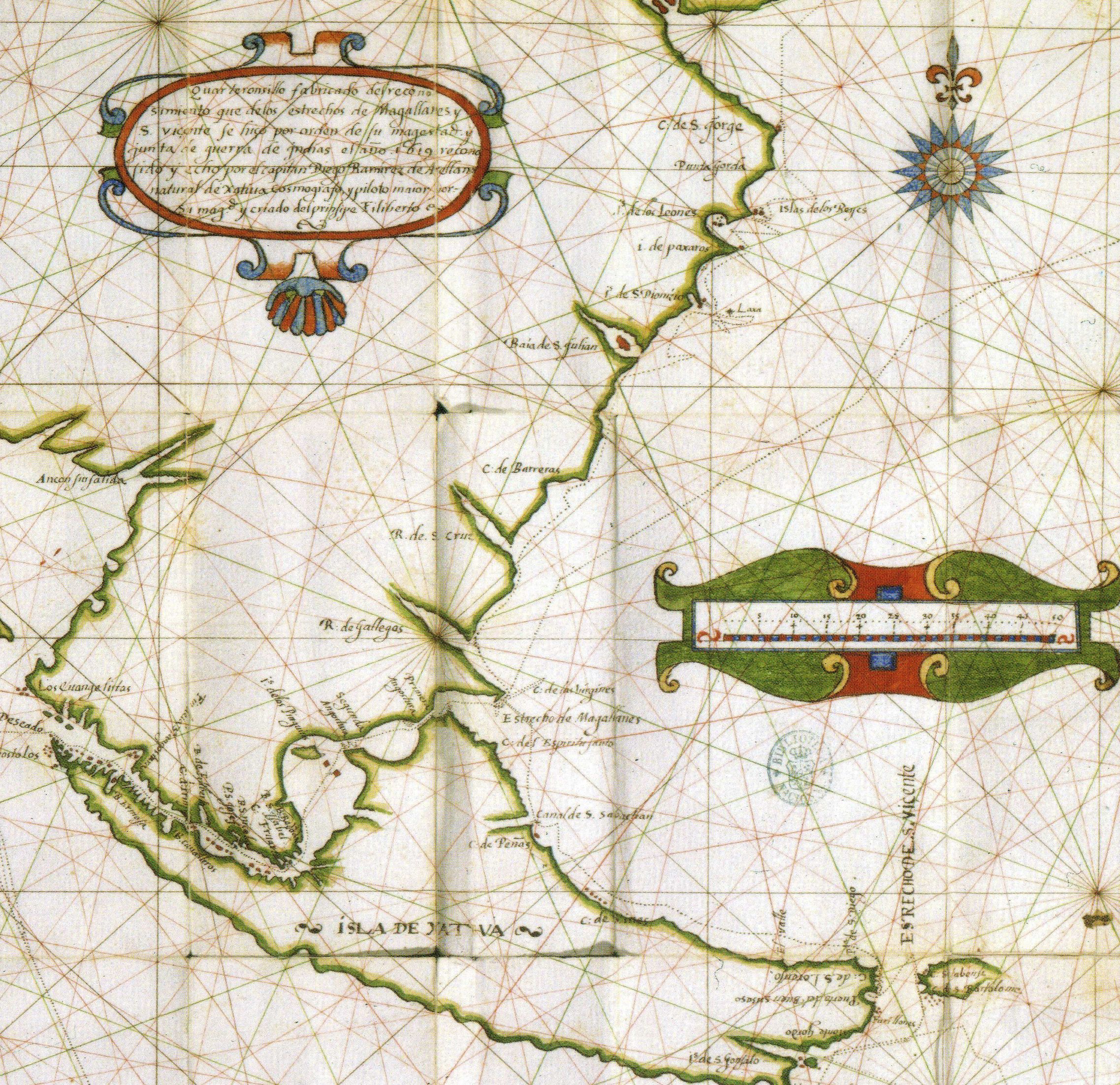
Català: Mapa de Diego Ramírez de Arellano amb l'Illa de Xàtiva, actualment Isla Grande de Tierra del Fuego .
English: Part of a map by Diego Ramírez de Arellano that includes the toponym Isla de Xativa, nowadays Isla Grande de Tierra del Fuego .
Español: Parte del mapa de Diego Ramírez de Arellano contenido en el manuscrito Reconocimiento de los estrechos de Magallanes y S. Vicente, con algunas cosas curiosas de navegación (BNE Mss/3190). El mapa se titula "Quarteronsillo fabricado del reconosimiento que de los estrechos de Magallanes y S. Viçente se hiço por orden de su magestad y junta de guerra de Indias el año 1619 reconosido y echo por el capitan Diego Ramirez de Arellano natural de Xatiua Cosmografo y piloto maior por su magestad y criado del prinsipe Filiberto". Incluye el topónimo Isla de Xativa en la actualmente denominada Isla Grande de Tierra del Fuego . |
| Date | |
| Source | http://www.histo.cat/1/illa_de_xativa3.jpg |
| Author | Diego Ramírez de Arellano |
| Permission (Reusing this file) |
Multi-license CC-BY-SA-3.0 and GFDL |
| Other versions | Illa de Xàtiva millorat.jpg |
Licensing
[edit]
|
This work is in the public domain in its country of origin and other countries and areas where the copyright term is the author's life plus 70 years or fewer.
| |
| This file has been identified as being free of known restrictions under copyright law, including all related and neighboring rights. | |
File history
Click on a date/time to view the file as it appeared at that time.
| Date/Time | Thumbnail | Dimensions | User | Comment | |
|---|---|---|---|---|---|
| current | 17:33, 22 July 2015 | | 2,275 × 2,203 (1.5 MB) | Mcapdevila (talk | contribs) | Map in color of Diego Ramírez de Arellano depicting the actual Island of Tierra de Fuego with the name of Illa de Xàtiva, after he did circumnavigated an chartered the whole island for the very first time. |
| 08:43, 21 June 2007 |  | 250 × 187 (13 KB) | Pere prlpz (talk | contribs) | {{Information |Description={{ca|Mapa de ca:Diego Ramírez de Arellano amb l'ca:Illa de Xàtiva, actualment Tierra de Fuego}} |Source=Web del diari Levante http://www.levante-emv.com/secciones/noticia.jsp?pNumEjemplar=3562&pIdSeccion=9&pIdNot |
You cannot overwrite this file.
File usage on Commons
The following page uses this file:
File usage on other wikis
The following other wikis use this file:
- Usage on ca.wikipedia.org
- Usage on en.wikipedia.org
- Usage on es.wikipedia.org
- Usage on he.wikipedia.org