File:Ile-Saint-Denis. Plan d'un atterrissement de la Seine XVIIIe.jpg
Jump to navigation
Jump to search

Size of this preview: 800 × 546 pixels. Other resolutions: 320 × 218 pixels | 640 × 437 pixels | 1,024 × 699 pixels | 1,280 × 874 pixels | 2,470 × 1,686 pixels.
Original file (2,470 × 1,686 pixels, file size: 594 KB, MIME type: image/jpeg)
Captions
Captions
Add a one-line explanation of what this file represents
Summary
[edit]| Français : Ile-Saint-Denis. Plan d'un atterrissement de la Seine
( |
|||||||||||||||||||||
|---|---|---|---|---|---|---|---|---|---|---|---|---|---|---|---|---|---|---|---|---|---|
| Title |
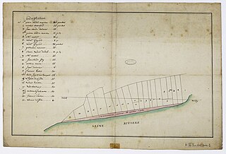
Français : Ile-Saint-Denis. Plan d'un atterrissement de la Seine |
||||||||||||||||||||
| Description |
Ile-Saint-Denis. Plan d'un atterrissement de la Seine |
||||||||||||||||||||
| Date | XVIIIe | ||||||||||||||||||||
| Collection |
|
||||||||||||||||||||
| Accession number |
N/III/Seine/601 |
||||||||||||||||||||
| References | notice en ligne | ||||||||||||||||||||
| Source | Archives nationales | ||||||||||||||||||||

Licensing
[edit]
| This file is licensed under the Licence Ouverte 1.0 (License text, English license text).
|
| Object location | | View this and other nearby images on: OpenStreetMap |
|---|
File history
Click on a date/time to view the file as it appeared at that time.
| Date/Time | Thumbnail | Dimensions | User | Comment | |
|---|---|---|---|---|---|
| current | 12:00, 19 July 2023 | | 2,470 × 1,686 (594 KB) | Archives nationales (France) (talk | contribs) | ajout media AN pour editathon 2023 (details) |
You cannot overwrite this file.
File usage on Commons
The following page uses this file:
Metadata
Categories:
- Media contributed by the Archives Nationales (France)/17
- 18th-century documents in the Archives nationales (France)
- Maps in the Archives Nationales (France)
- Archives nationales (France) - série N
- Ile-Saint-Denis (Seine-Saint-Denis) in the Archives nationales (France)
- Saint-Denis (Seine-Saint-Denis) in the Archives nationales (France)
- Maps of Saint-Denis (Seine-Saint-Denis)