File:Iheya Island gsi-20081025.jpg
Jump to navigation
Jump to search

Size of this preview: 600 × 600 pixels. Other resolutions: 240 × 240 pixels | 480 × 480 pixels | 768 × 768 pixels | 1,024 × 1,024 pixels | 2,048 × 2,048 pixels | 10,000 × 10,000 pixels.
Original file (10,000 × 10,000 pixels, file size: 19.49 MB, MIME type: image/jpeg)
Captions
Captions
Add a one-line explanation of what this file represents
Summary
[edit]| Warning | The original file is very high-resolution. It might not load properly or could cause your browser to freeze when opened at full size. |
|---|
| Description |
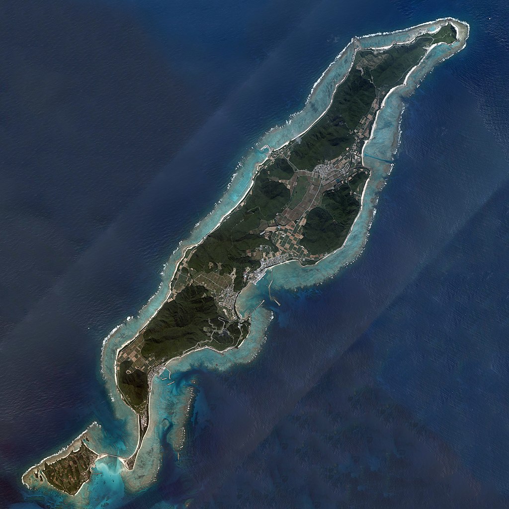
English: Iheya Island, Iheya, Okinawa, Japan.
日本語: 伊平屋島
国土交通省の地図・空中写真閲覧サービスを元に作成。36枚の航空写真を使用。
|
| Date | |
| Source | COK20081X-C3-1, C3-2, C3-3, C3-4, C3-5, C3-6, C3-7, C3-8, C3-9, C3-10, C3-11, C3-12, C3-13, C3-14, C3-15, C3-16, C3-17, C4-1, C4-2, C4-3, C4-4, C4-5, C4-6, C4-7, C4-8, C4-9, C4-10, C4-11, C4-12, C4-13, C4-14, C4-15, C4-16, C4-17, C4-18, C4-19 |
| Author |
English: Geospatial Information Authority of Japan
日本語: 国土地理院 |
| Camera location | | View this and other nearby images on: OpenStreetMap |
|---|
| This is a retouched picture, which means that it has been digitally altered from its original version. Modifications: Combined 36 aerial photos, rotated upward to north direction, and cropped, retouched. Modifications made by Kugel~commonswiki.
|
Licensing
[edit]
|
The copyright holder of this file, Ministry of Land, Infrastructure, Transport and Tourism, allows anyone to use it for any purpose, provided that the copyright holder is properly attributed. Redistribution, derivative work, commercial use, and all other use is permitted. |
Attribution:
National Land Image Information (Color Aerial Photographs), created by Ministry of Land, Infrastructure, Transport and Tourism, distributed by Geospatial Information Authority of Japan
|

File history
Click on a date/time to view the file as it appeared at that time.
| Date/Time | Thumbnail | Dimensions | User | Comment | |
|---|---|---|---|---|---|
| current | 05:31, 24 October 2016 | | 10,000 × 10,000 (19.49 MB) | Kugel~commonswiki (talk | contribs) | {{Information |description={{en|Iheya Island, Iheya, Okinawa, Japan.}} {{ja|伊平屋島 国土交通省の地図・空中写真閲覧サービスを元に作成。36枚の航空写真を使用。 * 整理番号 : COK20081X * 撮影年月日 : 2008年... |
You cannot overwrite this file.
File usage on Commons
The following page uses this file:
File usage on other wikis
The following other wikis use this file:
- Usage on ja.wikipedia.org