File:Ifpo 23361 Syrie, gouvernorat de Tartous, District de Tartous, l'île de Raouad et la côte syrienne, vue aérienne oblique.jpg
Jump to navigation
Jump to search

Size of this preview: 738 × 600 pixels. Other resolutions: 295 × 240 pixels | 591 × 480 pixels | 945 × 768 pixels | 1,260 × 1,024 pixels | 2,080 × 1,690 pixels.
Original file (2,080 × 1,690 pixels, file size: 481 KB, MIME type: image/jpeg)
Captions
Captions
Add a one-line explanation of what this file represents
| Photographer |
|
|||||||||||
| Description |
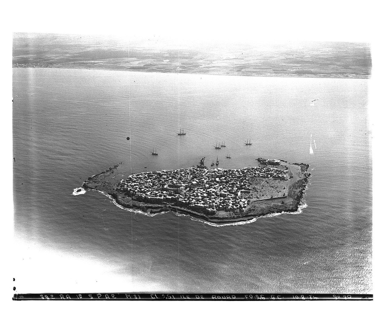
Français : Syrie, gouvernorat de Tartous, District de Tartous, l'île de Raouad et la côte syrienne, vue aérienne oblique |
|||||||||||
| Depicted place | Arwad | |||||||||||
| Date |
Taken on 10 August 1934 4 February 2020, 09:48:39 (upload date) |
|||||||||||
| Medium | dry plate | |||||||||||
| Dimensions | height: 18 cm (7 in); width: 24 cm (9.4 in) | |||||||||||
| Collection |
|
|||||||||||
| Accession number |
hal-02465724 Ifpo-23361 |
|||||||||||
| Object history | French army | |||||||||||
| Credit line |
Français : Institut français du Proche-Orient (Ifpo) ; ALIPH – Alliance internationale pour la protection du patrimoine dans les zones en conflit |
|||||||||||
| Source |
https://hal.archives-ouvertes.fr/hal-02465724 https://hal.archives-ouvertes.fr/hal-02465724/document |
|||||||||||
| Permission (Reusing this file) |
|
|||||||||||
| Mots-clés | Français : Photographie aérienne,Vue aérienne,Syrie,Archéologie,Gouvernorat de Tartous,District de Tartous,Mer,Arouad,Île de Rouad,Aradus,Arwād,Photographie aérienne oblique,Ile,Bateau de pêche,Côte |
|||||||||||
| Camera location | | View this and other nearby images on: OpenStreetMap |
|---|
File history
Click on a date/time to view the file as it appeared at that time.
| Date/Time | Thumbnail | Dimensions | User | Comment | |
|---|---|---|---|---|---|
| current | 22:49, 18 April 2021 | | 2,080 × 1,690 (481 KB) | Don-vip (talk | contribs) | pattypan 20.04 |
You cannot overwrite this file.
File usage on Commons
The following page uses this file: