File:Ifpo 23357 Syrie, gouvernorat de Tartous, District de Tartous, bâteaux de pêche aux abords de l'île de Raouad, vue aérienne oblique.jpg
Jump to navigation
Jump to search

Size of this preview: 800 × 580 pixels. Other resolutions: 320 × 232 pixels | 640 × 464 pixels | 1,024 × 742 pixels | 1,280 × 928 pixels | 2,067 × 1,498 pixels.
Original file (2,067 × 1,498 pixels, file size: 314 KB, MIME type: image/jpeg)
Captions
Captions
Add a one-line explanation of what this file represents
| Photographer |
|
|||||||||||
| Description |
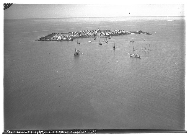
Français : Syrie, gouvernorat de Tartous, District de Tartous, bâteaux de pêche aux abords de l'île de Raouad, vue aérienne oblique |
|||||||||||
| Depicted place | Arwad | |||||||||||
| Date |
Taken on 15 March 1939 3 February 2020, 21:54:22 (upload date) |
|||||||||||
| Medium | dry plate | |||||||||||
| Dimensions | height: 18 cm (7 in); width: 24 cm (9.4 in) | |||||||||||
| Collection |
|
|||||||||||
| Accession number |
hal-02465457 Ifpo-23357 |
|||||||||||
| Object history | French army | |||||||||||
| Credit line |
Français : Institut français du Proche-Orient (Ifpo) ; ALIPH – Alliance internationale pour la protection du patrimoine dans les zones en conflit |
|||||||||||
| Source |
https://hal.archives-ouvertes.fr/hal-02465457 https://hal.archives-ouvertes.fr/hal-02465457/document |
|||||||||||
| Permission (Reusing this file) |
|
|||||||||||
| Mots-clés | Français : Photographie aérienne,Vue aérienne,Syrie,Archéologie,Gouvernorat de Tartous,District de Tartous,Mer,Arouad,Île de Rouad,Aradus,Arwād,Photographie aérienne oblique,Ile,Bateau de pêche |
|||||||||||
| Camera location | | View this and other nearby images on: OpenStreetMap |
|---|
File history
Click on a date/time to view the file as it appeared at that time.
| Date/Time | Thumbnail | Dimensions | User | Comment | |
|---|---|---|---|---|---|
| current | 22:48, 18 April 2021 | | 2,067 × 1,498 (314 KB) | Don-vip (talk | contribs) | pattypan 20.04 |
You cannot overwrite this file.
File usage on Commons
The following page uses this file: