File:Ifpo 23354 Syrie, gouvernorat de Tartous, District de Tartous, île de Raouad, vue aérienne oblique.jpg
Jump to navigation
Jump to search
Size of this preview: 800 × 571 pixels. Other resolutions: 320 × 228 pixels | 640 × 457 pixels | 1,024 × 731 pixels | 1,280 × 914 pixels | 1,977 × 1,411 pixels.
Original file (1,977 × 1,411 pixels, file size: 310 KB, MIME type: image/jpeg)
Captions
Captions
Add a one-line explanation of what this file represents
| Photographer |
|
|||||||||||
| Description |
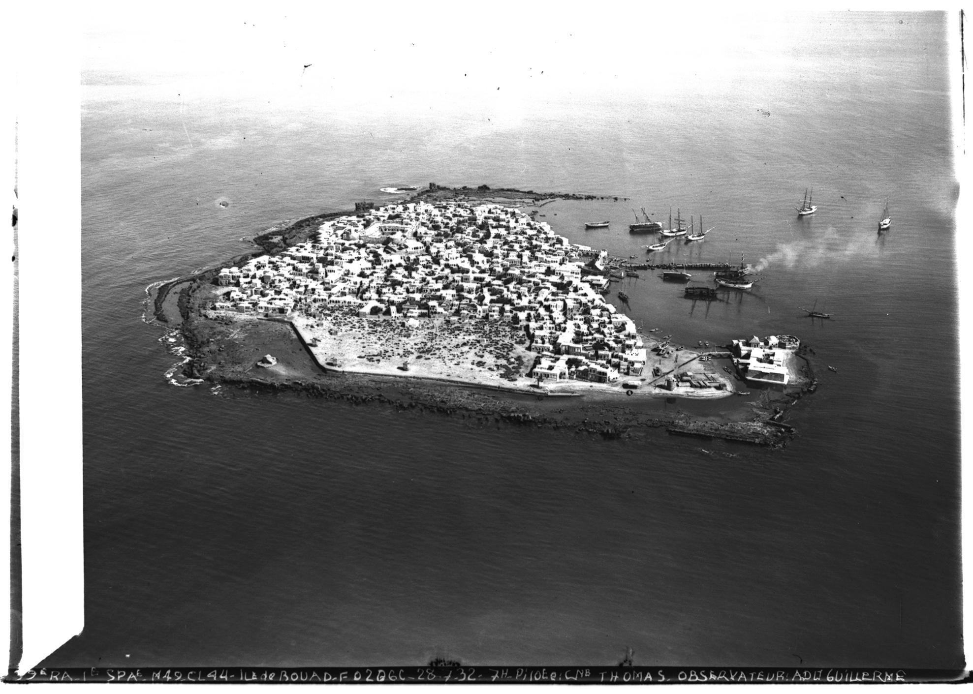
Français : Syrie, gouvernorat de Tartous, District de Tartous, île de Raouad, vue aérienne oblique |
|||||||||||
| Depicted place | Arwad | |||||||||||
| Date |
Taken on 28 July 1932 1 February 2020, 11:48:09 (upload date) |
|||||||||||
| Medium | dry plate | |||||||||||
| Dimensions | height: 18 cm (7 in); width: 24 cm (9.4 in) | |||||||||||
| Collection |
|
|||||||||||
| Accession number |
hal-02463598 Ifpo-23354 |
|||||||||||
| Object history | French army | |||||||||||
| Credit line |
Français : Institut français du Proche-Orient (Ifpo) ; ALIPH – Alliance internationale pour la protection du patrimoine dans les zones en conflit |
|||||||||||
| Source |
https://hal.archives-ouvertes.fr/hal-02463598 https://hal.archives-ouvertes.fr/hal-02463598/document |
|||||||||||
| Permission (Reusing this file) |
|
|||||||||||
| Other versions |
|
|||||||||||
| Mots-clés | Français : Aradus,Île de Rouad,Arouad,Mer,District de Tartous,Gouvernorat de Tartous,Archéologie,Syrie,Vue aérienne,Photographie aérienne,Arwād,Photographie aérienne oblique,Ile,Bateau de pêche |
|||||||||||

| Camera location | | View this and other nearby images on: OpenStreetMap |
|---|
File history
Click on a date/time to view the file as it appeared at that time.
| Date/Time | Thumbnail | Dimensions | User | Comment | |
|---|---|---|---|---|---|
| current | 22:48, 18 April 2021 | | 1,977 × 1,411 (310 KB) | Don-vip (talk | contribs) | pattypan 20.04 |
You cannot overwrite this file.
File usage on Commons
The following 2 pages use this file: