File:Ifpo 21322 Syrie, gouvernorat de Damas, Damas, vue aérienne oblique (cropped).jpg
Jump to navigation
Jump to search

Size of this preview: 800 × 434 pixels. Other resolutions: 320 × 174 pixels | 640 × 347 pixels | 1,091 × 592 pixels.
Original file (1,091 × 592 pixels, file size: 111 KB, MIME type: image/jpeg)
Captions
Captions
Add a one-line explanation of what this file represents
| Photographer |
|
|||||||||||
| Description |
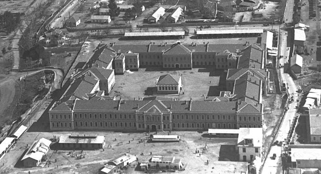
Français : Syrie, gouvernorat de Damas, Damas, vue aérienne oblique |
|||||||||||
| Depicted place | Damascus | |||||||||||
| Date |
Taken on 10 February 1933 12 March 2020, 14:27:15 (upload date) |
|||||||||||
| Medium | dry plate | |||||||||||
| Dimensions | height: 13 cm (5.1 in); width: 18 cm (7 in) | |||||||||||
| Collection |
|
|||||||||||
| Accession number |
hal-02506658 Ifpo-21322 |
|||||||||||
| Object history | French army | |||||||||||
| Credit line |
Français : Institut français du Proche-Orient (Ifpo) ; ALIPH – Alliance internationale pour la protection du patrimoine dans les zones en conflit |
|||||||||||
| Source |
https://hal.archives-ouvertes.fr/hal-02506658 https://hal.archives-ouvertes.fr/hal-02506658/document |
|||||||||||
| Permission (Reusing this file) |
|
|||||||||||
| Other versions | ||||||||||||
| Mots-clés | Français : Vue aérienne,Photographie aérienne oblique,Syrie,Dimašq,Archéologie,Photographie aérienne,Grande mosquée de Damas,Mosquée des Omeyyades,Gouvernorat de Damas,Damas |
|||||||||||

| Camera location | | View this and other nearby images on: OpenStreetMap |
|---|
.jpg¶ms=033.511612_N_0036.306541_E_globe:Earth_type:camera__&language=en)
File history
Click on a date/time to view the file as it appeared at that time.
| Date/Time | Thumbnail | Dimensions | User | Comment | |
|---|---|---|---|---|---|
| current | 13:14, 3 May 2021 | | 1,091 × 592 (111 KB) | Don-vip (talk | contribs) | File:Ifpo 21322 Syrie, gouvernorat de Damas, Damas, vue aérienne oblique.jpg cropped 48 % horizontally, 62 % vertically using CropTool with lossless mode. |
You cannot overwrite this file.
File usage on Commons
The following 2 pages use this file:
.jpg)
File usage on other wikis
The following other wikis use this file:
- Usage on ca.wikipedia.org
- Usage on en.wikipedia.org
- Usage on fr.wikipedia.org
.jpg&oldid=906546684)