File:Icy Crater on Mars ESP 016954 2245.jpg
Jump to navigation
Jump to search

Size of this preview: 800 × 600 pixels. Other resolutions: 320 × 240 pixels | 640 × 480 pixels | 1,024 × 768 pixels | 1,280 × 960 pixels | 2,560 × 1,920 pixels.
Original file (2,560 × 1,920 pixels, file size: 6.67 MB, MIME type: image/jpeg)
Captions
Captions
Add a one-line explanation of what this file represents
| Description |
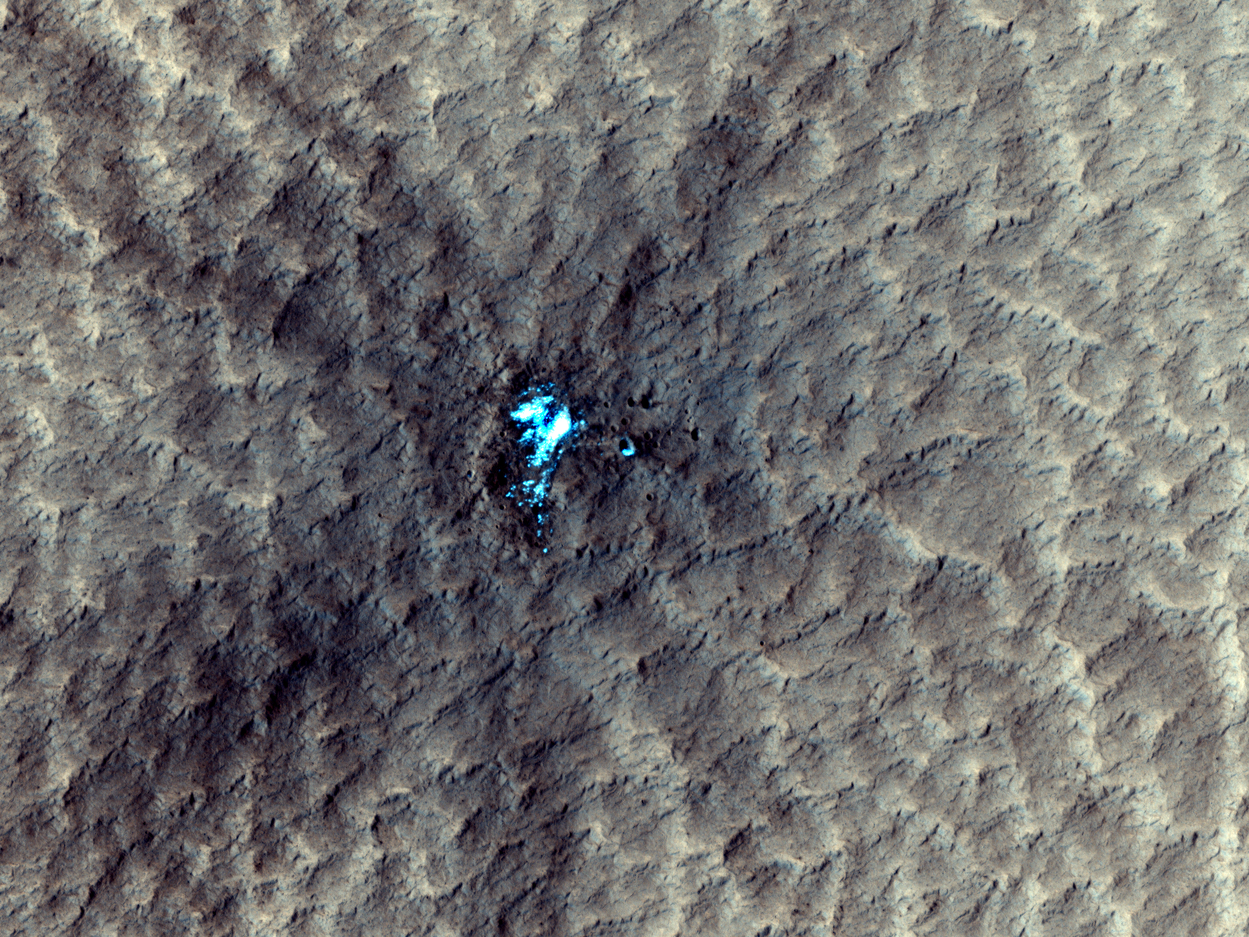
English: A newly formed impact crater, observed by HiRISE on Mars Reconnaissance Orbiter. The impact that formed the crater exposed the water ice beneath the surface. Some of the ice can be seen scattered at the adjascent area in the subimages. The blast zone (excavated dark material) is almost 800 meters (half a mile) across. The crater itself is just over 20 meters (66 feet) across
Ελληνικά: Ένας νεοσχηματισμένος κρατήρας στην επιφάνεια του Άρη. Ο κρατήρας φτάνει μέχρι το στρώμα πάγου που βρίσκεται κάτω από το έδαφος. Εικόνα από το τηλεσκόπιο HiRISE, στη διαστημοσυσκευή Mars Reconnaissance Orbiter της NASA. |
|||||
| Date | ||||||
| Source | HiRISE webpage with full description, file | |||||
| Author | NASA/JPL/University of Arizona | |||||
| Permission (Reusing this file) |
|
|||||
| Other versions |
  |

| Location on Mars | View this and other nearby images on: Google Maps |
|---|
File history
Click on a date/time to view the file as it appeared at that time.
| Date/Time | Thumbnail | Dimensions | User | Comment | |
|---|---|---|---|---|---|
| current | 14:42, 18 September 2011 | | 2,560 × 1,920 (6.67 MB) | Badseed (talk | contribs) | {{Information |Description={{en|A newly formed impact crater, observed by HiRISE on Mars Reconnaissance Orbiter. The impact that formed the crater exposed the water ice beneath the surface. Some of the ice can be seen scattered at the adjascent area in th |
You cannot overwrite this file.
File usage on Commons
The following 2 pages use this file:
File usage on other wikis
The following other wikis use this file:
- Usage on beta.wikiversity.org
- Usage on en.wikiversity.org