File:ISS031-E-120908 - View of South Africa.jpg
Jump to navigation
Jump to search
Size of this preview: 800 × 531 pixels. Other resolutions: 320 × 213 pixels | 640 × 425 pixels | 1,024 × 680 pixels | 1,280 × 850 pixels | 2,560 × 1,700 pixels | 4,288 × 2,848 pixels.
Original file (4,288 × 2,848 pixels, file size: 2.01 MB, MIME type: image/jpeg)
Captions
Captions
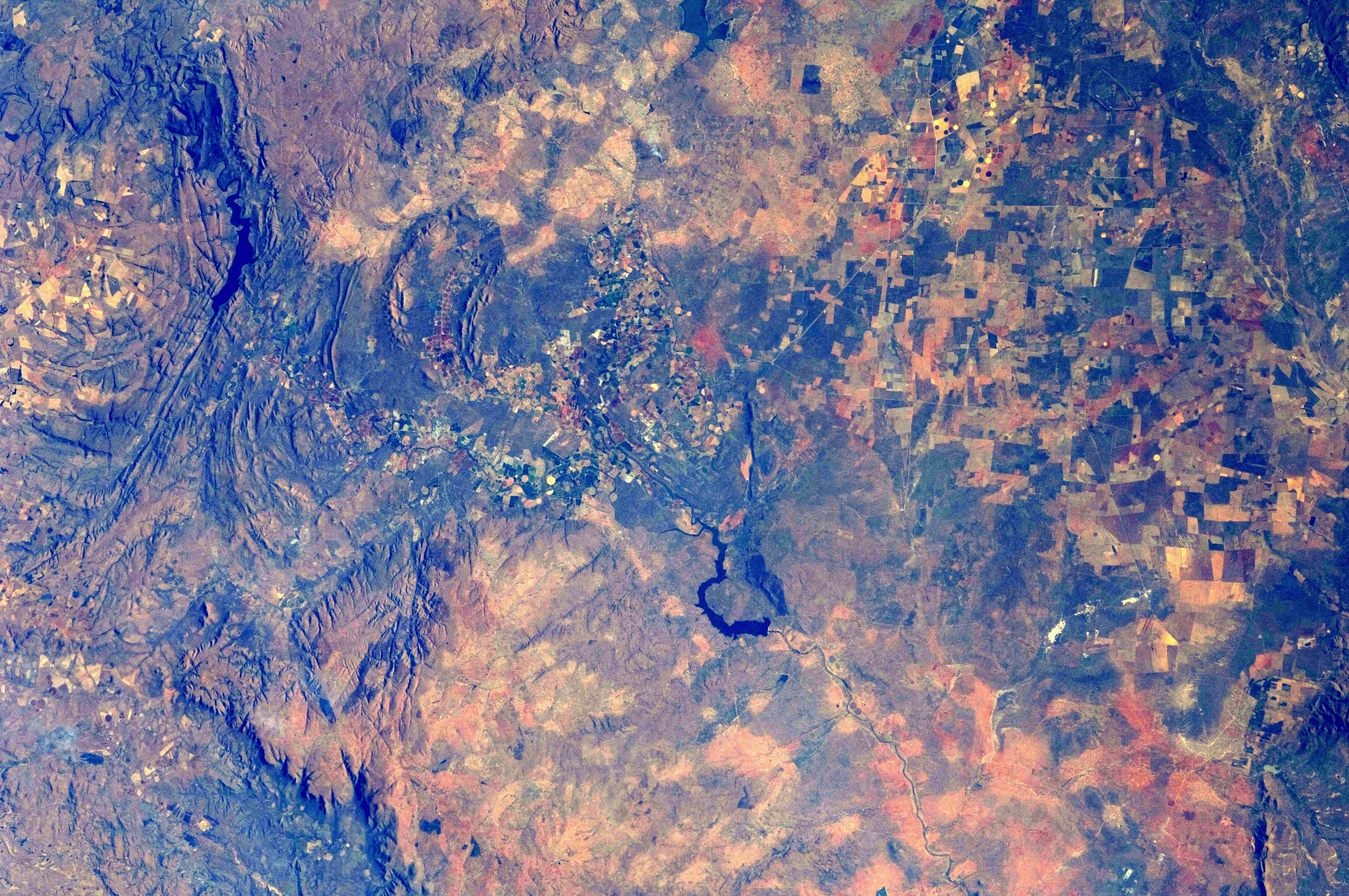
View of South Africa taken during ISS Expedition 31: agricultural and conservation regions around Groblersdal, northern South Africa
Summary
[edit]
| Description |
Afrikaans: Gesig op Suid-Afrika, geneem tydens IRS-sending 31: Ingesluit is gedeeltes van noordelike Mpumalanga- (links) en suidelike Limpopoprovinsies (regs), met die Olifantsrivier en twee opgaardamme daarvan wat 'n diagonaal oor die beeld vorm.
English: View of South Africa, taken during ISS Expedition 31: Included are sections of northern Mpumalanga (at left) and southern Limpopo (at right) Provinces, with the Olifants River and two of its main reservoirs forming a diagonal over the image. |
| Date | |
| Source | JSC Gateway to Astronaut Photography of Earth |
| Author | Earth Science and Remote Sensing Unit, Lyndon B. Johnson Space Center |
| Other versions |
     |
| Mission | ISS031 |
| Roll | E |
| Frame | 120908 |
| Geographic area | South Africa |
| Features | ARABIE L., LOSKOP RES., AGR., GROBLERSDAL, MARBLE HALL, SPRINGBOK FLATS, NEBO PLATEAU, STEELPOORT VALLEY |
| Cloud percentage | 10% |
| Altitude | 217 nautical miles (402 km) |
| Look angle | 20 |
| Look direction | S |
| Sun Azimuth | 319° |
| Sun Elevation | 30° |
| Camera | Nikon D2Xs Electronic Still Camera |
| Focal length | 70 mm |
| Camera location | | View this and other nearby images on: OpenStreetMap |
|---|
| Object location | | View this and other nearby images on: OpenStreetMap |
|---|
This image or video was catalogued by Johnson Space Center of the United States National Aeronautics and Space Administration (NASA) under Photo ID: ISS031-E-120908. This tag does not indicate the copyright status of the attached work. A normal copyright tag is still required. See Commons:Licensing. Other languages:
|
Licensing
[edit]
| This file is in the public domain in the United States because it was solely created by NASA. NASA copyright policy states that "NASA material is not protected by copyright unless noted". (See Template:PD-USGov, NASA copyright policy page or JPL Image Use Policy.) | ||
 |
Warnings:
|
| Annotations | This image is annotated: View the annotations at Commons |
File history
Click on a date/time to view the file as it appeared at that time.
| Date/Time | Thumbnail | Dimensions | User | Comment | |
|---|---|---|---|---|---|
| current | 21:22, 25 June 2024 | | 4,288 × 2,848 (2.01 MB) | JMK (talk | contribs) | adjust midtones, light and colour balance, add contrast |
| 17:29, 5 June 2022 |  | 4,288 × 2,848 (849 KB) | AskeBot (talk | contribs) |
You cannot overwrite this file.
File usage on Commons
The following 6 pages use this file:
- File:ISS031-E-120908 - View of South Africa, Kwaggavoetpad NR & Nebo Plateau.jpg
- File:ISS031-E-120908 - View of South Africa, Loskop Dam.jpg
- File:ISS031-E-120908 - View of South Africa, Marblehall & Groblersdal.jpg
- File:ISS031-E-120908 - View of South Africa, Olifants River Valley.jpg
- File:ISS031-E-120908 - View of South Africa, Schuinsdraai NR, Arabie Dam & Leswena NR.jpg
- File:ISS031-E-120908 - View of South Africa, Springbok Flats.jpg