File:ISS031-E-120908 - View of South Africa, Olifants River Valley.jpg
Jump to navigation
Jump to search

Size of this preview: 426 × 599 pixels. Other resolutions: 171 × 240 pixels | 341 × 480 pixels | 546 × 768 pixels | 728 × 1,024 pixels | 1,629 × 2,290 pixels.
Original file (1,629 × 2,290 pixels, file size: 1.13 MB, MIME type: image/jpeg)
Captions
Captions
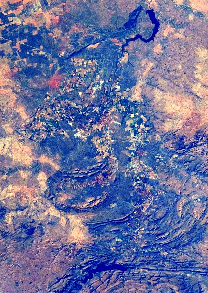
Marble Hall and Groblersdal in the Olifants River Valley (between Loskop Dam below, and Arabie Dam above), northern Mpumalanga and southern Limpopo, South Africa
Summary
[edit]
| Description |
Afrikaans: Gesig op die grensgebied van Limpopo- en Mpumalangaprovinsies, Suid-Afrika, geneem tydens IRS-sending 31: Marble Hall en Groblersdal in die Olifantsriviervallei (tussen Loskopdam, onder, in noordelike Mpumalanga, en Arabiedam, bo, in suidelike Limpopo)
English: View of the boundary region between northern Mpumalanga and southern Limpopo Provinces, South Africa, taken during ISS Expedition 31: Marble Hall and Groblersdal in the Olifants River Valley (between Loskop Dam below, in northern Mpumalanga, and Arabie Dam above, in southern Limpopo) |
| Date | |
| Source | JSC Gateway to Astronaut Photography of Earth |
| Author | Earth Science and Remote Sensing Unit, Lyndon B. Johnson Space Center |
| Other versions |
 |
| Mission | ISS031 |
| Roll | E |
| Frame | 120908 |
| Geographic area | South Africa |
| Features | ARABIE L., LOSKOP RES., AGR., MARBLE HALL, GROBLERSDAL |
| Cloud percentage | 10% |
| Altitude | 217 nautical miles (402 km) |
| Look angle | 20 |
| Look direction | S |
| Sun Azimuth | 319° |
| Sun Elevation | 30° |
| Camera | Nikon D2Xs Electronic Still Camera |
| Focal length | 70 mm |
| Camera location | | View this and other nearby images on: OpenStreetMap |
|---|
| Object location | | View this and other nearby images on: OpenStreetMap |
|---|
This image or video was catalogued by Johnson Space Center of the United States National Aeronautics and Space Administration (NASA) under Photo ID: ISS031-E-120908. This tag does not indicate the copyright status of the attached work. A normal copyright tag is still required. See Commons:Licensing. Other languages:
|
Licensing
[edit]
| This file is in the public domain in the United States because it was solely created by NASA. NASA copyright policy states that "NASA material is not protected by copyright unless noted". (See Template:PD-USGov, NASA copyright policy page or JPL Image Use Policy.) | ||
 |
Warnings:
|
| Annotations | This image is annotated: View the annotations at Commons |
File history
Click on a date/time to view the file as it appeared at that time.
| Date/Time | Thumbnail | Dimensions | User | Comment | |
|---|---|---|---|---|---|
| current | 17:51, 3 July 2024 | | 1,629 × 2,290 (1.13 MB) | JMK (talk | contribs) | Uploaded a work by Earth Science and Remote Sensing Unit, Lyndon B. Johnson Space Center from JSC Gateway to Astronaut Photography of Earth with UploadWizard |
You cannot overwrite this file.
File usage on Commons
The following page uses this file: