File:ISS006-E-36005 - View of Cuba - Trinidad (Sancti Spiritus province).jpg

Original file (3,032 × 2,064 pixels, file size: 861 KB, MIME type: image/jpeg)
Captions
Captions
Summary
[edit].jpg&action=edit§ion=1)
| Description |
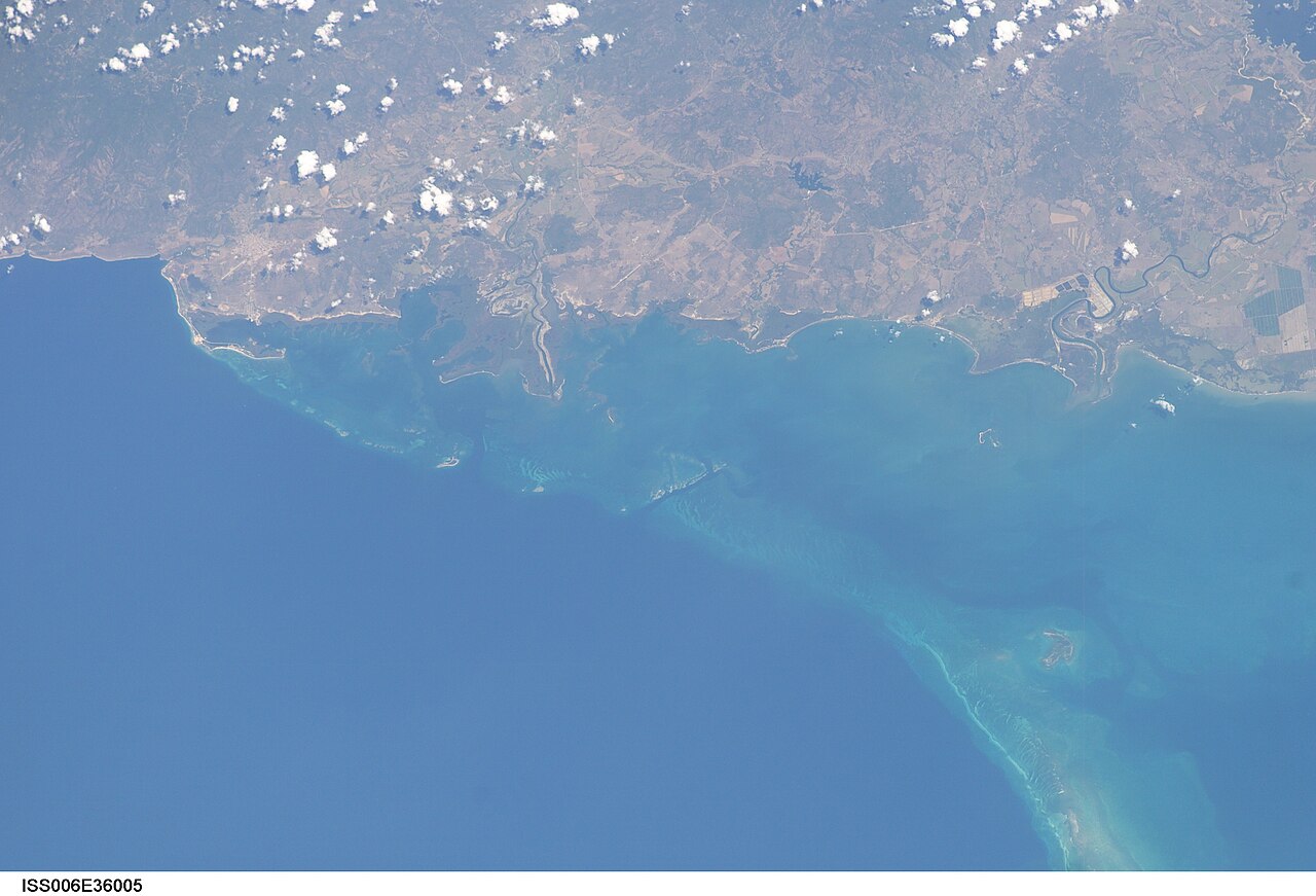
English: View of Cuba taken during ISS Expedition 6. South coast of Cuba, Sancti Spíritus province. Trinidad on the left and, on the right, the Zaza river separating the municipalities of Trinidad and La Sierpe.
On the left, the first two small nicks in the coast are rio Cabagán (limit between Cumanayagua west and Trinidad east) and rio Guanayara.
|
| Date | |
| Source | JSC Gateway to Astronaut Photography of Earth |
| Author | Earth Science and Remote Sensing Unit, Lyndon B. Johnson Space Center |
| Mission | ISS006 |
| Roll | E |
| Frame | 36005 |
| Geographic area | Cuba |
| Features | TRINIDAD,SAN PEDRO, REEFS |
| Cloud percentage | 10% |
| Altitude | 212 nautical miles (393 km) |
| Look angle | 30 |
| Look direction | E |
| Sun Azimuth | 139° |
| Sun Elevation | 56° |
| Camera | Kodak DCS760c Electronic Still Camera |
| Focal length | 180 mm |
| Camera location | | View this and other nearby images on: OpenStreetMap |
|---|
.jpg¶ms=021.400000_N_-081.500000_E_globe:Earth_type:camera__&language=en)
| Object location | | View this and other nearby images on: OpenStreetMap |
|---|
.jpg¶ms=021.500000_N_-079.500000_E_globe:Earth_class:object_type:object__&language=en)
This image or video was catalogued by Johnson Space Center of the United States National Aeronautics and Space Administration (NASA) under Photo ID: ISS006-E-36005. This tag does not indicate the copyright status of the attached work. A normal copyright tag is still required. See Commons:Licensing. Other languages:
|
Licensing
[edit].jpg&action=edit§ion=2)
| This file is in the public domain in the United States because it was solely created by NASA. NASA copyright policy states that "NASA material is not protected by copyright unless noted". (See Template:PD-USGov, NASA copyright policy page or JPL Image Use Policy.) | ||
 |
Warnings:
|
File history
Click on a date/time to view the file as it appeared at that time.
| Date/Time | Thumbnail | Dimensions | User | Comment | |
|---|---|---|---|---|---|
| current | 21:33, 9 August 2022 | | 3,032 × 2,064 (861 KB) | AskeBot (talk | contribs) |
You cannot overwrite this file.
File usage on Commons
The following page uses this file:
- File:ISS006-E-36005 - View of Cuba.jpg (file redirect)
File usage on other wikis
The following other wikis use this file:
- Usage on fr.wikipedia.org
.jpg&oldid=830046422)