File:ISS-56 Amur River and Lake Kizi, Russia.jpg
Jump to navigation
Jump to search
Size of this preview: 400 × 600 pixels. Other resolutions: 160 × 240 pixels | 320 × 480 pixels | 512 × 768 pixels | 682 × 1,024 pixels | 1,365 × 2,048 pixels | 3,712 × 5,568 pixels.
Original file (3,712 × 5,568 pixels, file size: 3.19 MB, MIME type: image/jpeg)
Captions
Captions
Add a one-line explanation of what this file represents
Summary
[edit]
| Description |
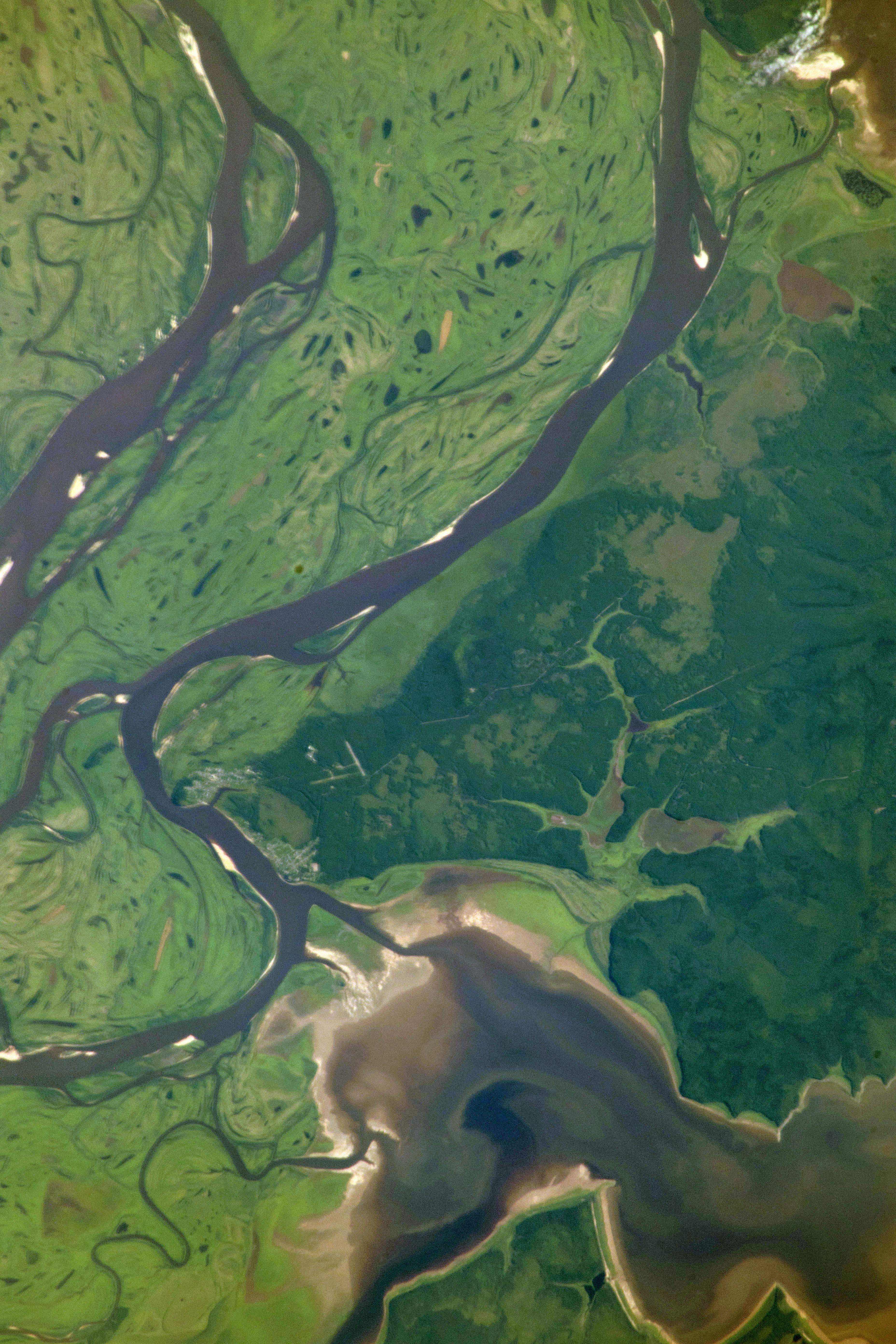
English: The eastern-flowing Amur River forms a portion of the border between northeastern China and far eastern Russia. At the time of this photograph, the International Space Station was orbiting almost 257 miles above the Strait of Tartary which separates mainland Asia from the Russian island of Sakhalin. |
| Date | Taken on 6 July 2018 |
| Source | https://www.flickr.com/photos/nasa2explore/28629035837/ |
| Author | NASA |
This image or video was catalogued by Johnson Space Center of the United States National Aeronautics and Space Administration (NASA) under Photo ID: ISS056-E-084388. This tag does not indicate the copyright status of the attached work. A normal copyright tag is still required. See Commons:Licensing. Other languages:
|
Licensing
[edit]
| This image, originally posted to Flickr, is currently not available on Flickr under the license specified on this page. However, please see {{PD-USGov-NASA-AP}} for permission to use it under this license. |
This file is in the public domain in the United States because it was created by the Image Science & Analysis Laboratory, of the NASA Johnson Space Center. NASA copyright policy states that "NASA material is not protected by copyright unless noted". (NASA media use guidelines or Conditions of Use of Astronaut Photographs).
Photo source: ISS056-E-084388.
|
| Annotations | This image is annotated: View the annotations at Commons |
File history
Click on a date/time to view the file as it appeared at that time.
| Date/Time | Thumbnail | Dimensions | User | Comment | |
|---|---|---|---|---|---|
| current | 19:49, 29 July 2018 | | 3,712 × 5,568 (3.19 MB) | Ras67 (talk | contribs) | rotated and levels adjusted, now approximately north oriented |
| 16:53, 29 July 2018 |  | 5,568 × 3,712 (1.89 MB) | Ras67 (talk | contribs) | {{Information |description={{en|1=The eastern-flowing Amur River forms a portion of the border between northeastern China and far eastern Russia. At the time of this photograph, the International Space Station was orbiting almost 257 miles above the Strait of Tartary which separates mainland Asia from the Russian island of Sakhalin.}} |date={{taken on|2018-07-06}} |source=https://www.flickr.com/photos/nasa2explore/28629035837/ |author=NASA |permission= |other versions= }} {{NASA-image|center=... |
You cannot overwrite this file.
File usage on Commons
The following page uses this file:
File usage on other wikis
The following other wikis use this file:
- Usage on en.wikipedia.org
- Usage on incubator.wikimedia.org