File:IND airport map.PNG
Jump to navigation
Jump to search
Size of this preview: 386 × 600 pixels. Other resolutions: 154 × 240 pixels | 309 × 480 pixels | 717 × 1,114 pixels.
Original file (717 × 1,114 pixels, file size: 107 KB, MIME type: image/png)
Captions
Captions
Add a one-line explanation of what this file represents
| Description |
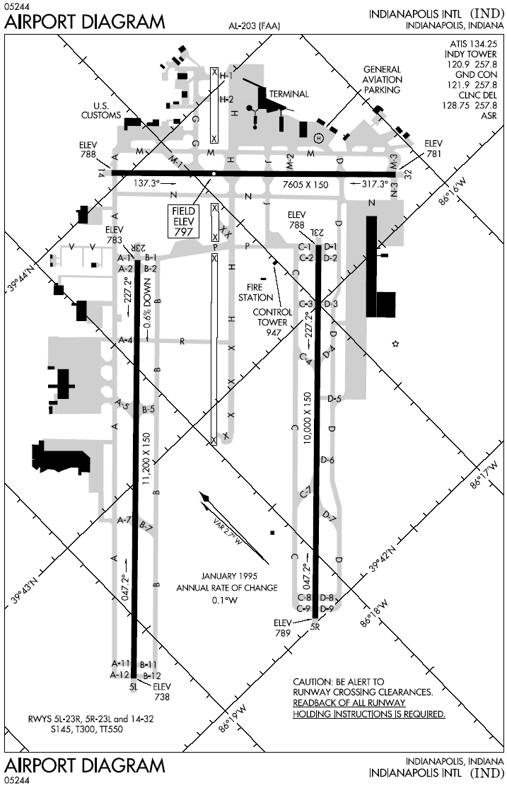
English: Diagram of Indianapolis International Airport |
| Date | Unknown date |
| Source | |
| Author |
This image or file is a work of a Federal Aviation Administration employee, taken or made as part of that person's official duties. As a work of the U.S. federal government, the image is in the public domain in the United States.
|
 |
File history
Click on a date/time to view the file as it appeared at that time.
| Date/Time | Thumbnail | Dimensions | User | Comment | |
|---|---|---|---|---|---|
| current | 00:37, 5 January 2006 | | 717 × 1,114 (107 KB) | Cmprince (talk | contribs) | Diagram of Indianapolis International Airport {{PD-USGov-FAA}} |
You cannot overwrite this file.
File usage on Commons
There are no pages that use this file.