File:Hylton Castle, geograph.jpg
Jump to navigation
Jump to search
No higher resolution available.
Hylton_Castle,_geograph.jpg (640 × 475 pixels, file size: 114 KB, MIME type: image/jpeg)
Captions
Captions
Add a one-line explanation of what this file represents
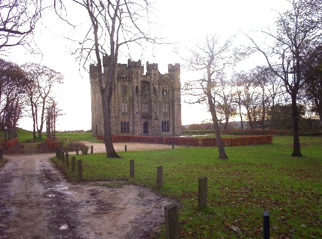
| Description | Hylton Castle, a ruined castle in the north west of Sunderland. | ||
| Date | |||
| Source | Geograph project | ||
| Author | C G Burke | ||
| Permission (Reusing this file) |
This file is licensed under the Creative Commons Attribution-Share Alike 2.0 Generic license. Attribution: C G Burke
|

| Object location | | View this and other nearby images on: OpenStreetMap |
|---|
_region:GB-GBN_&language=en)
File history
Click on a date/time to view the file as it appeared at that time.
| Date/Time | Thumbnail | Dimensions | User | Comment | |
|---|---|---|---|---|---|
| current | 14:15, 26 November 2006 | | 640 × 475 (114 KB) | GeeJo (talk | contribs) | {{Information| |Description = Runcorn Bridge, also known as the Silver Jubilee Bridge, Cheshire, England. |Source = [http://www.geograph.org.uk/photo/87610 Geograph project] |Date = 4 December, 2005 |Author = C G Burke |Permi |
You cannot overwrite this file.
File usage on Commons
There are no pages that use this file.