File:Hwasun-map.png
Jump to navigation
Jump to search
Size of this preview: 482 × 599 pixels. Other resolutions: 193 × 240 pixels | 386 × 480 pixels.
Original file (800 × 994 pixels, file size: 380 KB, MIME type: image/png)
Captions
Captions
Add a one-line explanation of what this file represents
Summary
[edit]
| Description |
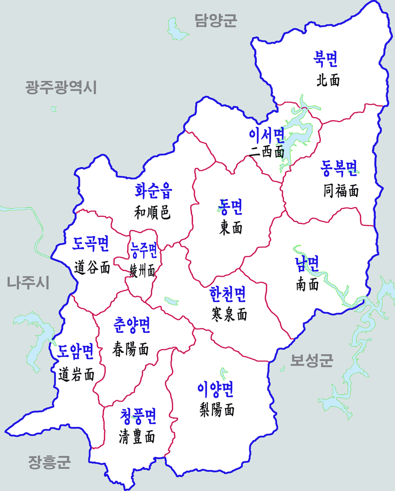
한국어: 전남 화순군 행정구역도 |
| Date | |
| Source | Own work |
| Author | 장길산 |
Licensing
[edit]
| I, the copyright holder of this work, release this work into the public domain. This applies worldwide. In some countries this may not be legally possible; if so: I grant anyone the right to use this work for any purpose, without any conditions, unless such conditions are required by law. |
File history
Click on a date/time to view the file as it appeared at that time.
| Date/Time | Thumbnail | Dimensions | User | Comment | |
|---|---|---|---|---|---|
| current | 15:17, 15 January 2023 | | 800 × 994 (380 KB) | 마이산 (talk | contribs) | 오류 수정 |
| 14:45, 31 August 2021 |  | 1,500 × 1,863 (453 KB) | 린눈라단 (talk | contribs) | Reverted to version as of 21:12, 17 August 2012 (UTC) | |
| 23:17, 23 August 2021 |  | 200 × 178 (37 KB) | Amanda1970 (talk | contribs) | ||
| 21:12, 17 August 2012 |  | 1,500 × 1,863 (453 KB) | Asfreeas (talk | contribs) | Color and Font Adjusted 주변 구역 추가 | |
| 11:09, 30 November 2011 |  | 1,500 × 1,863 (1,008 KB) | Gloyacks (talk | contribs) | {{파일 정보 |설명=전남 화순군 행정구역도 |출처=자작 |날짜=2011년 11월 30일 |만든이=장길산 |저작권= |기타= }} |
You cannot overwrite this file.
File usage on Commons
The following 3 pages use this file:
File usage on other wikis
The following other wikis use this file: