File:Hurricane irene 082811 0832 edt.jpg
Jump to navigation
Jump to search
Size of this preview: 800 × 564 pixels. Other resolutions: 320 × 226 pixels | 640 × 451 pixels | 1,024 × 722 pixels | 1,280 × 903 pixels | 1,500 × 1,058 pixels.
Original file (1,500 × 1,058 pixels, file size: 566 KB, MIME type: image/jpeg)
Captions
Captions
Add a one-line explanation of what this file represents
Summary
[edit]
| Description |
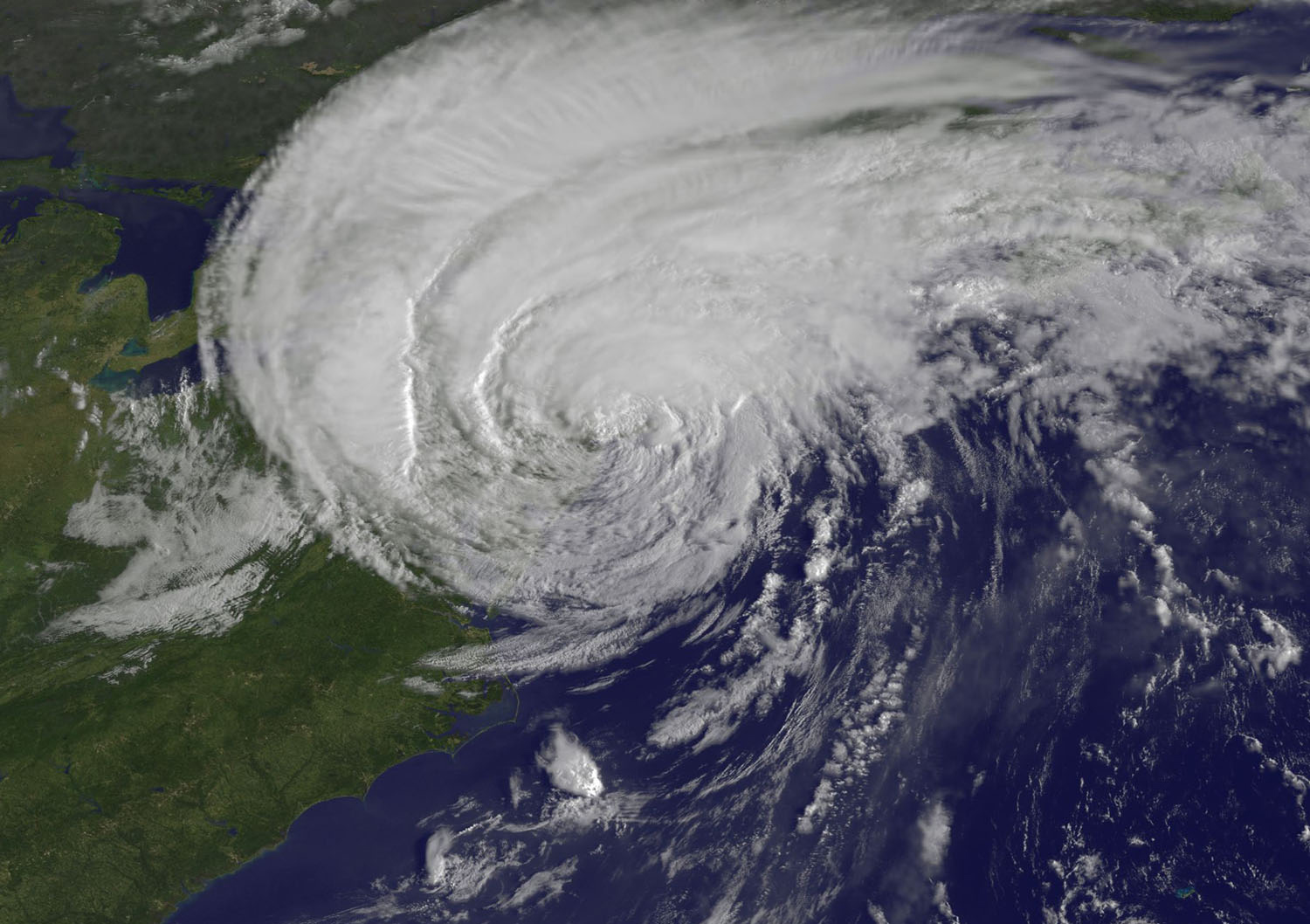
English: The GOES-13 satellite captured this stunning visible image of Hurricane Irene at 8:32 a.m. EDT, just 28 minutes before Irene's landfall in New York City. The image showed Irene's huge cloud cover blanketing New England, New York and over Toronto, Canada. Shadows in Irene's clouds indicate the bands of thunderstorms that surround now tropical storm Irene. (Credit: NASA/NOAA GOES Project) |
| Date | |
| Source | NASA Satellite Confirms Irene as a Big Rainmaker, She Makes Landfall in NYC |
| Author | NASA/NOAA GOES Project |
Licensing
[edit]
| This file is in the public domain in the United States because it was solely created by NASA. NASA copyright policy states that "NASA material is not protected by copyright unless noted". (See Template:PD-USGov, NASA copyright policy page or JPL Image Use Policy.) | ||
 |
Warnings:
|
File history
Click on a date/time to view the file as it appeared at that time.
| Date/Time | Thumbnail | Dimensions | User | Comment | |
|---|---|---|---|---|---|
| current | 15:25, 28 August 2011 | | 1,500 × 1,058 (566 KB) | ComputerHotline (talk | contribs) | {{Information |Description={{en|The GOES-13 satellite captured this stunning visible image of Hurricane Irene at 8:32 a.m. EDT, just 28 minutes before Irene's landfall in New York City. The image showed Irene's huge cloud cover blanketing New England, New |
You cannot overwrite this file.
File usage on Commons
The following page uses this file:
- File:Hurricane irene 082711 0150 est.jpg (file redirect)
File usage on other wikis
The following other wikis use this file:
- Usage on en.wikipedia.org
- Usage on fi.wikipedia.org
- Usage on it.wikipedia.org
- Usage on zh.wikipedia.org