File:Hurricane Felicia (MODIS 2021-07-17).jpg
Jump to navigation
Jump to search

Size of this preview: 739 × 599 pixels. Other resolutions: 296 × 240 pixels | 592 × 480 pixels | 947 × 768 pixels | 1,263 × 1,024 pixels | 2,525 × 2,048 pixels | 3,712 × 3,011 pixels.
Original file (3,712 × 3,011 pixels, file size: 1.01 MB, MIME type: image/jpeg)
Captions
Captions
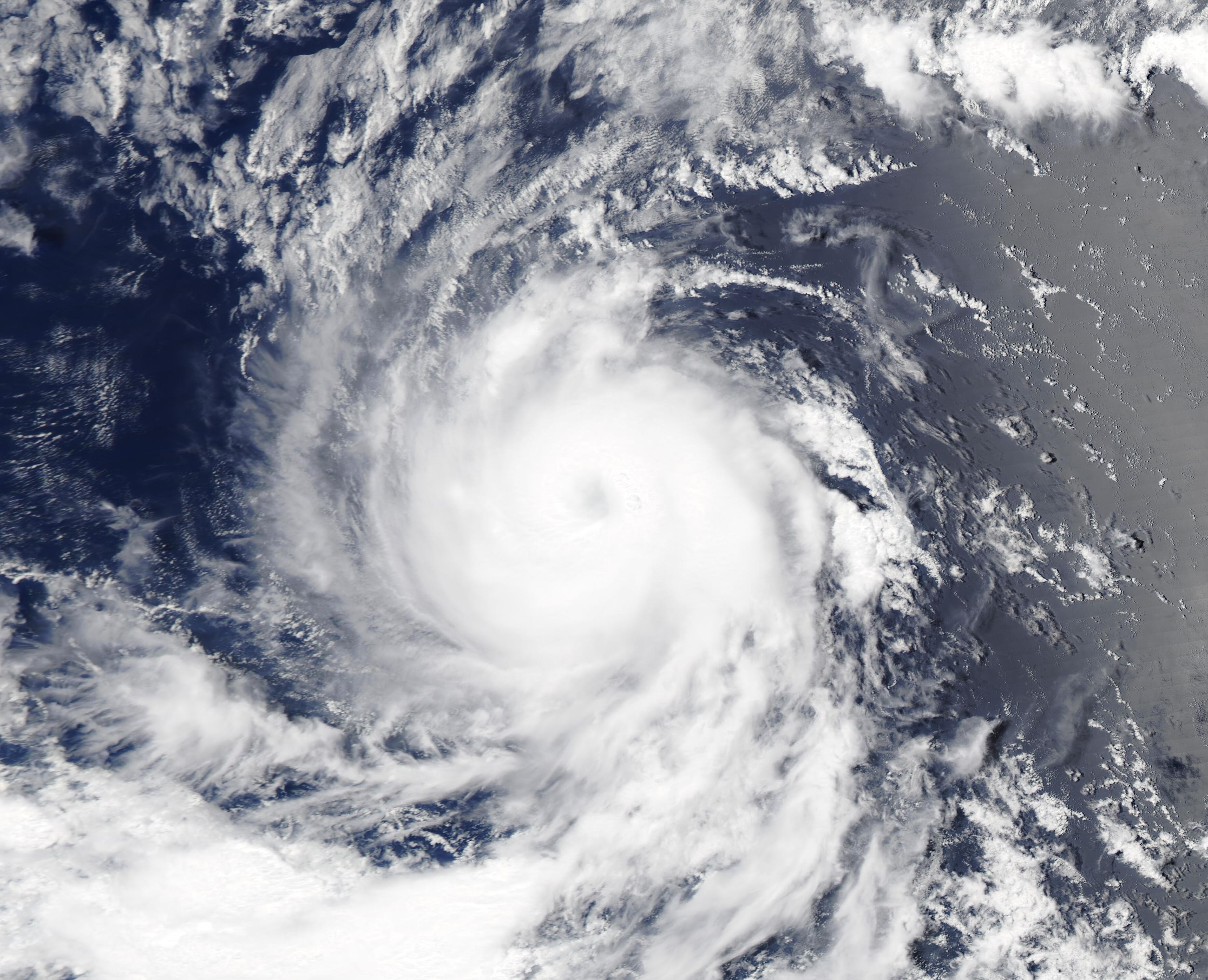
The Moderate Resolution Imaging Spectroradiometer (MODIS) on board the Aqua satellite acquired a true-color image of newly-formed Hurricane Felicia on July 15 as it was strengthening.
Summary
[edit].jpg&action=edit§ion=1)
| Description |
English: On July 16, the Eastern Pacific Ocean saw its first major hurricane of the season as Hurricane Felicia strengthened to Category 3 strength. Less than twelve hours later, at 1200 UTC on July 16 (8:00 a.m. EDT), Felicia had further strengthened, carrying maximum sustained winds of 130 mph (215 km/h), placing it as a Category 4 storm on the Saffir-Simpson Hurricane Wind Scale. At that time the strong hurricane was located over the open ocean about 985 miles (1,585 km) west southwest of the southern tip of Baja California and was moving westward at 9 mph (15 km/h).
According to the National Hurricane Center, Felicia remains a small tropical cyclone, with hurricane-force winds extending outward up to 25 miles (35 km) from the center and tropical-storm-force winds extending outward up to 70 miles (110 km) from the center. The storm is expected to begin a cycle of slow weakening by early on July 17. It is not expected that Hurricane Felicia will present hazards to land. The Moderate Resolution Imaging Spectroradiometer (MODIS) on board the Aqua satellite acquired a true-color image of newly-formed Hurricane Felicia on July 15 as it was strengthening. The compact storm sported a distinct but partially cloud-filled eye, with convective banding spiraling into the center at the time the image was captured. |
||
| Date | Taken on 15 July 2021 | ||
| Source |
Hurricane Felicia (direct link)
|
||
| Author | MODIS Land Rapid Response Team, NASA GSFC |
| This media is a product of the Aqua mission Credit and attribution belongs to the mission team, if not already specified in the "author" row |
Licensing
[edit].jpg&action=edit§ion=2)
| This file is in the public domain in the United States because it was solely created by NASA. NASA copyright policy states that "NASA material is not protected by copyright unless noted". (See Template:PD-USGov, NASA copyright policy page or JPL Image Use Policy.) | ||
 |
Warnings:
|
File history
Click on a date/time to view the file as it appeared at that time.
| Date/Time | Thumbnail | Dimensions | User | Comment | |
|---|---|---|---|---|---|
| current | 17:38, 30 January 2024 | | 3,712 × 3,011 (1.01 MB) | OptimusPrimeBot (talk | contribs) | #Spacemedia - Upload of http://modis.gsfc.nasa.gov/gallery/images/image07172021_250m.jpg via Commons:Spacemedia |
You cannot overwrite this file.
File usage on Commons
There are no pages that use this file.
.jpg&oldid=847257135)