File:Charley 2004-08-13 1635Z (cropped).jpg
(Redirected from File:Hurricane Charley 2004.jpg)
Size of this preview: 600 × 600 pixels. Other resolutions: 240 × 240 pixels | 480 × 480 pixels | 768 × 768 pixels | 1,024 × 1,024 pixels | 2,048 × 2,048 pixels | 4,000 × 4,000 pixels.
Original file (4,000 × 4,000 pixels, file size: 2.36 MB, MIME type: image/jpeg)
Captions
Captions
Add a one-line explanation of what this file represents
Summary
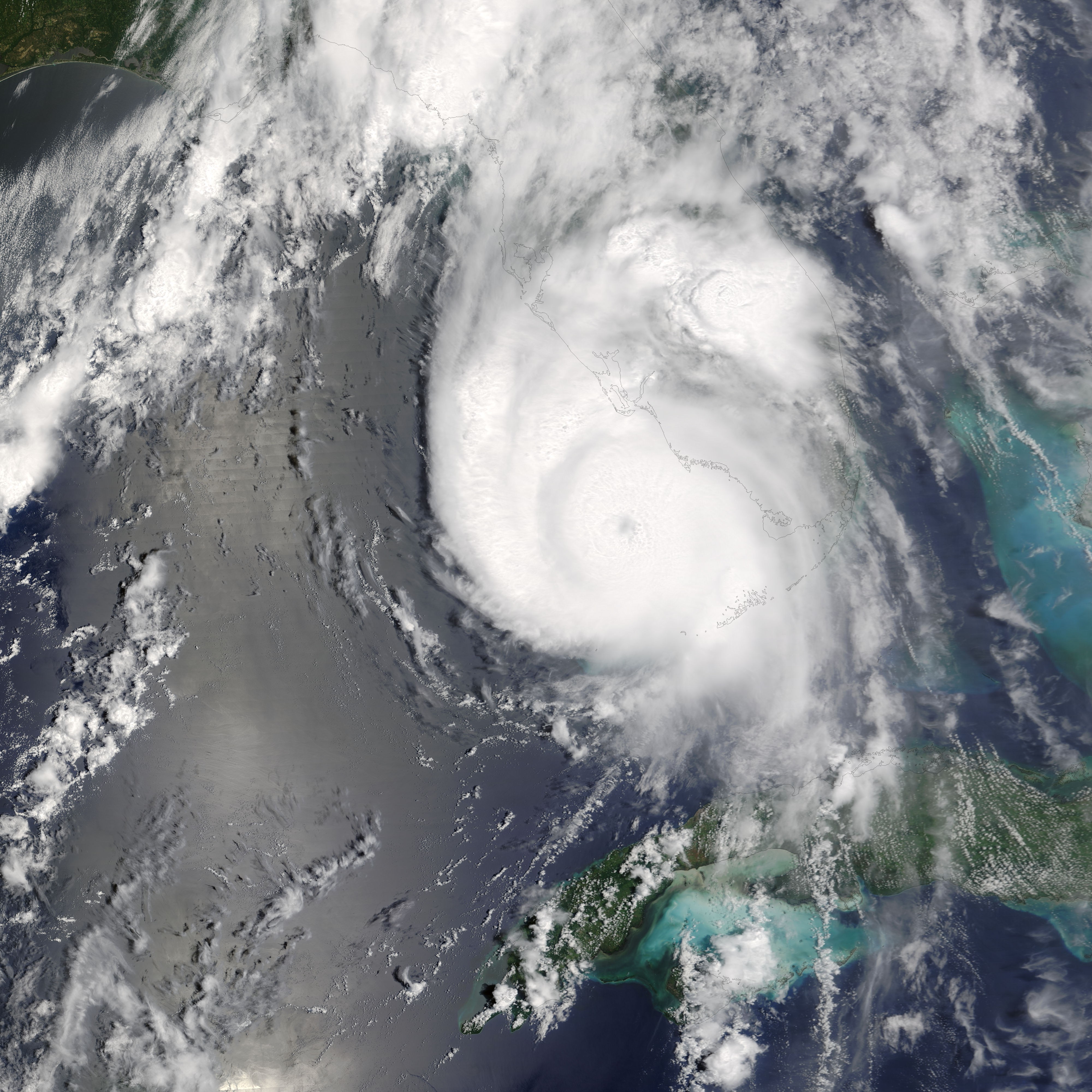
[edit]| Description | The Moderate Resolution Imaging Spectroradiometer (MODIS) aboard NASA’s Terra satellite captured this true-color image of Hurricane Charley on August 13, 2004, at 12:35 p.m. Eastern Daylight Savings Time. At the time this image was taken, Charley was rapidly gaining strength and would reach Category Four status just 90 minutes later. Maximum sustained winds at 2:00 p.m. were at 145 miles per hour, and Charley was moving towards the north-northeast at 20 miles per hour. | |||||
| Date | ||||||
| Source | http://visibleearth.nasa.gov/view_rec.php?id=6513 | |||||
| Author | Jacques Descloitres, MODIS Rapid Response Team, NASA/GSFC | |||||
| Permission (Reusing this file) |
|
|||||
| Other versions | Image:Hurricane Charley 13 aug 2004 1635Z.jpg |

.jpg&action=edit§ion=1)
File history
Click on a date/time to view the file as it appeared at that time.
| Date/Time | Thumbnail | Dimensions | User | Comment | |
|---|---|---|---|---|---|
| current | 19:06, 17 August 2006 | | 4,000 × 4,000 (2.36 MB) | Good kitty (talk | contribs) | |
| 18:56, 17 August 2006 |  | 1,785 × 1,785 (697 KB) | Good kitty (talk | contribs) | {{Information |Description=The MODIS sensor aboard NASA's Terra satellite captured this true-color image of Hurricane Charley on August 13 at 12:35 p.m. EDT. At the time this image was taken Charley was rapidly gaining strength and would reach category 4 |
You cannot overwrite this file.
File usage on Commons
The following page uses this file:
- File:Hurricane Charley 2004.jpg (file redirect)
File usage on other wikis
The following other wikis use this file:
- Usage on de.wikipedia.org
- Usage on en.wikipedia.org
- Usage on fr.wikipedia.org
- Usage on pt.wikipedia.org
- Usage on simple.wikipedia.org
- Usage on www.wikidata.org
- Usage on zh.wikipedia.org
.jpg&oldid=910782090)