File:Hunga tonga.jpg
Jump to navigation
Jump to search

Size of this preview: 737 × 600 pixels. Other resolutions: 295 × 240 pixels | 590 × 480 pixels | 944 × 768 pixels | 1,258 × 1,024 pixels | 2,516 × 2,048 pixels | 3,155 × 2,568 pixels.
Original file (3,155 × 2,568 pixels, file size: 3.88 MB, MIME type: image/jpeg)
Captions
Captions
Add a one-line explanation of what this file represents
Summary
[edit]
| Description |
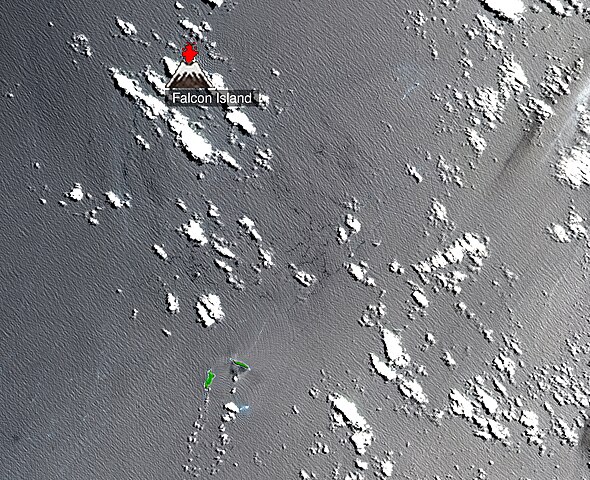
English: ASTER Very Near Infrared (VNIR) satellite image of Falcon Island (in red) and nearby Hunga Tonga-Hunga Haʻapai volcano caldera (in green) near Tonga in the South Pacific, taken on October 19, 2000. Image has been cropped to focus on Falcon Island and Hunga Tonga-Hunga Haʻapai. |
| Date | |
| Source | http://ava.jpl.nasa.gov/public/2000/10/19/20001019221401-label.jpg |
| Author | ASTER Volcano Archive (AVA), Jet Propulsion Laboratory, National Aeronautics and Space Administration. |
| Camera location | | View this and other nearby images on: OpenStreetMap |
|---|
Licensing
[edit]
| This file is in the public domain in the United States because it was solely created by NASA. NASA copyright policy states that "NASA material is not protected by copyright unless noted". (See Template:PD-USGov, NASA copyright policy page or JPL Image Use Policy.) | ||
 |
Warnings:
|
File history
Click on a date/time to view the file as it appeared at that time.
| Date/Time | Thumbnail | Dimensions | User | Comment | |
|---|---|---|---|---|---|
| current | 13:33, 19 March 2009 | | 3,155 × 2,568 (3.88 MB) | Tim1965 (talk | contribs) | {{Information |Description={{en|1=ASTER Very Near Infrared (VNIR) satellite image of Falcon Island (in red) and nearby Hunga Tonga-Hunga Haʻapai volcano caldera (in green) near Tonga in the South Pacific, taken on October 19, 2000.}} |Source=http://ava.j |
You cannot overwrite this file.
File usage on Commons
There are no pages that use this file.
File usage on other wikis
The following other wikis use this file:
- Usage on ceb.wikipedia.org
- Usage on de.wikipedia.org
- Usage on fr.wikipedia.org
- Usage on he.wikipedia.org
- Usage on ms.wikipedia.org