File:Hucknall Central Station (geograph 6498502).jpg
Jump to navigation
Jump to search
Size of this preview: 800 × 518 pixels. Other resolutions: 320 × 207 pixels | 640 × 415 pixels | 1,024 × 663 pixels | 1,280 × 829 pixels.
Original file (1,280 × 829 pixels, file size: 1.15 MB, MIME type: image/jpeg)
Captions
Captions
Add a one-line explanation of what this file represents
Summary
[edit].jpg&action=edit§ion=1)
| Description |
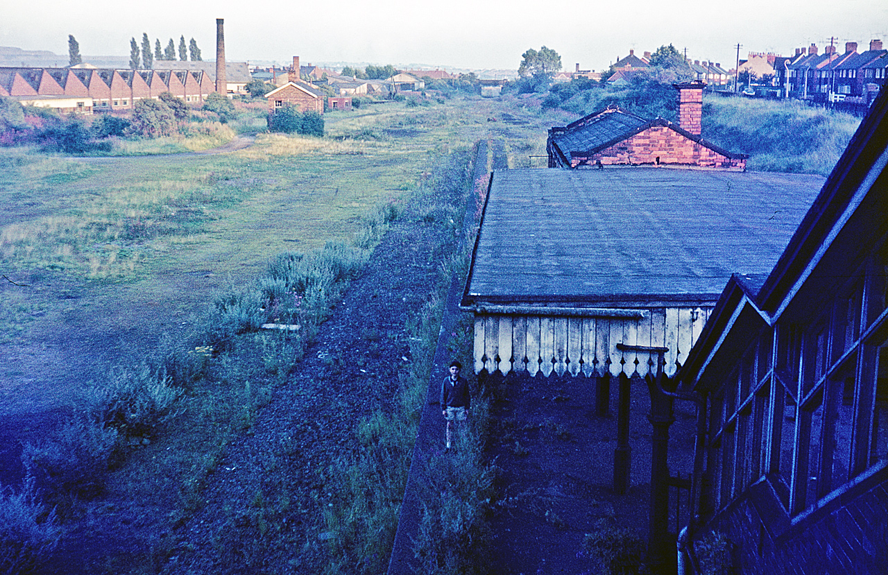
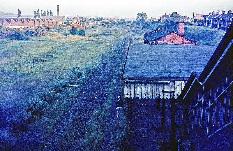
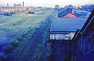
English: Hucknall Central Station At its peak Hucknall had three passenger stations, the first of which was closed as early as 1931. In the 1960s the other two closed: Central in 1963 and Byron in 1964 (although the town has since regained a station on the Robin Hood Line). Central station was typical of the Great Central Railway's London extension with an island platform and buildings in a Jacobean architectural style; it opened in 1899. After closure the line continued to be used until September 1966. By the time this photograph was taken, about two years later, the track had been lifted but the buildings remained, albeit in a dilapidated condition - there was no attempt to prevent the public gaining access. See SK5348 : Hucknall Station on the Great Central Railway for a view of the station as it was in Edwardian times. |
| Date | |
| Source | From geograph.org.uk |
| Author | Derek McKay |
| Permission (Reusing this file) |
Creative Commons Attribution Share-alike license 2.0 |
| Attribution (required by the license) | Derek McKay / Hucknall Central Station / |
.jpg)
| Camera location | | View this and other nearby images on: OpenStreetMap |
|---|
.jpg¶ms=053.031966_N_-001.209648_E_globe:Earth_type:camera_source:geograph-osgb36(SK53104859)_heading:157.00&language=en)
| Object location | | View this and other nearby images on: OpenStreetMap |
|---|
.jpg¶ms=053.031600_N_-001.209360_E_globe:Earth_class:object_type:object_source:geograph-osgb36(SK53124855)_heading:157.00&language=en)
Licensing
[edit].jpg&action=edit§ion=2)

|
This image was taken from the Geograph project collection. See this photograph's page on the Geograph website for the photographer's contact details. The copyright on this image is owned by Derek McKay and is licensed for reuse under the Creative Commons Attribution-ShareAlike 2.0 license.
|
This file is licensed under the Creative Commons Attribution-Share Alike 2.0 Generic license.
Attribution: Derek McKay
- You are free:
- to share – to copy, distribute and transmit the work
- to remix – to adapt the work
- Under the following conditions:
- attribution – You must give appropriate credit, provide a link to the license, and indicate if changes were made. You may do so in any reasonable manner, but not in any way that suggests the licensor endorses you or your use.
- share alike – If you remix, transform, or build upon the material, you must distribute your contributions under the same or compatible license as the original.
File history
Click on a date/time to view the file as it appeared at that time.
| Date/Time | Thumbnail | Dimensions | User | Comment | |
|---|---|---|---|---|---|
| current | 19:09, 11 April 2021 | | 1,280 × 829 (1.15 MB) | Lamberhurst (talk | contribs) | Transferred from geograph.co.uk using [https://tools.wmflabs.org/geograph2commons/ geograph2commons] |
You cannot overwrite this file.
File usage on Commons
The following page uses this file:
File usage on other wikis
The following other wikis use this file:
- Usage on en.wikipedia.org
.jpg&oldid=671725041)